Gambia
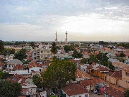
A view of the King Fahad Mosque in Banjul, The Gambia. Source:Bjørn Christian Tørrissen
The Gambia is a nation of 1.8 million people in western Africa on the flood plain of the Gambia River flanked by some low hills. Countries and Regions of the World Collection 
It borders the North Atlantic Ocean and, but for its coast, is surrounded by the nation of Senegal.
The Gambia is smallest country on the continent of Africa.
The Gambia's major environmental issues include:
|
|

- deforestation;
- desertification; and,
- water-borne diseases which are prevalent.
It is also susceptible to drought (rainfall has dropped by 30% in the last 30 years).
The Gambia gained its independence from the United Kingdom in 1965.
Geographically surrounded by Senegal, it formed a short-lived federation of Senegambia between 1982 and 1989.
In 1991 the two nations signed a friendship and cooperation treaty, but tensions have flared up intermittently since then.
Yahya A. J. J. Jammeh led a military coup in 1994 that overthrew the president and banned political activity.
Jammeh has been elected president in all subsequent elections, including most recently in late 2011.

Contents
Geography
Location: Western Africa, bordering the North Atlantic Ocean and Senegal
Geographic Coordinates: 13 28 N, 16 34 W
Area: 11,300 km2 (10,000 land and 1,300 km2 water)
arable land: 27.88%
permanent crops: 0.44%
other: 71.68% (2005)
Land Boundaries: 740 km. Border countries: Senegal 740 km
Coastline: 80 km
Maritime Claims:
territorial sea: 12 nm
contiguous zone: 18 nm
exclusive fishing zone: 200 nm
continental shelf: extent not specified
Natural Hazards: drought (rainfall has dropped by 30% in the last 30 years)
Terrain: Flood plain of the Gambia River flanked by some low hills. Its lowest point is the Atlantic Ocean (0 metres) and its highest point is an unnamed location (53 metres)
Climate: Tropical; hot, rainy season (June to November); cooler, dry season (November to May)

Source: The Map Library
Ecology and Biodiversity

Ecoregions of the Gambia. Source: World Wildlife Fund
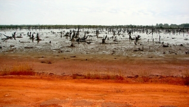
- Guinean mangroves stretch from Senegal to west of the Dahomey Gap.The Guinean Mangroves, influenced by a large tidal range and high inputs of freshwater, contain stands that are more than 25 m in height and extend as far as 160 km inland. As the best developed mangroves in western Africa, this ecoregion provides important habitat for migratory birds and endangered species such as the West African manatee and the pygmy hippopotamus. However, the mangrove habitat is threatened by agriculture and urban development and has been affected by poor rainfall over the entire region during the past three decades.
- Guinean forest-savanna mosaic
- West Sudanian savanna
See also:
- Biological diversity in the Guinean forests of West Africa
- Western Africa and coastal and marine environments
- Western Africa and land resources
- Canary Current large marine ecosystem
|
|
|
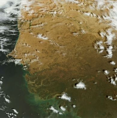
The Gambia River is seen slight below the middle of the image. Source: Eosnap. |
|
|
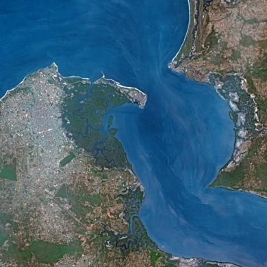
| Banjul. Source: SPOT Satellite |
People and Society
A wide variety of ethnic groups live in The Gambia with a minimum of intertribal friction, each preserving its own language and traditions. The Mandinka tribe is the largest, followed by the Fula, Wolof, Jola, and Sarahule. Approximately 3,500 non-Africans live in The Gambia, including Europeans and families of Lebanese origin.
Muslims constitute more than 90% of the population. Christians of different denominations account for most of the remainder. Gambians officially observe the holidays of both religions and practice religious tolerance.
According to the 1993 census, more than 63% of Gambians lived in rural villages, although more and more young people were coming to the capital in search of work and education. Provisional figures from the 2003 census showed that the gap between the urban and rural populations was narrowing as more areas were declared urban. While urban migration, development projects, and modernization are bringing more Gambians into contact with Western habits and values, the traditional emphasis on the extended family, as well as indigenous forms of dress and celebration, remain integral parts of everyday life.
Population: 1,840,454 (July 2012 est.)
Ethnic groups: African 99% (Mandinka 42%, Fula 18%, Wolof 16%, Jola 10%, Serahuli 9%, other 4%), non-African 1% (2003 census)
Age Structure:
0-14 years: 40% (male 360,732/female 358,440)
15-64 years: 56.9% (male 501,946/female 520,826)
65 years and over: 3.1% (male 26,645/female 29,271) (2011 est.)
Population Growth Rate: 2.344% (2012 est.)
Birthrate: 33.41 births/1,000 population (2012 est.)
Death Rate: 7.5 deaths/1,000 population (July 2012 est.)
Net Migration Rate: -2.46 migrant(s)/1,000 population (2012 est.)
Life Expectancy at Birth: 63.82 years
male: 61.52 years
female: 66.18 years (2012 est.)
Total Fertility Rate: 4.1 children born/woman (2012 est.)
Languages: English (official), Mandinka, Wolof, Fula, other indigenous vernaculars
Literacy (2003 est.) : 40.1% (male: 47.8% - female: 32.8%)
Urbanization: 58% of total population (2010) growing at an annual rate of change of 3.7% (2010-15 est.)
History
The Gambia was once part of the Mali and Kaabu Empires. The first written accounts of the region come from records of Arab traders in the 9th and 10th centuries A.D. Arab traders established the trans-Saharan trade route for slaves, gold, and ivory. In the 15th century, the Portuguese took over this trade using maritime routes. At that time, The Gambia was part of the Kingdom of Mali.
In 1588, the claimant to the Portuguese throne, Antonio, Prior of Crato, sold exclusive trade rights on The Gambia River to English merchants; this grant was confirmed by letters patent from Queen Elizabeth I. In 1618, King James I granted a charter to a British company for trade with The Gambia and the Gold Coast (now Ghana).
During the late 17th century and throughout the 18th, England and France struggled continuously for political and commercial supremacy in the regions of the Senegal and Gambia Rivers. The 1783 Treaty of Versailles gave Great Britain possession of The Gambia, but the French retained a tiny enclave at Albreda on the north bank of the river, which was ceded to the United Kingdom in 1857.
As many as 3 million slaves may have been taken from the region during the 3 centuries that the transatlantic slave trade operated. It is not known how many slaves were taken by Arab traders prior to and simultaneous with the transatlantic slave trade. Most of those taken were sold to Europeans by other Africans; some were prisoners of intertribal wars; some were sold because of unpaid debts, while others were kidnapped. Slaves were initially sent to Europe to work as servants until the market for labor expanded in the West Indies and North America in the 18th century. In 1807, slave trading was abolished throughout the British Empire, and the British tried unsuccessfully to end the slave traffic in The Gambia. They established the military post of Bathurst (now Banjul) in 1816. In the ensuing years, Banjul was at times under the jurisdiction of the British governor general in Sierra Leone. In 1888, The Gambia became a separate colonial entity.
An 1889 agreement with France established the present boundaries, and The Gambia became a British Crown Colony, divided for administrative purposes into the colony (city of Banjul and the surrounding area) and the protectorate (remainder of the territory). The Gambia received its own executive and legislative councils in 1901 and gradually progressed toward self-government. A 1906 ordinance abolished slavery.
During World War II, Gambian troops fought with the Allies in Burma. Banjul served as an air stop for the U.S. Army Air Corps and a port of call for Allied naval convoys. U.S. President Franklin D. Roosevelt stopped overnight in Banjul en route to and from the Casablanca Conference in 1943, marking the first visit to the African Continent by an American president while in office.
After World War II, the pace of constitutional reform quickened. Following general elections in 1962, full internal self-government was granted in 1963. The Gambia achieved independence on February 18, 1965, as a constitutional monarchy within the British Commonwealth. Shortly thereafter, the government proposed conversion from a monarchy to a republic with an elected president replacing the British monarch as chief of state. The proposal failed to receive the two-thirds majority required to amend the constitution, but the results won widespread attention abroad as testimony to The Gambia's observance of secret balloting, honest elections, and civil rights and liberties. On April 24, 1970, The Gambia became a republic following a referendum.
Until a military coup in July 1994, The Gambia was led by President Sir Dawda Kairaba Jawara, who was re-elected five times. The relative stability of the Jawara era was first broken by a violent, unsuccessful coup attempt in 1981. The coup was led by Kukoi Samba Sanyang, who, on two occasions, had unsuccessfully sought election to parliament. After a week of violence which left several hundred dead, President Jawara, in London when the attack began, appealed to Senegal for help. Senegalese troops defeated the rebel force.
In the aftermath of the attempted coup, Senegal and The Gambia signed the 1982 Treaty of Confederation. The result, the Senegambia Confederation, aimed eventually to combine the armed forces of the two nations and to unify economies and currencies. The Gambia withdrew from the confederation in 1989.
In July 1994, the Armed Forces Provisional Ruling Council (AFPRC) seized power in a military coup d'etat, deposing the government of Sir Dawda Jawara. Lieutenant Yahya A.J.J. Jammeh, chairman of the AFPRC, became head of state.
The AFPRC announced a transition plan for return to democratic civilian government. The Provisional Independent Electoral Commission (PIEC) was established in 1996 to conduct national elections. The transition process included the compilation of a new electoral register, adoption of a new constitution by referendum in August 1996, and presidential and legislative elections in September 1996 and January 1997, respectively. Foreign observers did not deem these elections free and fair. Retired Col. Yahya A.J.J. Jammeh was sworn into office as President of the Republic of The Gambia in November 1996. The PIEC was transformed to the Independent Electoral Commission (IEC) in 1997 and became responsible for registration of voters and conduct of elections and referenda.
In late 2001 and early 2002, The Gambia completed a full cycle of presidential, legislative, and local elections, which foreign observers deemed free, fair, and transparent, albeit with some shortcomings. President Yahya Jammeh, who was re-elected, took the oath of office again on December 21, 2001. The APRC maintained its strong majority in the National Assembly, particularly after the main opposition United Democratic Party (UDP) boycotted the legislative elections. President Jammeh was re-elected for a third 5-year term on September 22, 2006 with 67% of the vote. The UDP received 27% of the vote, and instead of boycotting future elections, vowed to take part in the 2007 National Assembly elections. In the January 2007 parliamentary elections the ruling Alliance for Patriotic Reorientation and Construction (APRC) won 42 of the available 48 elected seats.
Government
The 1970 constitution, which divided the government into independent executive, legislative, and judicial branches, was suspended after the 1994 military coup. As part of the transition process, the AFPRC established the Constitution Review Commission (CRC) through decree in March 1995. In accordance with the timetable for the transition to a democratically elected government, the commission drafted a new constitution for The Gambia, which approved by referendum in August 1996. The constitution provides for a strong presidential government, a unicameral legislature, an independent judiciary, and the protection of human rights.
Local government in The Gambia varies. The capital city, Banjul, and the much larger Kanifing Municipality have elected town and municipal councils. Five rural regions exist, each with a council containing a majority of elected members. Each council has its own treasury and is responsible for local government services. Tribal chiefs retain traditional powers authorized by customary law in some instances.
Government Type: Republic
Capital: Banjul - 436,000 (2009)
Administrative Divisions: 5 divisions and 1 city*; Banjul*, Central River, Lower River, North Bank, Upper River, Western

Source: Wikimedia Commons
Independence Date: 18 February 1965 (from UK)
Legal System: based on a composite of English common law, Islamic law, and customary law. The Gambia accepts compulsory International court of Justice (ICJ) jurisdiction with reservations; and accepts International Criminal Court (ICCt) jurisdiction.
Suffrage: 18 years of age; universal
International Environmental Agreements
The Gambia is party to international agreements on: Biodiversity, Climate Change, Climate Change-Kyoto Protocol, Desertification, Endangered Species, Hazardous Wastes, Law of the Sea, Ozone Layer Protection, Ship Pollution, Wetlands, and Whaling.
Water
Total Renewable Water Resource: 8 cu km (1982)
Freshwater Withdrawal: Total: 0.03 cu km/yr (23% domestic, 12% industrial, 65% agricultural).
Per Capita Freshwater Withdrawal: 20 cu m/yr (2000)
Access to improved sources of drinking water: 92% of population
Access to improved sanitation facilities: 67% of population
See: Water profile of Gambia
Agriculture
Agriculture accounts for roughly 24% of gross domestic product (GDP) and employs about 70% of the labor force. Within agriculture, peanut production accounts for 6.9% of GDP, other crops 8.3%, livestock 5.3%, fishing 4%, and forestry 0.5%. Industry accounts for approximately 12% of GDP and services about 59%. The limited amount of manufacturing is primarily agricultural-based (e.g., peanut processing, bakeries, a brewery, and a tannery). Other manufacturing activities include soap, soft drinks, and clothing.
Agricultural Products: rice, millet, sorghum, peanuts, corn, sesame, cassava (tapioca), palm kernels; cattle, sheep, goats
Irrigated Land: 20 sq km (2008)
Resources
Natural Resources: fish, titanium (rutile and ilmenite), tin, zircon, silica sand, clay, petroleum.
Energy
| Energy in Gambia | |||||
| Production | Consumption | Exports | Imports | Reserves | |
| Electricity | 220 million kWh (2008 est.) |
204.6 million kWh (2008 est.) |
0 kWh (2009 est.) |
0 kWh (2009 est.) |
|
| Oil | 0 bbl/day (2010 est.) |
2,000 bbl/day (2010 est.) |
41.62 bbl/day (2009 est.) |
2,807 bbl/day (2009 est.) |
0 bbl (1 January 2011 est.) |
| Natural Gas | 0 cu m (2009 est.) |
0 cu m (2009 est.) |
0 cu m (2009 est.) |
0 cu m (2009 est.) |
0 cu m (1 January 2011 est.) |
| source: CIA Factbook | |||||
Economy
The Gambia has a liberal, market-based economy characterized by traditional subsistence agriculture, a historic reliance on groundnuts (peanuts) for export earnings, a re-export trade built up around its ocean port, low import duties, minimal administrative procedures, a fluctuating exchange rate with no exchange controls, and a significant tourism industry.
The Gambia has sparse natural resource deposits and a limited agricultural base, and relies in part on remittances from workers overseas and tourist receipts.
Agriculture accounts for roughly 24% of gross domestic product (GDP) and employs about 70% of the labor force. Within agriculture, peanut production accounts for 6.9% of GDP, other crops 8.3%, livestock 5.3%, fishing 4%, and forestry 0.5%. Industry accounts for approximately 12% of GDP and services about 59%. The limited amount of manufacturing is primarily agricultural-based (e.g., peanut processing, bakeries, a brewery, and a tannery). Other manufacturing activities include soap, soft drinks, and clothing. The agricultural sector has untapped potential - less than half of arable land is cultivated.
|
|
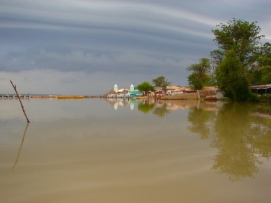
| Tendaba, The Gambia. Source:Bjørn Christian Tørrissen |
|
|
| Source:Bjørn Christian Tørrissen |
Small-scale manufacturing activity features the processing of peanuts, fish, and hides.
The Gambia's natural beauty and proximity to Europe has made it one of the larger markets for tourism in West Africa, boosted by government and private sector investments in eco-tourism and upscale facilities.
In 2011 tourism contributed about one-fifth of GDP, but suffered from the European economic downturn.
The Gambia's re-export trade accounted for almost 80% of goods exports.
Unemployment and underemployment rates remain high; economic progress depends on sustained bilateral and multilateral aid, on responsible government economic management, and on continued technical assistance from multilateral and bilateral donors.
International donors and lenders continue to be concerned about the quality of fiscal management and The Gambia's debt burden.
GDP (Purchasing Power Parity): $3.774 billion (2011 est.)
GDP (Official Exchange Rate): $1.1 billion (2011 est.)
GDP-per capita (PPP): $2,100 (2011 est.)
GDP-composition by sector:
agriculture: 29.5%
industry: 15.1%
services: 55.4% (2011 est.)
Industries:processing peanuts, fish, and hides; tourism, beverages, agricultural machinery assembly, woodworking, metalworking, clothing
Exports: peanut products, fish, cotton lint, palm kernels, re-exports
Imports: foodstuffs, manufactures, fuel, machinery and transport equipment
Currency: dalasi (GMD)
Ports and Terminals: Banjul