Faroe Islands
| Topics: |
Countries and Regions of the World Collection  The Faroe Islands are an archipelago of 17 inhabited islands and one uninhabited island, and a few uninhabited islets in northeastern Atlantic; precipitous terrain limits habitation to small coastal lowlands between the Norwegian Sea and the North Atlantic Ocean, about half way between Iceland and Norway.
The Faroe Islands, with a population of just under 50,000 people, are strategically located along important sea lanes.
The population of the Faroe Islands is largely descended from Viking settlers who arrived in the 9th century.
The islands have been connected politically to Denmark since the 14th century.
A high degree of self government was granted the Faroese in 1948, who have autonomy over most internal affairs while Denmark is responsible for justice, defense, and foreign affairs.
The Faroe Islands are not part of the European Union.
Because anticipated offshore hydrocarbon resources have not been realized, earlier Faroese proposals for full independence have been deferred.
Iceland, the UK, and Ireland dispute Denmark's claim that the Faroe Islands' continental shelf extends beyond 200 nm
Contents
Geography
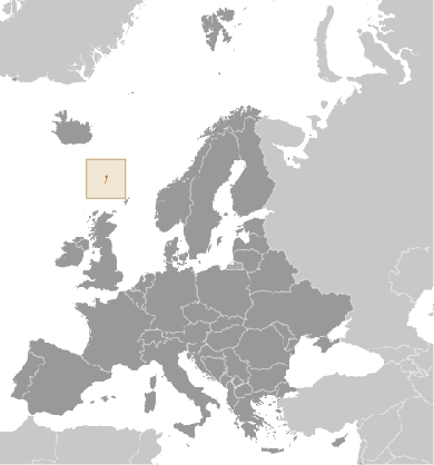
Location: Northern Europe, island group between the Norwegian Sea and the North Atlantic Ocean, about half way between Iceland and Norway
Geographic Coordinates: 62 00 N, 7 00 W
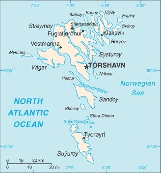
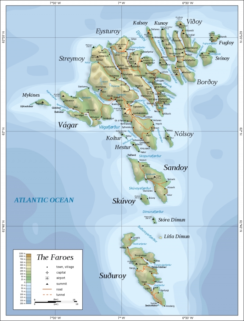
Islands:
- Borðoy
- Eysturoy
- Fugloy
- Hestur
- Kalsoy
- Koltur
- Kunoy
- Lítla Dímun
- Mykines
- Nólsoy
- Sandoy
- Skúvoy
- Stóra Dímun
- Streymoy
- Suðuroy
- Svínoy
- Vágar
- Viðoy
Area: 1,393 sq km
Coastline: 1,117 km
Maritime Claims:
territorial sea: 3 nm
continental shelf: 200 nm or agreed boundaries or median line
exclusive fishing zone: 200 nm or agreed boundaries or median line
Terrain: rugged, rocky, some low peaks; cliffs along most of coast. The highest point is Slaettaratindur (882 m).
|
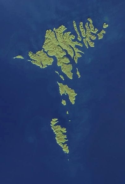
Satellite photo of Faroe Islands April 17, 2003. Source: Cropped and edited from: NASA. |
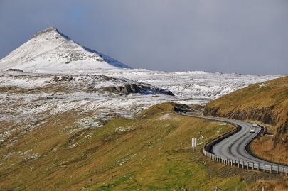
| Faroe Islands, Eysturoy, road from Skipanes to Sy?rugøta |
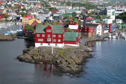
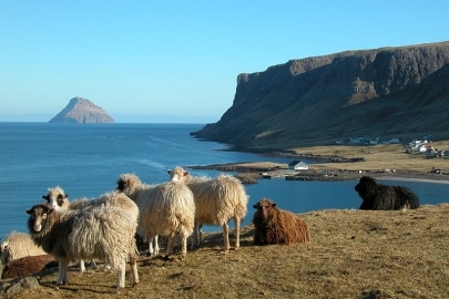
| Scenery from Hvalba, Faroe Islands. Source: Erik Christensen/Wikipedia |
Climate: mild winters, cool summers; usually overcast; foggy, windy
Ecology and Biodiversity
The faroe Isalnds are part of the Faroe Islands boreal grasslands ecoregion.
See also: Faroe Plateau large marine ecosystem
People and Society
Population: 49,483 (July 2012 est.)
Age Structure:
0-14 years: 21% (male 5,362/female 4,975)
15-64 years: 64.2% (male 16,837/female 14,788)
65 years and over: 14.8% (male 3,487/female 3,818) (2011 est.)
Population Growth Rate: 0.447% (2012 est.)
Birthrate: 13.14 births/1,000 population (2012 est.)
Death Rate: 8.67 deaths/1,000 population (July 2012 est.)
Net Migration Rate: 0 migrant(s)/1,000 population (2012 est.)
Life Expectancy at Birth: 79.85 years
male: 77.37 years
female: 82.5 years (2012 est.)
Total Fertility Rate: 2.4 children born/woman (2012 est.)
Languages: Faroese (derived from Old Norse), Danish
Literacy: NA; note - probably 99%, the same as Denmark proper
Urbanization: 40% of total population (2010) growing at an annual rate of change of 0.9% (2010-15 est.)
Government
Government Type: part of the Kingdom of Denmark; self-governing overseas administrative division of Denmark since 1948
Capital: Torshavn
Legal System: the laws of Denmark, where applicable, apply
International Environmental Agreements
Thje faroe Islands are party to to an international treaty on Marine Dumping - associate member to the London Convention and Ship Pollution
Resources
Natural Resources: fish, whales, hydropower, possible oil and gas
Land Use:
arable land: 2.14%
permanent crops: 0%
other: 97.86% (2005)
Economy
The Faroese economy is dependent on fishing, which makes the economy vulnerable to price swings. The sector accounts for about 95% of exports and nearly half of GDP.
==
In early 2008 the Faroese economy began to slow as a result of smaller catches and historically high oil prices that continue to trouble the economy. Reduced catches, especially of cod and haddock, have continued to strain the Faroese economy. GDP grew 0.5% in 2008-09. The slowdown in the Faroese economy followed a strong performance since the mid-1990s with annual growth rates averaging close to 6%, mostly a result of increased fish landings and salmon farming, and high export prices. Unemployment reached its lowest level in the first half of 2008, but increased to 3.9% in 2009 and is rising.
The Faroese Home Rule Government produced increasing budget surpluses that helped to reduce the large public debt, most of it to Denmark. However, total dependence on fishing and salmon farming make the Faroese economy very vulnerable to fluctuations in world demand. In addition, budget surpluses turned to deficits in 2008-09, and the economy at both the country and local level is running large deficits.
Initial discoveries of oil in the Faroese area give hope for eventual oil production, which may provide a foundation for a more diversified economy and less dependence on Danish economic assistance.
Aided by an annual subsidy from Denmark amounting to about 6% of Faroese GDP, the Faroese have a standard of living almost equal to that of Denmark and Greenland.
GDP: (Purchasing Power Parity): $1.471 billion (2010 est.)
GDP: (Official Exchange Rate): $2.22 billion (2010 est.)
GDP- per capita (PPP): $30,500 (2008 est.)
GDP- composition by sector:
agriculture: 16%
industry: 29%
services: 55% (2007 est.)
Agricultural products: milk, potatoes, vegetables; sheep; salmon, other fish
Industries: fishing, fish processing, small ship repair and refurbishment, handicrafts
Currency: Danish kroner (DKK)
