Ecoregions of Wyoming (EPA)
The ecoregions of Wyoming include a diversity of biomes, and span a wide array of landforms, such that the elements include dense forests, rocky talus, steppe, riverine plains, grassland and other diverse landscape types.
Ecoregions denote areas of general similarity in ecosystems and in the type, quality, and quantity of environmental resources; they are designed to serve as a spatial framework for the research, assessment, management, and monitoring of ecosystems and ecosystem components. By recognizing the spatial differences in the capacities and potentials of ecosystems, ecoregions stratify the environment by its probable response to disturbance (Bryce and others, 1999). These general purpose regions are critical for structuring and implementing ecosystem management strategies across federal agencies, state agencies, and nongovernment organizations that are responsible for different types of resources within the same geographical areas (Omernik and others, 2000).
The approach used to compile this classification scheme is based on the premise that ecological regions can be identified through the analysis of the spatial patterns and the composition of biotic and abiotic phenomena that affect or reflect differences in ecosystem quality and integrity (Wiken, 1986; Omernik, 1987, 1995). These phenomena include geology, physiography, vegetation, climate, soils, land use, wildlife, and hydrology.
The relative importance of each characteristic varies from one ecological region to another regardless of the hierarchical level. A Roman numeral hierarchical scheme has been adopted for different levels of ecological regions. Level I is the coarsest level, dividing North America into 15 ecological regions. Level II divides the continent into 52 regions (Commission for Environmental Cooperation Working Group, 1997). At level III, the continental United States contains 104 ecoregions and the conterminous United States has 84 ecoregions (United States Environmental Protection Agency [USEPA], 2003). Level IV is a further subdivision of level III ecoregions. Explanations of the methods used to define the USEPA’s ecoregions are given in Omernik (1995), Omernik and others (2000), Griffith and others (1994), and Gallant and others (1989).
Wyoming is made up of semiarid shrub- and grass-covered plains, alluvial valleys, volcanic plateaus, forested mountains, woodland- and shrubland-covered hills, glaciated peaks, lava fields, and wetlands. Ecological diversity is enormous. There are 7 level III ecoregions and 39 level IV ecoregions in Wyoming and many continue into ecologically similar parts of adjacent states.
The level III and IV ecoregion map on this poster was compiled at a scale of 1:250,000 and depicts revisions and subdivisions of earlier level III ecoregions that were originally compiled at a smaller scale (USEPA, 2003; Omernik, 1987). This poster is part of a collaborative project primarily between USEPA Region X, USEPA National Health and Environmental Effects Research Laboratory (Corvallis, Oregon), Wyoming Department of Environmental Quality (WDEQ), United States Department of Agriculture–Forest Service (USFS), United States Department of Agriculture–Natural Resources Conservation Service (NRCS), United States Department of the Interior–Bureau of Land Management (BLM), and United States Department of the Interior–Geological Survey (USGS)–Earth Resources Observation Systems (EROS) Data Center.
The project is associated with an interagency effort to develop a common framework of ecological regions. Reaching that objective requires recognition of the differences in the conceptual approaches and mapping methodologies applied to develop the most common ecoregion-type frameworks, including those developed by the USFS (Bailey and others, 1994), the USEPA (Omernik, 1987, 1995), and the NRCS (U.S. Department of Agriculture–Soil Conservation Service, 1981). As each of these frameworks is further refined, their differences are becoming less discernible. Regional collaborative projects such as this one in Wyoming, where agreement has been reached among multiple resource management agencies, are a step toward attaining consensus and consistency in ecoregion frameworks for the entire nation.
|
12. Snake River Plain | |
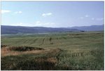
| 12d. The Dissected Plateaus and Teton Basin is a high, cold valley west of the Teton Range. Its climate makes Ecoregion 12d an atypical part of the Snake River Plain, which is lower and drier over much of its extent in Idaho. The potential natural vegetation is sagebrush steppe with mountain big sagebrush, Idaho fescue, slender wheatgrass, and bluebunch wheatgrass. Although Ecoregion 12d is similar in vegetation and climate to Jackson Hole on the east side of the Teton Range (Ecoregion 17n), it has a higher water table and its soil contains more moisture-holding loess. And, unlike Jackson Hole, much of Ecoregion 12d, with its more productive soil, has been converted to barley fields. During the growing season, the water from mountain streams is diverted to the alluvial fans for irrigation. Recreation is also an important land use and there is increasing development of resort condominiums, lodges, and vacation ranches. | |
| 17. Middle Rockies The Middle Rockies ecoregion, like the Northern Rockies (15), is composed of steep-crested, high mountains that are largely covered by coniferous forests. However, the mix of tree species is different in the two regions. The Middle Rockies commonly contain lodgepole pine but lack Western white pine, grand fir, and Western red cedar of the Northern Rockies (15). Forests of the Middle Rockies are more open-canopied than those of the Northern Rockies (15). Foothills are partly wooded or shrub- and grass-covered. Intermontane valleys are grass- and/or shrub-covered and contain a mosaic of terrestrial and aquatic fauna that is distinct from the nearby mountains. Many mountain-fed, perennial streams occur and provide water resources for the more arid ecoregions of the Wyoming Basin (18) and the Northwestern Great Plains (43). The Black Hills are an outlier of the Middle Rockies and share with them a montane climate, hydrography, and land use pattern. Recreation, logging, mining, and summer livestock grazing are common land uses. | |
| 17a. The Black Hills Foothills ecoregion is composed of two contrasting landscapes, the Hogback Ridge and the Red Valley (or Racetrack). It is characterized by a ring of foothills surrounding the Black Hills mountainous core (17b and 17c). The Dakota Hogback separates the foothills from the plains. The Red Valley (Racetrack) inside the hogback encircles most of the Black Hills dome. Potential natural vegetation includes ponderosa pine woodlands with an understory of little bluestem, blue grama, buffalo grass, and leadplant. In addition, some burr oak is found in the north and Rocky Mountain juniper occurs in the south. Land use is mainly cattle grazing and ranching. Bison, antelope, deer, and elk still graze in some of the grasslands found in the Black Hills Foothills. |
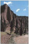
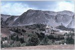
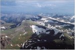 The Middle Rockies contain mountains with many different substrate types. This photo is of the southern end of the volcanic alpine zone of the Absaroka Range. The Absaroka Range is unlike the other major mountain ranges in Wyoming, which are uplifts of ancient granite. The Absarokas are the remains of a chain of at least 25 large volcanoes active between 40 and 50 million years ago. (Photo: Kristen Green, WDEQ)  The Gray Wolf, Canis lupus, once common in most of North America became nearly extinct in the lower 48 states in the early part of the 20th Century because settlers believed wolves caused widespread livestock losses. The wolf was federally listed as endangered triggering a recovery effort under the Endangered Species Act. Reintroduction into Yellowstone National Park began in 1995. Since that time the introduced population has expanded from the original 35 to about 560 wolves. (Photo: USDA) 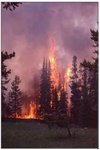 Fire is an important element of forest ecology. Many plant species, such as lodgepole pine, are fire adapted and need fire to regenerate. The Yellowstone fire of 1988 burned 793,000 acres (about 36% of the parks total acreage). A combination of severe drought and years of fire suppression contributed to the large fuel base for the fire. In the aftermath of the 1988 fire, a better understanding of fire ecology emerged and fire management practices have been revised to better reflect the natural ecosystem process. (Photo: Jack Smith, WDEQ) 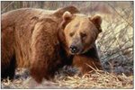 The American grizzly bear, Ursus arctos horribilis, is a federally listed threatened species. Historically these large mammals had an extensive range throughout the Middle Rockies. Habitat loss and human disturbance have contributed to the reduction in grizzly populations. A federally mandated recovery plan is currently in effect. |
| 17b. The Black Hills Plateau ecoregion is a relatively flat, elevated expanse, with broad ridges and entrenched canyons, covering the mid-elevation slopes of the Black Hills. In the metamorphic areas, highly dissected, tilted rock faces, and steep canyon slopes are common. The limestone areas have caves, springs, and consistent yearly stream flow. The Black Hills, a mountainous outlier in the Great Plains, have a highly diverse vegetative cover, with an overlap of eastern, boreal, and Rocky Mountain species. Rocky Mountain ponderosa pine dominates the landscape; it blends with eastern boxelder and burr oak and boreal paper birch and white spruce in moist areas. The understory includes little bluestem grasses and shrubs. Similarly, western bird species such as the western flycatcher and the western tanager are at the eastern limits of their range in the Black Hills; they share habitats with eastern bird species, such as the ovenbird and indigo bunting. Logging, farming, ranching, and tourist development are competing land uses in this ecoregion. | |
| 17c. Mountainous topography with highly eroded outcrops and broad valleys typify the Black Hills Core Highlands ecoregion. Ecoregion 17c includes the higher portions of the limestone plateau above 5,000 feet and the granitic intrusions that form the major peaks to elevations greater than 7,000 feet. Ponderosa pine forests interspersed with high meadows predominate; white spruce, paper birch, and aspen grow on north slopes and in moist canyons. Some of the common tree species found elsewhere in the Middle Rockies (17), such as Engelmann spruce, subalpine fir, and Douglasfir, are absent from the Black Hills. Mining for aggregates occurs in the metamorphic areas surrounding the intrusive core. | |
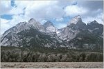
| 17g. The Mid-Elevation Sedimentary Mountains ecoregion includes sections of the Teton and Wyoming ranges, and areas in the overthrust belt underlain by faulted and folded Mesozoic and Paleozoic sedimentary rocks (limestone, dolomite, shale, and sandstone). Stream water quality, water availability, and aquatic biota are affected by carbonate substrates that are soluble and nutrient rich. Soils are generally finer-textured than those found on granitic substrates such as those in Ecoregions 17c and 17k. Because of higher precipitation levels in Ecoregion 17g, the water-holding capacity of soil is higher than in the Dry Mid-Elevation Sedimentary Mountains (17m); as a result, some of the largest areas of Douglas-fir in Wyoming are found in this ecoregion. | |
| 17h. The Alpine Zone includes disjunct high elevation, glaciated mountainous areas above timberline across all of Ecoregion 17. The Alpine Zone is expressed physiographically as rockland, talus, tundra, and glacial lake (tarn) basins. Ecoregion 17h characteristically receives higher amounts of precipitation than surrounding mountains, as much as 50 to 70 inches annually. However, wind and snowdrift distribution are the limiting factors that influence upper tree line (defined as the elevational extent of upright trees). In alpine areas above 10,000 feet, krummholz vegetation clings to windswept areas above the mosaic of meadow and subalpine forest. Alpine tundra plants, including alpine forbs, sedges, and grasses, support nomadic groups of mountain bighorn sheep and mountain goats. Spring snow melt feeds area streams and serves as an important summer water source for inhabitants at lower elevations. | |
| 17i. Fifty million years ago, the collision of oceanic and continental plates created the Absaroka-Gallatin Volcanic Mountains, one of the only volcanic ranges in western Wyoming. Steep-sided mountains, ash beds, and volcanic mudflows are common. In unglaciated terrain, landslides on failed ash beds have occurred, producing rounded hills. Resultant clay weathering products as well as dissolved calcium and magnesium tend to make the streams of this ecoregion turbid, particularly after intense or prolonged rainfall. The andesitic volcanic material has higher nutrient content and water holding capacity than the rhyolitic soils of the neighboring Yellowstone Plateau (17j). As a result, Ecoregion 17i has greater forest vegetation diversity than that in the monotypic lodgepole pine forest at the same elevations in Ecoregion 17j. Deer, elk, and moose frequent the forested valleys and riparian wetlands. | |
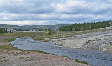
| 17j. The Yellowstone Plateau has a more subdued topography than other mountainous portions of the Middle Rockies. Geologically, the Plateau is composed of Quaternary extrusive rocks, mostly rhyolite, basalt, and tuff. The presence of numerous geothermal features, such as mudpots and geysers, indicate the Yellowstone Plateau is still volcanically active. On the high plateaus, lodgepole pine dominates forest vegetation on rhyolitic substrates, which are droughty, coarse-textured, and poor in nutrients. The lower western slopes of the Yellowstone Plateau have a coniferous forest-shrubland mosaic. Douglas-fir, lodgepole pine, and aspen cover north-facing slopes and flatter uplands, while southfacing slopes support mountain big sagebrush and mountain shrubs. Subalpine meadows are rare on rhyolitic substrates. The greater Yellowstone ecosystem is largely intact and protected in parks and wilderness. It supports a high concentration of wildlife: ungulates such as elk, moose, and bison, and their major predators, cougar, lynx, and reintroduced wolves. Recreation activity is high in Yellowstone National Park and surrounding National Forest areas. Mining, grazing, and logging occur outside National Park boundaries. | |
| 17k. The glaciated, granitic cores of the Bighorn and Beartooth mountains, and the Wind River and Teton ranges, comprise the Granitic Subalpine Zone. The sedimentary layers of these mountains have been eroded away to expose the Precambrian igneous core. Pleistocene glaciation created broad glacial basins, particularly in the Beartooth Mountains and Wind River Range, where numerous glacial lakes (tarns) dot the landscape. Although granitic soil is coarse, acidic, and low in nutrients, the shallow bedrock is rather impervious; it holds snowmelt moisture and allows the growth of drought-intolerant trees in higher elevations where precipitation levels exceed 25 inches per year. Snow melt moisture, absorbed and released throughout the spring and summer, provides water for humans and wildlife living at lower elevations in the droughty, sedimentary fringes of these mountains. Lodgepole pine is abundant; at the lower elevation range of Ecoregion 17k, it may be considered a climax species. At higher elevations, it is seral to subalpine fir and Engelmann spruce. Understory growth is not luxuriant, consisting mostly of grouse whortleberry, Oregon grape, and birchleaf spirea. The subalpine spruce-fir zone is not as heavily grazed by livestock as mid-elevation areas; it serves as summer range for mule deer and elk. | |
| 17m. The Dry Mid-Elevation Sedimentary Mountains ecoregion includes the mid-elevation Bighorn Mountains and the drier northeastern portion of the Wind River Range that are underlain by sedimentary rocks. The natural droughtiness of the soil in ecoregion 17m is enhanced by its location in the rain shadow of the two mountain ranges. The various sedimentary rock types have a distinctive topographic expression: rounded shale hills, limestone bluffs, and sandstone flatirons. Forested canyons slice through the more soluble limestone layer. Upland forest cover is open and patchy because of the droughty conditions. The vegetation cover is a combination of grasses, dry, open forest, and shrubland, including mountain big sagebrush and mountain mahogany. Forest cover is more extensive on the east slopes of the Bighorns where there is more summer precipitation. A ponderosa pine/juniper/mountain mahogany association exists here similar to one in the Black Hills (17b) to the east, but it is of limited extent. The forest of the eastern Bighorn Mountains lacks enough precipitation to support the eastern deciduous species and boreal vegetation present in the Black Hills (17b). Some quaking aspen groves occur in Ecoregion 17m, particularly in the Wind River Range; the fact that aspen groves in the Bighorns are heavily grazed may account for low aspen reproduction there. | |
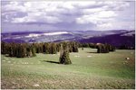
| 17n. The High Elevation Valleys ecoregion includes Jackson Hole and Star Valley and to the north in the greater Yellowstone area, the Lamar, Hayden and Pelican valleys. These valleys include wet bottomlands, marshes, stream terraces, alluvial fans, and lower foothill slopes. Elevations range from 5,000 to 8,000 feet with an annual precipitation of 12 to 30 inches. Terraces and foothill slopes are covered with sagebrush (big, mountain, and some silver) with an understory of Idaho fescue and bearded wheatgrass. Douglas-fir with an understory of snowberry and pinegrass grows in mesic areas and on north-facing slopes. Some aspen groves also occur. Pasture, non-irrigated winter wheat, spring barley, hay, and livestock grazing are the most common land uses in developed areas. However, the cold climate and short growing season limits the extent of agriculture. In the Yellowstone region, elk and bison use the cold valleys as winter range. Elk still use Jackson Hole as a wintering ground, mostly within the confines of the National Elk Refuge. | |
| 17o. The dry, steep, Partly Forested Mountains ecoregion in Wyoming occupies the eastern extent of a much larger region in Idaho. Soils are rocky and shallow, which limits the extent of tree growth. The natural vegetation is a mosaic of conifers, shrubs, sagebrush, and grassland. Douglas-fir, lodgepole pine, quaking aspen, and mountain mahogany occupy the north-facing slopes. Southerly slopes support mountain big sagebrush, mountain mahogany, snowberry and rose with an understory of Idaho fescue. The forest cover of this ecoregion is more open than the neighboring Mid- Elevation Sedimentary Mountains (17g), where soil texture and water-holding capacity allows denser tree growth. | |
| 17ao. Due to the steepness of the terrain, the areal extent of the Absaroka Volcanic Subalpine Zone is limited compared to subalpine areas in the sedimentary and granitic substrate mountains (Ecoregions 17k and 17ap). Like other subalpine regions in the Middle Rockies, subalpine fir, Englemann spruce, and limber pine are the dominant tree species. The highly dissected landscape is a result of erosion as these mountains are composed of loosely consolidated volcanic material. Soils are derived from a mixture of ash, tuff, basalt, and pumice. Sagebrush and grass grow in these droughty soils on open ridge tops where high wind and drifting snow limit tree growth. Mule deer, elk, bighorn sheep, and, on the eastern slopes, pronghorn antelope graze the high mountain meadows. | |
| 17ap. The Sedimentary Subalpine Zone ecoregion is found southeast of Yellowstone National Park, in the overthrust belt, and in the northwest corner of the Bighorn Mountains in areas underlain by faulted and folded Mesozoic and Paleozoic sedimentary rocks (limestone, dolomite, shale, and sandstone). Elevations range between 8,500 feet and 10,000 feet. Relatively high precipitation amounts, areas of heavy snowpack, and snow with high water content provide enough moisture to support spruce-fir forest on the normally droughty sedimentary substrates. Potential natural vegetation includes subalpine fir and Engelmann spruce, with lodgepole pine as a seral species. However, tree growth is limited in fine-grained shale-derived soils which results in a landscape that alternates between forest groves and open grassy slopes. | |
|
18. Wyoming Basin | |
| 18a. The semiarid Rolling Sagebrush Steppe is a vast region of rolling plains with hills, cuestas, mesas, terraces, and near the mountains, footslopes, ridges, alluvial fans, and outwash fans. Overall, this region is less hilly than the Foothill Shrublands and Low Mountains (18d) ecoregion. Average annual precipitation is 6 to 16 inches and varies with elevation and proximity to mountains. The region has a continental climate with cold winters and mild summers. Potential natural vegetation is mostly sagebrush steppe, with the eastern edge of the region having more mixed grass prairie. Wyoming big sagebrush is the most common shrub with silver and black sagebrush occurring in the lowlands and mountain big sagebrush in the higher elevations. Frequent fires have affected the sagebrush steppe and, in some places, European annual grasses have replaced it. Most of the land is in rangeland, cattle and sheep ranches, or wildlife habitat. Oil, gas, and coal deposits are scattered throughout the region and oil shale deposits are found in the southwest. Uranium mining occurs in areas in the Red Desert and the Shirley Basin. |
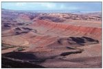
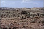 The sagebrush dominated grassland of the Wyoming Basin (18) covers a large portion of the state. It is surrounded almost entirely by mountainous areas and is in the rain shadow of the Rocky Mountains, so it receives very little precipitation. The ecoregion contains a diverse mix of arid basins, badlands, and foothills. (Photo: Jeremy ZumBerge, WDEQ.)  The Wyoming toad, Bufo hemiophrys baxteri, is found only in the Laramie Basin (18f). It is one of the nation's most endangered species. It is estimated that only 100 to 150 of these toads live in the wild. Scientists believe that the Wyoming toad is the victim of pesticides used to control the mosquito population in and around the toad's habitat. (Photo: Amy Hopperstad, US Fish and Wildlife Service) |
| 18b. The Bighorn Basin is an arid depression in the rainshadow of the Beartooth Mountains, Absaroka Range, and Pryor Mountains. This region receives more precipitation, between 8 to 14 inches a year, than the neighboring Bighorn Salt Desert Basins (18g) that lie at lower elevations. The soils, formed from sedimentary rocks, such as shale, sandstone and siltstone, are also not as alkaline as those found in Ecoregion 18g. This higher portion of the greater Bighorn Basin forms a transition from arid desert shrubland to semiarid shrubland dominated by Wyoming big sagebrush that grows best in slightly wetter, more permeable soil. Large oil, gas, and coal deposits occur in this ecoregion. | |
| 18c. The Sub-Irrigated High Valleys are wet meadow systems located in areas of high drainage density beneath surrounding mountain ranges. The term sub-irrigated refers to the high water table that keeps the soil moist much of the year. Physiographically, Ecoregion 18c includes floodplains, low terraces, riparian wetlands, and alluvial fans. Willows, alders, cottonwoods and hydrophilic wetland plants, such as horsetail, spikerush, sedges, and tufted hairgrass, line the drainages. Man-made irrigation projects have increased the areal extent of Ecoregion 18c. | |
| 18d. The Foothill Shrublands and Low Mountains ecoregion includes isolated dry mountain ranges and foothill slopes scattered across the Wyoming Basin. It has a more rugged topography than the Rolling Sagebrush Steppe (18a). Elevations range between 5,000 to 7,000 feet in foothill areas to over 9,000 feet on a few isolated ranges. Tertiary sedimentary rock including sandstone and conglomerate are most extensive, but shale, siltstone, and limestone also occur. Big sagebrush, rabbitbrush, prickly pear, bluebunch wheatgrass, and Idaho fescue dominate on fine-textured soils; Rocky Mountain juniper, Utah juniper, and mountain mahogany woodlands occur on rock outcrops. Small forested areas occur at higher elevations in the Owl Creek, Pine, Green, Ferris, and Shirley mountains. Land use is mostly livestock grazing and wildlife habitat. | |
| 18e. The arid Salt Desert Shrub Basins ecoregion includes disjunct playas and sand dunes scattered throughout the Wyoming Basin. Soils in Ecoregion 18e tend to be more alkaline and less permeable than soils in the Rolling Sagebrush Steppe (18a). Vegetation is a sparse cover of arid land shrubs such as shadscale, greasewood, and Gardner saltbush. Plant life is more diverse on sand dunes, which provide greater moisture, higher permeability, and lower alkalinity than the basin floor. This arid landscape is very sensitive to grazing pressure which may promote the invasion of weeds such as Russian thistle, cheatgrass, and the toxic halogeton. | |
| 18f. The Laramie Basin ecoregion is a wide intermontane valley, dominated by mixed-grass prairie. Potential natural vegetation includes needle-and-thread grass, western wheatgrass, blue grama, Indian ricegrass, and other mixedgrass species. Although the Laramie Basin has some moist riparian alluvial flats, it is generally drier than the Sub-Irrigated High Valleys (18c). Ecoregion 18f is too dry for big sagebrush to grow, except where snow accumulates. Land cover is primarily rangeland used for seasonal grazing. | |
| 18g. The Bighorn Salt Desert Shrub Basins comprise two large, arid, alkaline depressions surrounded by mountains. Ecoregion 18g was distinguished from the other salt desert shrub basins (Ecoregion 18e) because it forms a larger contiguous area that is somewhat geographically isolated from the scattered small basins and playas in southern Wyoming. It also experiences greater human influence because of its proximity to major rivers (Bighorn, Shoshone, and Greybull rivers) that provide water for irrigation. Soils are alkaline or gypsum bearing and are derived from sedimentary rocks such as shale, sandstone and siltstone, or windblown material. The arid climate (just 6 inches of precipitation per year) supports desert shrubs and grasses: greasewood, Gardner saltbush, shadscale, alkali sacaton, and saltgrass. Oil, bentonite, and coal deposits are extensive throughout the basin. | |
| 19. Wasatch and Uinta Moutains The Wasatch and Uinta Mountains ecoregion is composed of high mountains, dissected volcanic plateaus, and flanking valleys. In Wyoming, Ecoregion 19 includes the northern slopes of the heavily glaciated Uinta Mountains. Elevational banding of the vegetation occurs and the pattern is similar to that of the Southern Rockies (21). Streams draining the quartzite-dominated Uinta Mountains tend to be acidic, low in nutrients, and low in total dissolved solids. | |
| 19c. The Mid-Elevation Uinta Mountains ecoregion is characterized by forested, glaciated mountains with extensive morainal deposits. The northern slopes of the Uinta Mountains are not as steep as the southern slopes. Average annual snowfall exceeds about 70 inches and average annual precipitation ranges from about 20-30 inches. Perennial streams, originating from glacial basins above, flow through deep canyons. Potential natural vegetation is Douglas-fir forest. Today Douglas-fir and ponderosa pine are common, along with lodgepole pine and some aspen parkland with a sagebrush and forb understory. In riparian areas, cottonwood, willow, and Engelmann spruce are common. Logging, seasonal range, recreation, wildlife habitat, and water supply are major land uses. | |
| 21. Southern Rockies | |
| The Southern Rockies are characterized by rugged, steep mountains, intermontane depressions and open meadows, and high-elevation plateaus composed of dissected, horizontally layered rocks. Forests tend to be patchier than those of the Middle Rockies (17) to the north. Alpine tundra gives way to various coniferous forests often with aspen intermixed. Ponderosa pine is at lower elevations, pinyon-juniper below that, and grasslands are in the lowest areas. Lodgepole pine is more common in the Middle Rockies; white pine, grand fir, and cedar, prevalent in the Northern Rockies (15), are absent from Ecoregion 21. A greater portion of the Middle Rockies (17) is used for summer grazing of livestock. Recreation and logging are major land uses. | |
| 21a. The Alpine Zone is found on the mountain tops above treeline, beginning at about 10,500 to 11,000 feet. It includes alpine meadows as well as steep exposed rock and glaciated peaks. Annual precipitation ranges from 25 to greater than 50 inches, falling mostly as snow. Potential natural vegetation includes low shrubs, cushion plants, and wildflowers and sedges in wet meadows. The forest-tundra interface is sparsely colonized by stunted, deformed Englemann spruce, subalpine fir, and limber pine. Land use includes wildlife habitat and recreation. However, use is limited by inaccessibility. Ecoregion 21a is snow-free only 4 to 6 weeks annually. The use of snowmobiles and four wheel all terrain vehicles has increased in recent years, making the area more accessible for recreational use. This practice is controversial and some have pushed to eliminate their use in this and other mountain regions. |
 The abandoned Ferris-Haggarty copper mine is in the Medicine Bow National Forest in the Subalpine Forests (21b) ecoregion. Discharge into Haggarty Creek from the mine has turned the water the bright aqua color, due to copper contamination. Haggarty Creek is listed on the Wyoming federal 303d list of impaired waters. (Photo: WDEQ) 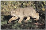 The Southern Rockies (21) marks the southern range for the threatened Canada lynx, Lynx canadensis. This larger cousin of the bobcat was once common throughout the mountainous regions of the West. Now they only number in the hundreds and are rare in the Southern Rockies. (Photo: Erwin and Peggy Bauer, US Fish And Wildlife Service) |
| 21b. The Subalpine Forests ecoregion is a forested zone occupying a narrow elevational band found on the steep forested slopes of the Medicine Bow and Sierra Madre mountains, becoming more extensive on the north slopes. The elevation range of the region is 8,500 to 10,800 feet, just below the Alpine Zone. The dense forests are dominated by lodgepole pine, Englemann spruce and subalpine fir; some areas are locally dominated by aspen. Whortleberry dominates the forest understory. Subalpine meadows also occur in some areas. Soils are weathered from a variety of crystalline and sedimentary materials and include areas of rock outcrops. Average annual precipitation is 26 to 46 inches for most of the region, including several feet of snow which remains on the ground well into summer months. Land use includes wildlife habitat, recreation, logging and historic mining. Grazing is limited by climatic conditions, lack of forage, and lingering snowpack. | |
| 21c. The Mid-Elevation Forests and Shrublands ecoregion is found in the 7,500 to 9,000 feet elevation range within the Laramie, Medicine Bow, and Sierra Madre mountains. Potential natural vegetation from southwestern to northeastern areas of the ecoregion includes aspen (especially on the west slope of the Sierra Madre), Douglas fir, lodgepole pine, limber pine, and ponderosa pine. Ponderosa pine grows mainly on the eastern slopes of the Laramie Mountains, as it does on the eastern Bighorn Mountains (17m), because of the availability of summer moisture. Forested areas are denser than they would have been historically because of fire suppression. Land use includes wildlife habitat, livestock grazing, mineral extraction, and recreation. Perennial streams are diverted for irrigation in lower elevations (21d) and are often dry in their lower reaches in the summer. | |
| 21d. The Foothill Shrublands ecoregion is a transition from the higher elevation forests of the Laramie, Medicine Bow, and Sierra Madre mountains to the more arid grassland and sagebrush regions in the Wyoming Basin (18) and the High Plains (25). This semiarid region has rolling to irregular terrain. On the east side of the Laramie Mountains, Ecoregion 21d is a continuation of high plains prairie grasslands of blue grama, prairie junegrass, and western wheatgrass interspersed with mountain big sagebrush and mountain mahogany shrubland. Pockets of aspen, limber pine, and Douglasfir are often found on north-facing slopes. Riparian vegetation along the water courses originating in higher mountains include willow species and narrowleaf cottonwood, with boxelder and wild plum in the north. Land use is mainly livestock grazing and some irrigated hayland adjacent to perennial streams. | |
| 25. High Plains The High Plains ecoregion is a landscape of rolling plains and tablelands formed by uplift and the erosion of the Rocky Mountains. Moisture is a limiting factor in the rainshadow of the Rocky Mountains; as a result, drought resistant shortgrass and some mixed-grass prairie dominate the plains vegetation. Seasonal precipitation in this region generally falls during the growing season. Dryland farming, once dependent on rainfall only, has been supplemented by irrigation water from the Ogallala Aquifer. However, irrigation in Ecoregion 25 will be limited over the long term due to constant lowering of the aquifers water table. Ecoregion 25 occupies the southeastern corner of Wyoming where three level III ecoregions meet. The boundaries of these regions fade into one another and some characteristics of each region can be found near the borders, making the level III boundary of the High Plains in Wyoming a transitional area. | |
| 25c. Irregular plains formed by fluvial deposits and eroded gravels from the Laramie Mountains compose the Moderate Relief Rangeland ecoregion. Natural prairie vegetation includes needle-and-thread, prairie junegrass, winter fat, and scattered yucca. Patches of mountain mahogany and skunkbush sumac grow on bluffs and hilltops. The plains surface steadily increases in elevation as it rises to a subtle boundary transition with the Laramie Mountains (21c and 21d). Land use is commonly livestock grazing in contrast to cropland agriculture in neighboring Ecoregion 25d. The differences in land use between Ecoregions 25c and 25d are related more to topographic differences than to differences in soil capacity. |
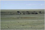
 The black-tailed prairie dog, Cynomys ludovicanus, is a keystone species in the short-grass and mixed-grass prairie ecosystems. Their populations have been reduced by an estimated 99 percent, from historic levels, through habitat destruction by urban sprawl, conversion to agriculture, and more than 100 years of poisoning. Prairie dog |
| 25d. The plains of the Flat to Rolling Cropland ecoregion are more level and less dissected than in the adjacent Moderate Relief Rangeland (25c). Soils are generally silty and loamy and in Wyoming they are similar to soils in Ecoregion 25c. Some areas of loess occur in the southeast corner of the state. Dryland farming with areas of irrigated cropland agriculture are extensive throughout the ecoregion. Winter wheat is the main cash crop, with smaller acreage in forage crops. | |
| 25f. The Pine Bluffs and Hills ecoregion is composed of light colored sedimentary rocks eroded into escarpments, bluffs, and badlands. Ponderosa pine woodland and open grasslands alternate along the rocky outcrops. The Hat Creek Breaks near Lusk are an extension of the Pine Ridge of Nebraska and South Dakota. Numerous springs flow from the fractured rock on the north side of the Hat Creek Breaks. The Hartville Uplift north of Wheatland is also included in Ecoregion 25f. Although the underlying geology of the Hartville Uplift contains dolomite and limestone in addition to sandstone, the topography, vegetation, and land use are similar to the pine escarpments. Land use includes cattle grazing, limited farming for hay and feed crops, and some timber cutting. | |
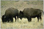
| 25g. The Sandy and Silty Tablelands ecoregion is characterized by tablelands with areas of moderate relief. The fine sandy and silty loams are formed from weathered Oligocene and Miocene sandstone (Ogallala and Arikaree Formations, and upper White River Groups). As in other parts of the eastern Wyoming plains, the prairies in Ecoregion 25g were once home to vast herds of bison that were the mainstay of the plains Indians, the Cheyenne, Arapaho, and Sioux. The bison was also central to the prairie ecosystem that included prairie dog, black-footed ferret, burrowing owl, gray wolf, and pronghorn antelope. By 1889, 30 to 70 million plains bison had been reduced to just 1000 animals. Since the 1880's Ecoregion 25g has been mainly used for livestock grazing. | |
| 25h. The Platte Valley and Terraces ecoregion, also known as Goshen Hole in Wyoming, is part of the extensive Platte River system. Historically, large volumes of water from spring snowmelt deposited silty and sandy alluvium in the floodplain, creating a wide alluvial valley and associated terraces. Potential natural vegetation is mostly mixed-grass prairie, with riparian vegetation of cottonwood, snowberry, wildplum, and silver buffalo-berry along the North Platte River. The Platte River is a major stopover point for migratory birds traveling the Central Flyway. Dams and irrigation water withdrawals have reduced the scouring power of the river, increased the amount of riparian woody vegetation, and decreased the area of wet meadows and open sandbars that attract migrating ducks, geese, sandhill and whooping cranes. | |
|
43. Northwestern Great Plains | |
| 43e. The Sagebrush Steppe ecoregion is more extensive in Montana and in the Dakotas with only a small area extending into Wyoming. This region has a sparse cover of big sagebrush, Nuttall saltbush, and short grass prairie. Salt pans punctuate the expanse of shortgrass prairie and dusky gray sagebrush. Potential natural vegetation also includes dwarf sagebrush, western wheatgrass, green needlegrass, blue grama, Sandberg bluegrass, and buffalograss. The shrub vegetation of ecoregion 43e is transitional between the grasslands of the Montana Central Grassland (43n) and the woodland of the Pine Scoria Hills (43p). Soils are heavy and alkaline, with a frigid temperature regime that contrasts with the mesic soils of the Semiarid Pierre Shale Plains (43g). |
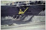
 The Northwestern Great Plains has a mix of rolling grasslands, sagebrush steppe, dissected plains, and foothills. Rivers and streams have wide, flat streambeds and broad floodplains. Isolated flattopped buttes, mesas, and ridges are common. Oil, coal, and coalbed methane extraction are big industries in this ecoregion. (Photo: Don Despain, USGS)  Coalbed methane development is extensive in the Powder River Basin (43w) and the Mesic Dissected Plains (43q). This practice has increased significantly in the past several years and concerns over water quality and land use issues have become a controversial topic between ranchers, land owners, and the mining companies. (Photo: BLM) |
| 43g. The mostly treeless Semiarid Pierre Shale Plains is characterized by heavy, mesic soils derived from underlying Cretaceous Pierre shale as well as calcareous Niobrara shale, Carlile shale, Mowry shale, and Belle Fourche shale that are generally not common in the Sagebrush Steppe (43e). The potential natural vegetation is mixed-grass prairie which includes a prevalence of shortgrass species, such as buffalograss, and it lacks the sagebrush component found in the neighboring Sagebrush Steppe (43e). Land use is primarily livestock grazing, with some isolated areas of dryland farming in winter wheat and alfalfa. This region also has extensive bentonite deposits. | |
| 43n. The Montana Central Grassland ecoregion is found mainly in Montana with only a small area continuing into northern Wyoming. Frigid soils are often clayey, and derived from residuum. They are a contrast to the more mesic soils of the Mesic Dissected Plains (43q) and the Powder River Basin (43w). Sheet-wash and gully erosion can be prominent. Potential natural vegetation is grama-needlegrass-wheatgrass; it lacks a shrub or woodland component found in the Sagebrush Steppe (43e) and Pine Scoria Hills (43p). | |
| 43p. Rugged, broken land and stony rough hills covered by open ponderosa pine-Rocky Mountain juniper forest or ponderosa pine savanna are characteristic of the Pine Scoria Hills. Coal, sandstone, and shale bedrock of the Tongue River Member of the Tertiary Fort Union Formation underlie the region. Porcellanite (also called scoria or clinker) forms from the natural burning of coal beds; it caps the hills with distinctive red-orange rock. Soils are often gravelly and poorly developed with rock outcrops common. Savanna and extensive open grassland are found in areas with less available moisture. Bluebunch wheatgrass, Idaho fescue, western wheatgrass, blue grama, and Sandberg bluegrass are the principal forage species. Skunkbush sumac and western snowberry are common shrubs. Land use includes woodland grazing and areas of historical small-scale coal mining. | |
| 43q. Steep grassy hills and verdant alluvial valleys characterize the Mesic Dissected Plains ecoregion in Wyoming. Ecoregion 43q receives more precipitation than the neighboring Powder River Basin (43w). In addition, numerous perennial streams flow off the northern Bighorn Mountains and wet meadows are common in riparian areas. As a result, riparian tree and shrub growth is more extensive than in other Northwestern Great Plains (43) ecoregions; boxelder, snowberry, serviceberry, and bullberry grow along streams and up north-facing slopes. Areas of irrigated agriculture are found along more level alluvial valleys. | |
| 43v. The Pryor-Bighorn Foothills ecoregion in Wyoming includes semi-arid, sedimentary foothills, alluvial fans, and high benches adjacent to the carbonate-rich Bighorn Mountains. The erosional material composing these foothills is coarser than the fine sediments of the adjacent Mesic Dissected Plains (43q). Shrub and tree covered canyons descend into Ecoregion 43v from the mountains above. Potential natural vegetation is mostly foothill prairie and is characterized by the predominance of fescues and wheatgrasses with some scattered ponderosa pines on the east side of the Bighorns. In addition, curlleaf mountain mahogany grows on rocky carbonate substrates. Average annual precipitation ranges from less than 10 to 20 inches depending on the rain shadow effect from the Bighorn Mountains. | |
| 43w. The Powder River Basin ecoregion covers rolling prairie and dissected river breaks surrounding the Powder, Cheyenne, and upper North Platte rivers. The Powder River Basin has less precipitation and less available water than the neighboring Mesic Dissected Plains (43q). Mule deer, pronghorn antelope, and sage grouse share the plains with livestock. However, oil, gas, and coal deposits are scattered throughout the ecoregion, and mining is exerting a powerful influence on the character of the landscape. Roads and pipelines feed coalbed methane wells placed in grids 80 acres apart, and vast amounts of underground water reserves are pumped to the surface and wasted in coalbed methane drilling. The mining fuels conflicts over surface/subsurface property rights and water management in a semiarid region. | |
| 43x. The Casper Arch ecoregion is a transitional region between the Northern Great Plains (43) and the Wyoming Basin (18). Soils are weathered from sodic Cody shale; they are generally well drained to slowly permeable, and are moderately to very shallow. Soils can be saline and strongly alkaline, which limits vegetation growth more than the low annual precipitation of 10 to 14 inches. Potential natural vegetation is mainly Gardner saltbush, western wheatgrass, bluebunch wheatgrass, Indian ricegrass, birdfoot sagebrush, and Sandberg bluegrass. Livestock grazing and wildlife habitat are the common land uses. | |
Literature Cited:
Bailey, R.G., Avers, P.E., King, T., and McNab, W.H., eds., 1994, Ecoregions and subregions of the United States (map) (supplementary table of map unit descriptions compiled and edited by McNab, W.H. and Bailey, R.G.): Washington, D.C., USFS, scale 1:7,500,000.
Bryce, S.A., Omernik, J.M., and Larsen, D.P., 1999, Ecoregions – a geographic framework to guide risk characterization and ecosystem management: Environmental Practice, v. 1, no. 3, p. 141-155.
Commission for Environmental Cooperation Working Group, 1997, Ecological regions of North America – toward a common perspective: Montreal, Commission for Environmental Cooperation, 71 p.
Gallant, A.L., Whittier, T.R., Larsen, D.P., Omernik, J.M., and Hughes, R.M., 1989, Regionalization as a tool for managing environmental resources: Corvallis, Oregon, U.S. Environmental Protection Agency, EPA/600/3-89/060, 152 p.
Griffith, G.E., Omernik, J.M., Wilton, T.F., and Pierson, S.M., 1994, Ecoregions and subregions of Iowa – a framework for water quality assessment and management: Journal of the Iowa Academy of Science, v. 101, no. 1, p. 5-13.
Omernik, J.M., 1987, Ecoregions of the conterminous United States (map supplement): Annals of the Association of American Geographers, v. 77, no. 1, p. 118-125, scale 1:7,500,000.
Omernik, J.M., 1995, Ecoregions – a framework for environmental management, in Davis, W.S. and Simon, T.P., eds., Biological assessment and criteria-tools for water resource planning and decision making: Boca Raton, Florida, Lewis Publishers, p. 49-62.
Omernik, J.M., Chapman, S.S., Lillie, R.A., and Dumke, R.T., 2000, Ecoregions of Wisconsin: Transactions of the Wisconsin Academy of Sciences, Arts, and Letters, v. 88, p. 77-103.
U.S. Department of Agriculture–Soil Conservation Service, 1981, Land resource regions and major land resource areas of the United States: Agriculture Handbook 296, 156 p.
U.S. Environmental Protection Agency, 2003, Level III ecoregions of the continental United States (revision of Omernik, 1987): Corvallis, Oregon, USEPA – National Health and Environmental Effects Research Laboratory, Map M-1, various scales.
Wiken, E., 1986, Terrestrial ecozones of Canada: Ottawa, Environment Canada, Ecological Land Classification Series no. 19, 26 p.
PRINCIPAL AUTHORS: Shannen S. Chapman (Dynamac Corporation), Sandra A. Bryce (Dynamac Corporation), James M. Omernik (USEPA, retired), Donald G. Despain (USGS), Jeremy ZumBerge (WDEQ), and Mark Conrad (WDEQ).
COLLABORATORS AND CONTRIBUTORS: Dennis Knight (University of Wyoming), Tony Selle (USEPA), Jack Smith (WDEQ), Darrell Schroeder (NRCS), Bill Daniels (BLM), Tom Enright (BLM), Jerry Freeouf (USFS), and Jeffrey Comstock (Indus Corporation).
REVIEWERS: Kurt King (WDEQ) and Myron Brooks (USGS, Wyoming).
CITING THIS POSTER: Chapman, S.S., Bryce, S.A., Omernik, J.M., Despain, D.G., ZumBerge, J., and Conrad, M., 2004, Ecoregions of Wyoming (color poster with map, descriptive text, summary tables, and photographs): Reston, Virginia, U.S. Geological Survey (map scale 1:1,400,000).
This project was partially supported by funds from the USEPA– Office of Research and Development’s Environmental Monitoring and Assessment Program through contract 68-C6-005 to Dynamac Corporation.
