Land-use & Land-cover Change (main)
From The Encyclopedia of Earth
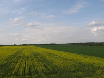
Land-use & Land-cover Change
========
-
 Featured Article
 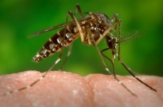 Yellow Fever (Land-use & Land-cover Change)Introduction Centers for Disease Control and Prevention Yellow fever is a viral disease that is transmitted to humans... More »
- Featured Article
 Woody encroachment in the southwestern United...Worldwide, observers report changes in the tree-grass matrix of arid and semi-arid grasslands insofar as woody species seem to be encroaching and crowding out grass species. ... More »
- Featured Article
 The Next Great Quake in Northern California?When Will the Next Great Quake Strike Northern California? The Great 1906 San Francisco Earthquake is the most powerful in Northern California's... More »
-
 Featured Photo Gallery
 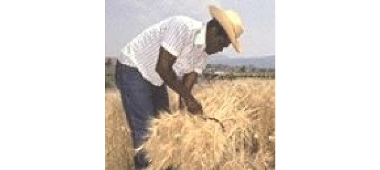 Agriculture II (Land-use & Land-cover Change)Humans began to cultivate food crops about 10,000 years ago. Prior to that time, hunter-gatherers secured their food as they traveled in the nearby environment. When they... More »
- Featured Article
 EPA on School SitingThis article, written byBob Weinhold*, appeared first in Environmental Health Perspectives—the peer-reviewed, open access journal of the National Institute of... More »
- Featured Article
 Daugava River (Land-use & Land-cover Change)The Daugava River drains portions of the countries of Latvia, Belarus and Russia, prior to discharging to the Gulf of Riga. Also known as the West Dvina River, this watercourse is... More »
- Featured Article
 Overgrazing (Land-use & Land-cover Change)Overgrazing is herbivory (animal comsumption of plants) that extracts an unsustainable yield of floral biomass from an ecosystem; however, the term is most often... More »
- Featured Article
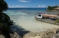 Tokelau (Land-use & Land-cover Change)Tokelau is group of three low-lying coral atolls (Atafu, Fakaofo, Nukunonu) enclosing large lagoons in the South Pacific Ocean, about one-half of the way from Hawaii to New... More »
- Featured Article
 King Memorial: Nation's 395th National ParkThe National Park Service formally welcomed the Martin Luther King, Jr. Memorial as America’s 395th national park on August 28, 2011 – the 48th anniversary of Dr.... More »
Recently Updated
Daugava River (Land-use & Land-cover Change) Last Updated on 2015-01-12 07:37:16 The Daugava River drains portions of the countries of Latvia, Belarus and Russia, prior to discharging to the Gulf of Riga. Also known as the West Dvina River, this watercourse is the fourth largest river discharging to the Baltic Sea catchment. This 1005 kilometer long river has suffered environmental damage from agricultural runoff and from hydroelectric dam construction, with major impacts dealt in the Soviet era of collective farming. In ancient history the Daugava estuary was a locus of prehistoric settlement, and later marked one of the eastern limits of the voyages of the Vikings. The lower Daugava valley (nearest the Gulf of Riga) was formed in relatively recent times, as glacial meltwater formed incision on the relatively level terrain near the Baltic Sea coast; these events occurred in the early Holocene, approximately 11,000 years before present. The relatively soft upper... More » 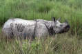 Kaziranga National Park, India Last Updated on 2014-07-07 17:22:24 Introduction Kaziranga National Park (26º40'N, 93º22'E) is a World Heritage Site that is one of the last areas in eastern India almost undisturbed by man. It is a forest-edged riverine grassland maintained by fire and annual floods inhabited by the world's largest population of one-horned rhinoceroses, as well as a wide diversity of animals, including tigers, elephants, leopards, bears, several species of deer and thousands of birds. 1985: Inscribed on the World Heritage list under Natural Criteria ix and x. Situated on the southern bank of the Brahmaputra River at the foot of the Mikir / Karbi Anglong Hills, about 8 kilometers (km) from Bokakhat and 220 km east of Gauhati, the Assam state capital. National Highway No. 37 forms the southern boundary. 26°30'-26°45'N, 93°05'-93°40'E. 1908: Originally established as a... More »
 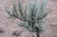 Sagebrush (Land-use & Land-cover Change) Last Updated on 2014-06-26 17:04:33 Sagebrush is an emblem of the mountain West. Its grey leaves and pale yellow inflorescences inspire differing emotions in different people, or even in the same people at different times. There are people who, on coming to Nevada, have declared it the ugliest land ever to meet their gaze, only to remain there and become enchanted by the silvery carpet of sagebrush covering the hills and mountains there. Artemisia is a generic name honouring the Greek goddess Artemis, known in the West as Diana; many medicinal plants share this genus with sagebrush, such as A. ludoviciana, A. vulgaris, and A. absinthum. The specific epithet tridentata refers to the leaves, which have at the end three "teeth", a useful tool for identification. Look for small, grey, hairy leaves an inch long or less, rather strap-like and shaped like a long wedge. The tip of the leaf should have the... More »
  Ecoregions of Wisconsin (EPA) Last Updated on 2014-06-26 16:34:28 Ecoregions denote areas of general similarity in ecosystems and in the type, quality, and quantity of environmental resources; they are designed to serve as a spatial framework for the research, assessment, monitoring, and management of ecosystems and ecosystem components. Special purpose maps of characteristics such as plant communities, water quality, soils, and fish distributions are necessary and have long been used for dealing with specific research and management problems. Ecoregions, on the other hand, portray areas within which there is similarity in the mosaic of all biotic and abiotic components of both terrestrial and aquatic ecosystems. Recognition, identification, and delineation of these multipurpose regions are critical for structuring and implementing integrated management strategies across federal, state, tribal, and local governmental agencies that are responsible for... More »
 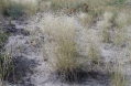 Indian Ricegrass (Land-use & Land-cover Change) Last Updated on 2014-06-25 18:00:06 Achnatherum hymenoides (Roemer & J.A. Schultes) Barkworth As the common name implies, Native Americans utilized this species of grass in a manner analogous to that of rice by peoples of the Old World and their descendants. The name in Spanish is essentially the same: “arroz indio.” It is also known as Indian Millet or Sand-grass, and Latin synonyms are Oryzopsis h., Stipa h., and Eriocoma cuspidata. Achnatherum hymenoides is a member of the Poaceae, or grass family. It likes to live in sandy soils and is adapted to dry places, but also lives in moist areas within drier environments; look for it where you see sagebrush, juniper, or ponderosa pine. Distinguishing Indian ricegrass from other grasses may sound difficult to someone who has not seen it before, but armed with a good picture and an idea of what to look for, it can be done. Look for a bunchgrass from 1... More »