Ecoregions of Suriname
Ecoregions of Suriname
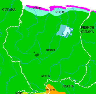 Map of Ecoregions of Suriname. Source: WWF
 The following ecoregions are found in Suriname.
- The Guianan moist forests are one of the largest continuous tracts of relatively pristine lowland tropical rainforest in the world. This ecoregion is characterized by high species richness and local and regional endemism, particularly among the flora, as well as relatively intact ecological processes.
- Paramaribo swamp forests, which cover about eight percent of Suriname's land area, are characterized by the fact that they grow on almost permanently inundated soils. In general, the resulting forests are shorter in stature, have many specialized species of flora and fauna, and a rather low floral diversity compared to the surrounding terra firma moist forests.
- Guianan mangroves are considered some of the most extensive and structurally complex mangrove ecosystems in South America, covering over 14,000 square kilometers (km2) and reaching heights of 35-40 meters (m).
- Guyanan savanna ecoregion occupies an area within the Roraima formation distinguished by extensive savannas and schrubby vegetation. The region is traversed by streams with gallery forests, and extensive savannas. In this ecoregion, recurrent fires and extremely poor soils are the most important factor in the advance of savannas in place of forest and the processes that are derived by these changes. More than 50 of the highest tabletop mountains are the remains of the ancient sandstone tableland overlying the even more ancient granitic Guayana Shield. They range from 1,000 to 3,000 meters (m) in elevation. And they are called Tepuis (singular: tepui), a word from the Pemón Amerindians. Many tepuis are graced with dramatic waterfalls, the tallest of which (in fact, the tallest in the world) is Angel Falls dropping 979 meters.
- The large Uatuma-Trombetas moist forests ecoregion with its evergreen tropical forests, falls in the eastern section of Amazonia. Due to ecoregion wide changing topography and associated climate variations, the ability to support a wide range of species both flora and fauna, elevates this ecoregion to a level of high biological diversity.
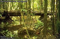 Near Brownsberg, Suriname. (Photograph by Marco Bleeker)
 The North Brazil Shelf Large Marine Ecosystem (LME) is characterized by its tropical climate. This LME has high levels of nutrients coming from the Amazon and Tocantins rivers, as well as from the smaller rivers of the Amapa and western Para coastal plains. It is bordered by four countries: Brazil, French Guiana, Suriname and Guyana.
Structural definition of ecoregions
Ecoregions are areas that: [1] share a large majority of their species and ecological dynamics; [2] share similar environmental conditions; and, [3] interact ecologically in ways that are critical for their long-term persistence. Scientists at the World Wildlife Fund (WWF), have established a classification system that divides the world in 867 terrestrial ecoregions, 426 freshwater ecoregions and 229 marine ecoregions that reflect the distribution of a broad range of fauna and flora across the entire planet.