Ecoregions of Oregon
Ecoregions of Oregon (EPA)
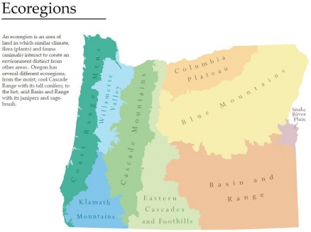
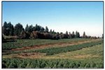
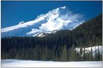
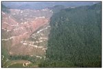
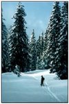
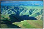
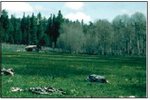
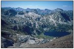
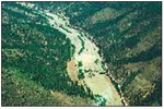
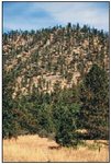
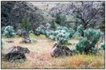
The ecoregions of Oregon span a great diversity of ecosystems, including maritime forests, alpine and subalpine forests, coastal dunes and grasslands.
Ecoregions denote areas of general similarity in ecosystems and in the type, quality, and quantity of environmental resources; they are designed to serve as a spatial framework for the research, assessment, management, and monitoring of ecosystems and ecosystem components. By recognizing the spatial differences in the capacities and potentials of ecosystems, ecoregions stratify the environment by its probable response to disturbance (Bryce and others, 1999). Ecoregions are directly useful to the regulatory affairs of state agencies, including the development of biological criteria and water quality standards and the establishment of management goals for nonpoint-source pollution (Omernik and Griffith, 1991; Hughes et al, 1990; Whittier et al, 1988). They are also relevant to integrated ecosystem management, an ultimate goal of many federal and state resource management agencies.
The approach used to compile this map is based on the premise that ecological regions can be identified through the analysis of the spatial patterns and the composition of biotic and abiotic phenomena that affect or reflect differences in ecosystem quality and integrity (Wiken, 1986; Omernik, 1987, 1995). These phenomena include geology, physiography, vegetation, climate, soils, land use, wildlife distributions and hydrology. The relative importance of each characteristic varies from one ecological region to another regardless of the hierarchical level. A Roman numeral hierarchical scheme has been adopted for different levels of ecological regions. Level I is the coarsest level, dividing North America into 15 ecological regions. Level II divides the continent into 52 regions (Commission for Environmental Cooperation Working Group, 1997). At level III, the continental United States contains 104 ecoregions and the conterminous United States has 84 ecoregions (United States Environmental Protection Agency [USEPA], 2003). Level IV is a further subdivision of level III ecoregions. Explanations of the methods used to define the USEPA’s ecoregions are given in Omernik (1995), Omernik and others (2000), Griffith and others (1994), and Gallant and others (1989).
Oregon is ecologically diverse. The western side of the state has a marine-influenced climate and receives plentiful precipitation three seasons of the year. In contrast, eastern Oregon lies in the rain shadow of the Cascades and is much drier. The climatic gradient is evident in the state's landscapes: forested mountains, glaciated peaks, shrub- and grass-covered plains, agricultural valleys, beaches, desert playas, and wetlands. There are nine level III ecoregions and 65 level IV ecoregions in Oregon and many continue into ecologically similar parts of adjacent states (Bryce and others, 2003; McGrath and others, 2002; Pater and others, 1998).
This level III and IV ecoregion map was compiled at a scale of 1:250,000. The western part was originally published as part of Pater and others (1998). The level IV lines in the Columbia Plateau and Blue Mountains were originally published in Clarke and Bryce (1997). Ecoregion boundaries in the remainder of Oregon depict revisions and subdivisions of earlier level III ecoregions that were originally compiled at a coarser scale (Omernik, 1987; USEPA, 2003).
This poster is the product of a collaborative effort primarily between the USEPA Region X, the USEPA National Health and Environmental Effects Research Laboratory (Corvallis, Oregon), the Oregon Natural Heritage Program, the United States Department of Agriculture–Forest Service (USFS), the United States Department of Agriculture–Natural Resources Conservation Service (NRCS) (formerly the Soil Conservation Service), and the United States Department of the Interior–Geological Survey (USGS)–Earth Resources Observation Systems (EROS) Data Center.
The Oregon ecoregion project is part of an interagency effort to develop a common framework of ecological regions for the United States. Reaching that objective requires recognition of the differences in the conceptual approaches and mapping methodologies applied to develop the most common ecoregion-type frameworks, including those developed by the USFS (Bailey and others, 1994), the USEPA (Omernik, 1987, 1995), and the NRCS (U.S. Department of Agriculture–Soil Conservation Service, 1981). As each of these frameworks is further refined, their differences are becoming less discernible. Regional collaborative projects, such as this one in Oregon, where agreement has been reached among multiple resource management agencies, are a step toward attaining consensus and consistency in ecoregion frameworks for the entire nation.
|
1. Coast Range | |
|
1a. The Coastal Lowlands ecoregion contains beaches, dunes, and marine terraces below 400 feet elevation. Wet forests, lakes, estuarine marshes, and tea-colored (tannic) streams are characteristic features of the landscape. Wetlands have been widely drained and converted to dairy pastures. Residential, commercial, and recreational developments are expanding in the coastal corridor. |
|
| 1b. The Coastal Uplands includes headlands and low mountains surrounding the Coastal Lowlands (1a). The climate of Ecoregion 1b is marine influenced with an extended winter rainy season and minimal seasonal temperature extremes. Abundant fog during the summer dry season reduces vegetation moisture stress. Ecoregion 1b includes much of the historic distribution of Sitka spruce. Today, its Douglas-fir forests are managed for logging. | |
| 1d. The lower, more coastal parts of the mountainous Volcanics ecoregion are affected by fog. Ecoregion 1d is underlain by fractured basaltic rocks. As a result, summer stream flows are more consistent than on the sedimentary rocks of surrounding ecoregions, and streams still support runs of spring chinook salmon and summer steelhead. Its Douglas-fir plantations are intensively logged. Sediment delivery rates to streams following disturbance are lower than in Ecoregion 1g. | |
| 1f. The Willapa Hills ecoregion is more rolling and has a lower drainage density than other upland areas in the Coast Range (1). Logging is relatively easy and less expensive in this accessible terrain. Industrial timberland has almost completely replaced the historic forests of the Willapa Hills (1f). When disturbed, the silt- and clay-textured soils are easily eroded, thereby degrading stream quality. Large herds of Roosevelt elk winter in Ecoregion 1f. | |
| 1g. The mountainous Mid-Coastal Sedimentary ecoregion lies outside of the coastal fog zone and is typically underlain by massive beds of sandstone and siltstone in contrast to the volcanics of Ecoregion 1d. Ecoregion 1g is more rugged than the geologically similar Willapa Hills (1f). Its Douglas-fir forests are intensively managed for logging. Slopes are prone to failure when disturbed, particularly south of the Siuslaw River. Stream sedimentation is higher than in the Volcanics ecoregion. | |
| 1h. The mountainous Mid-Coastal Sedimentary ecoregion lies outside of the coastal fog zone and is typically underlain by massive beds of sandstone and siltstone in contrast to the volcanics of Ecoregion 1d. Ecoregion 1g is more rugged than the ecologically similar Willapa Hills (1f). Its Douglas-fir forests are intensively managed for logging. Slopes are prone to failure when disturbed, particularly south of the Siuslaw River. Stream sedimentation is higher than in the Volcanics ecoregion. | |
| 1i. The low mountains of the Redwood Zone lie entirely within the coastal fog zone and are characteristically covered by coast redwood and Douglas-fir. Historically, unbroken redwood forests occurred and moderated local climate by trapping coastal fog and producing shade. Remnants of unlogged redwood forest still survive east of Brookings. | |
| 3. Willamette Valley Ecoregion 3 contains terraces and floodplains of the Willamette River system, scattered hills, buttes, and adjacent foothills. Originally, it was covered by prairies, oak savanna, coniferous forests, extensive wetlands, and deciduous riparian forests. Elevation and relief are lower and the vegetation mosaic differs from the coniferous forests of the surrounding Coast Range (1), Cascades (4), and Klamath Mountains (78). Mean annual rainfall is 37 to 60 inches and summers are generally dry; overall, precipitation is lower than in the surrounding mountains. Today, the Willamette Valley (3) contains the bulk of Oregon’s population, industry, commerce, and cropland. Productive soils and a temperate climate make it one of the most important agricultural areas in Oregon. | |
| 3a. The nearly level to undulating Portland/Vancouver Basin is a depression at the base of the Portland Hills fault block. It contains the confluence of the Columbia and Willamette Rivers and is composed of deltaic sands and gravels deposited by Pleistocene floods. Historically, prairie, oak woodland, Douglas-fir, and Oregon ash grew on terraces and wetland margins. Today, many wetlands, oxbow lakes, and ponds still occur, but, overall, the Portland/Vancouver Basin (3a) is dominated by urban and suburban development, pastures, and nurseries. The climate is usually marine-influenced but, periodically, easterly winds entering via the Columbia River Gorge bring continental temperature extremes to the Portland/Vancouver Basin (3a). |
|
| 3b. The Willamette River and Tributaries Gallery Forest ecoregion includes low-gradient, meandering, river channels, broad floodplains, oxbow lakes, and meander scars. Riparian gallery forests containing ash, black cottonwood, alder, and bigleaf maple once grew on its fertile, alluvial soils but most have been replaced by agriculture and rural residential, suburban, and urban development. Ecoregion 3b includes the major historic floodplains of the Willamette River system that rarely function today due to flood control dams upstream. Dams in the upper Willamette Basin reduce both flood frequency and flood volume, which are related to the decline of the endemic, endangered Oregon chub. | |
| 3c. The nearly level to undulating Prairie Terraces ecoregion includes all of the terraces of the Willamette River upstream of the Portland/Vancouver Basin (3a). Ecoregion 3c is drained by low-gradient, meandering streams and rivers. Its broad fluvial terraces once supported oak savanna and prairies that were maintained by burning; wetter areas supported Oregon ash and black cottonwood. Today, only relict native prairie remain. The poorly drained soils derived from glacio-lacustrine deposits are extensively farmed for grass seed and small grains. Grasses tolerate poor drainage and poor rooting conditions better than other crops. In addition to agriculture, the Prairie Terraces also experience the bulk of urban expansion. | |
| 3d. The Valley Foothills ecoregion is a transitional zone between the agricultural Willamette Valley and the more heavily forested Cascade and Coast ranges. The forest canopy of Ecoregion 3d is dominated by Oregon white oak and Douglas-fir. The Valley Foothills (3d) receive less precipitation than adjacent mountainous ecoregions. Eastern foothills are wetter than those that lie on the western side of the Willamette Valley in the lee of the Coast Range (1). Today, rural residential development, pastureland, vineyards, tree farms, and orchards are common in Ecoregion 3d. The foothills also serve as a wildlife corridor between the Willamette Valley and the surrounding mountains. | |
| 4. Cascades The mountains of Ecoregion 4 are widely underlain by Cenozoic volcanic rocks and have been affected by alpine glaciation. Maximum elevations of up to 11,239 feet occur on active and dormant volcanic peaks in the eastern part of Ecoregion 4. The western Cascades are older, lower, and dissected by numerous, steep-sided stream valleys. Ecoregion 4 has a moist, temperate climate that supports an extensive and highly productive coniferous forest that is intensively managed for logging. Subalpine meadows occur at high elevations. | |
| 4a. The Western Cascades Lowlands and Valleys ecoregion includes the lower slopes of the Cascades (4). Its mild, wet climate promotes lush western hemlock–Douglas-fir forests. Soils are warmer than in higher elevation ecoregions. The steep valleys contain high gradient rivers and streams that support cold water salmonids, including the threatened chinook salmon, steelhead, and bull trout. Reservoirs store winter snow melt for irrigation and municipal water supply in the Willamette Valley (3). |
|
| 4b. The Western Cascades Montane Highlands are composed of steeply sloping, dissected mountains between about 3,000 and 6,500 feet elevation. The western Cascades are older and more eroded than the lava plateau and prominent snow-covered cones of the high Cascades (Ecoregions 4c and 4d); they are composed of dark basalt in contrast to the gray andesite of the high Cascades. Ecoregion 4b has lower temperatures and receives more winter snow than the Western Cascades Lowlands and Valleys (4a). Soils have frigid or cryic temperature regimes, in contrast to the mesic temperature regime of soils in Ecoregion 4a. Abundant precipitation supports forests dominated by Douglas-fir, western hemlock, noble fir, and Pacific silver fir. | |
| 4c. The Cascade Crest Montane Forest ecoregion consists of an undulating plateau punctuated by volcanic mountains and lava flows. Volcanism in the Pliocene epoch overtopped the existing Miocene volcanics of Ecoregion 4b. Later Pleistocene glaciation left numerous naturally-fishless lakes. Today, Ecoregion 4c contains forests dominated by mountain hemlock and Pacific silver fir. It has a shorter summer drought and fewer intermittent streams than the High Southern Cascades Montane Forest (4e). | |
| 4d. The Cascades Subalpine/Alpine ecoregion contains the prominent volcanic peaks of the high Cascades. Pleistocene glaciation reshaped the mountains above 6500 feet, leaving moraines, glacial lakes, and U-shaped glacial canyons. Glaciers and permanent snowfields still occur on the highest peaks. The vegetation is adapted to high elevations, cold winter temperatures, short growing season, and deep winter snow pack. Herbaceous subalpine meadow vegetation and scattered patches of mountain hemlock, subalpine fir, and whitebark pine occur near timberline. | |
| 4e. The High Southern Cascades Montane Forest ecoregion is an undulating, glaciated, volcanic plateau containing isolated buttes, cones, and peaks. The terrain is less dissected than the Southern Cascades (4f). At 4,000 to 8,200 feet, maximum elevations are intermediate to those in the Southern Cascades (4f) and the Cascades Subalpine/Alpine ecoregion (4d). Cryic soils support mixed coniferous forests dominated by mountain hemlock, lodgepole pine, and Pacific silver fir; they are colder than the mesic and frigid soils of the Southern Cascades (4f). Grand fir, white fir, and Shasta red fir also occur and become more common oward the south and east. The High Southern Cascades Montane Forest (4e) has a longer summer drought and more intermittent streams than the Cascade Crest Montane Forest (4c). | |
| 4f. The Southern Cascades ecoregion is lower in elevation and less rugged than the more highly dissected Western Cascades Montane Highlands (4b) to the north. Mt. McLoughlin, at 9500 feet, is the highest peak in Ecoregion 4f. The climate is drier than in the Western Cascades Lowlands and Valleys (4a) and the Western Cascades Montane Highlands (4b), and the vegetation reflects it. Western hemlock and western red cedar, which are indicator species of Ecoregions 4a and 4b, decline southward in the Southern Cascades (4f), and are replaced by Sierra Nevada species such as incense cedar, white fir, and Shasta red fir that tolerate prolonged summer drought. Overall, river and stream discharge is also significantly lower than in systems to the north. | |
| 9. Eastern Cascades Slopes and Foothills Ecoregion 9 is in the rainshadow of the Cascade Range. It experiences greater temperature extremes and receives less precipitation than ecoregions to the west. Open forests of ponderosa pine and some lodgepole pine distinguish this region from the higher ecoregions to the west where hemlock and fir forests are common, and the lower, drier ecoregions to the east where shrubs and grasslands are predominant. The vegetation is adapted to the prevailing dry, continental climate and frequent fire. Historically, creeping ground fires consumed accumulated fuel and devastating crown fires were less common in dry forests. | |
| 9b. The Grand Fir Mixed Forest ecoregion is mostly outside the limit of maritime climatic influence. It is characterized by high, glaciated plateaus and mountains, frigid soils, and a snow-dominated, continental climate. Grand fir, Douglas-fir, ponderosa pine, and larch occur. Ecoregion 9b is higher and moister than Ecoregion 9c, but the boundary between them is not sharp. |
|
| 9c. The Oak/Conifer Foothills ecoregion is more diverse than other parts of Ecoregion 9. Marine weather enters Ecoregion 9c via the Columbia River Gorge, moderating its otherwise continental climate. As a result, soil, climate, and vegetation share characteristics of both eastern and western Oregon. Grasslands, oak woodlands, and forests dominated by ponderosa pine, and Douglas-fir occur. Ecoregion 9c is lower and drier than the Grand Fir Mixed Forest ecoregion (9b). | |
| 9d. The undulating volcanic plateaus and canyons of the Ponderosa Pine/Bitterbrush Woodland have well-drained, frigid soils that are often derived from ash. Ponderosa pine is common; lodgepole pine is largely absent unlike in the Pumice Plateau (9e). Understory vegetation varies with elevation; at lower elevations, antelope bitterbrush is important winter browse for deer. | |
| 9e. The Pumice Plateau ecoregion is a high volcanic plateau. Ecoregion 9e is characteristically covered by thick deposits of pumice and volcanic ash. Soils are very deep, highly permeable, and droughty. Spring-fed creeks and marshes occur. Ponderosa pine forests are common on slopes; colder depressions and flats are dominated by lodgepole pine and higher elevations have white fir. Freezing temperatures are possible any time of year. | |
| 9f. The Pumice Plateau Basins ecoregion includes Sycan Marsh, Klamath Marsh, and La Pine Basin. All three areas function as catch-basins for cold air during the winter and have lower minimum temperatures than Ecoregion 9e. Soils in Ecoregion 9f have water tables at or near the surface for significant periods of the year in contrast to Ecoregion 9e. Marshes and forested wetlands provide important habitat for migratory waterfowl. | |
|
9g. The Klamath/Goose Lake Basins ecoregion covers river floodplains, terraces, and lake basins. A variety of wildrye, bluegrass, and wheatgrass species once covered the basins, but most of the wet meadows and wetlands have been drained for agriculture. Several marshland wildlife refuges are key to preserving regional biodiversity, particularly at-risk bird and fish species. | |
| 9h. The Fremont Pine/Fir Forest ecoregion contains mid-elevation mountains and high plateaus that rarely exceed timberline. Closed canopy forests contrast with the savanna of the Klamath Juniper Woodland (9j). Ponderosa pine is widespread, but white fir, sugar pine, and incense cedar also grow above 6500 feet and on north slopes. Residual soils are common in contrast to Ecoregion 9e, where residual soils have been deeply buried by pumice and ash. Ecoregion 9h has a high density of lakes and reservoirs. | |
| 9i. The Southern Cascades Slope ecoregion is a transitional zone between the Cascades (4) and the drier Eastern Cascade Slopes and Foothills (9). Ecoregion 9i is higher and moister than ecoregion 9h, and it has a greater mix of forest types. Ponderosa pine woodland becomes mixed with white fir, incense cedar, Shasta red fir, and Douglas-fir at higher elevations. | |
| 9j. The Klamath Juniper Woodland ecoregion is composed of undulating hills, benches, and escarpments covered with a mosaic of rangeland and woodland. Western juniper grows on shallow, rocky soils with an understory of low sagebrush, big sagebrush, bitterbrush, and bunchgrasses. Other shrubland/grasslands include shrub species uncommon in eastern Oregon, such as woolly wyethia, Klamath plum, and birchleaf mountain mahogany. The diverse shrublands provide important wildlife habitat. | |
| 10. Columbia Plateau Ecoregion 10 is an arid, sagebrush steppe and grassland that is flanked by moister, predominantly forested, mountainous ecoregions. The Columbia Plateau (10) is underlain by basalt up to two miles thick and partially covered by thick loess deposits. Where precipitation amounts are sufficient, its deep loess soils have been extensively cultivated for wheat. The Columbia River bisects Ecoregion 10; its water is subject to resource allocation debates involving fisheries, navigation, power production, recreation, and irrigation. | |
| 10c. The nearly level to rolling, treeless Umatilla Plateau ecoregion is underlain by basalt and veneered with loess deposits. Areas with thick loess deposits are farmed for dry land winter wheat, or irrigated alfalfa and barley. In contrast, rangeland dominates more rugged areas where loess deposits are thinner or nonexistent, such as in neighboring Ecoregions 10k and 10n. Mean annual precipitation is 9 to 15 inches and increases with increasing elevation. In uncultivated areas, moisture levels are generally high enough to support grasslands of bluebunch wheatgrass and Idaho fescue without associated sagebrush, which is more common in 10e. |
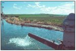
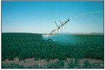 Irrigation projects supply Columbia River water to the Pleistocene Lake Beds (10e), the driest portion of the Columbia Plateau (10). They have allowed the conversion of large areas into cropland producing potatoes, wheat, alfalfa, and silage corn. Here, a center pivot system irrigates sandy Adkins soil. (NRCS) Irrigation projects supply Columbia River water to the Pleistocene Lake Beds (10e), the driest portion of the Columbia Plateau (10). They have allowed the conversion of large areas into cropland producing potatoes, wheat, alfalfa, and silage corn. Here, a center pivot system irrigates sandy Adkins soil. (NRCS) 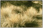 In protected, ungrazed areas one may still encounter the bunchgrasses that grew in association with sagebrush and juniper across vast areas of Ecoregions 10, 11, and 80. Bluebunch wheatgrass, pictured here, and Idaho fescue do not withstand intense grazing pressure and have been replaced by alien cheatgrass. In protected, ungrazed areas one may still encounter the bunchgrasses that grew in association with sagebrush and juniper across vast areas of Ecoregions 10, 11, and 80. Bluebunch wheatgrass, pictured here, and Idaho fescue do not withstand intense grazing pressure and have been replaced by alien cheatgrass. |
| 10e. The Pleistocene Lake Basins once contained vast temporary lakes that were created by flood waters from glacial lakes Missoula and Columbia. In Oregon, the flood waters accumulated from the eastern entrance of the Columbia River Gorge upstream to the Wallula Gap to form ancient Lake Condon. Today, Ecoregion 10e is the driest and warmest part of the Columbia Plateau (10) with mean annual precipitation varying from 7 to 10 inches. Native vegetation consists of bunchgrass and sagebrush. Major irrigation projects provide Columbia River water to Ecoregion 10e, allowing the conversion of large areas into agriculture. | |
| 10g. The Yakima Folds ecoregion consists of unforested anticlinal ridges composed of layer upon layer of basalt many thousands of feet thick. Loess blankets the south-facing slopes and supports dryland wheat farming. Steep, rocky north-facing slopes are commonly used for livestock grazing. Ecoregion 10g receives an average of 10 to 12 inches of rain per year. Sagebrush and bunchgrass associations dominate plant assemblages outside of heavily farmed or grazed areas. | |
| 10i. The Deep Loess Foothills have highly-productive, loess-rich soils. Moisture levels are high enough to support Idaho fescue and bluebunch wheatgrass grasslands. Today, Ecoregion 10i is dominated by non-irrigated winter wheat, barley, alfalfa, and green pea farming. Land use contrasts with the rangeland of the Umatilla Dissected Uplands (10n). Perennial streams occur that are fed by the precipitation that falls on the adjacent Blue Mountains (11). | |
| 10k. Deeply cut into basalt, the Deschutes/John Day Canyons fragment a lightly populated portion of the Umatilla Plateau (10c). Canyon depths up to 2,000 feet create drier conditions than on the plateau above. In the canyons, bunchgrasses, Wyoming big sagebrush, and cheatgrass grow on rocky, colluvial soil. Riparian vegetation in narrow reaches is often limited to a band of white alder at the water line; broader floodplains and gravel bars are dominated by introduced species, such as reed canarygrass, sweetclover, and teasel. The rivers support chinook salmon and steelhead runs. | |
| 10n. In the Umatilla Dissected Uplands, the dry grasslands of the Columbia Plateau (10) meet the forested Blue Mountains (11). The steep, dissected hills and terraced uplands are covered with Idaho fescue, bluebunch wheatgrass, and Sandberg bluegrass. Near the Blue Mountains, some north-facing slopes have Douglas-fir and ponderosa pine. Ecoregion 10n is mostly used as rangeland because it lacks the thick, arable loess deposits that cover the agricultural Umatilla Plateau (10c). Scablands, composed of arrays of earth mounds surrounded by rock polygons, are relics of Pleistocene glacial periods. | |
| 11. Blue Mountains Ecoregion 11 is a complex of mountain ranges that are lower and more open than the neighboring Cascades (4) and Northern Rockies (15). Like the Cascades (4), but unlike the Northern Rockies (15), the Blue Mountains (11) are mostly volcanic in origin. However, the core of the Blue Mountains and the highest ranges, the Wallowa and Elkhorn Mountains, are composed of granitic intrusives, deep sea sediments, and metamorphosed rocks. Much of Ecoregion 11 is grazed by cattle, unlike Ecoregions 4 and 15. | |
| 11a. The semiarid John Day/Clarno Uplands form a ring of dry foothills surrounding the western perimeter of the Blue Mountains. Highly dissected hills, palisades, and colorful ash beds flank the valleys of the John Day and Crooked Rivers. Ecoregion 11a has a continental climate moderated somewhat by marine influence. Juniper woodland has expanded markedly into the sagebrush-grassland during the 20th Century due to a combination of climatic factors, fire suppression, and grazing pressure. |
|
| 11b. The low mountains of the John Day/Clarno Highlands are uniformly covered by ponderosa pine forest with a grass and shrub understory. The continental climate is tempered by a marine influence; it is not as dry, nor are temperature extremes as great, as in the Continental Zone Highlands (11h). Historically, frequent low intensity fires reduced fuel loading in forests of widely spaced old-growth ponderosa pine. Today, after years of fire suppression and high grade logging, land managers attempt to emulate historical fire regimes to reverse the trend toward dense thickets of young growth that carry hot, stand-replacing fires. | |
| 11c. The Maritime-Influenced Zone is the portion of the Blue Mountains ecoregion that directly intercepts marine weather systems moving east through the Columbia River Gorge. In addition, loess and ash soils over basalt retain sufficient moisture to support forest cover at lower elevations than elsewhere in the Blue Mountains. A dense and diverse shrub layer grows beneath the relatively open canopy of ponderosa pine and Douglas-fir which may delay tree regeneration following logging. | |
| 11d. The Melange ecoregion has a complex geology, composed of ocean sediments, granitic intrusions, and metamorphosed sediments. Soils are droughty and high in magnesium, creating a poor medium for plant growth; reforestation problems limit logging. Placer mining for gold altered the structure of many stream channels and left extensive tailings piles in riparian areas. | |
| 11e. The Wallowas/Seven Devils Mountains ecoregion occupies the mid-elevation zone between the Subalpine-Alpine Zone (11m) and the Continental Zone Foothills (11i). It is not as complex geologically as the Melange ecoregion (11d), although it is also composed of ocean sediments. The character of its xeric forest of ponderosa pine and Douglas-fir varies between moister maritime-influenced and drier continental areas, particularly in the diversity and extent of the shrub understory. Streams following fault lines have eroded deep canyons, and mountain water is diverted or impounded for irrigation and drinking water. | |
| 11f. In the Canyons and Dissected Highlands ecoregion the uplifted Columbia Plateau basalt has been eroded to a series of knife-edge ridges flanked by deep canyons. Ecoregion 11f occupies the elevational zone above the unforested Canyons and Dissected Uplands (11g); it is drier than the marine-influenced Mesic Forest Zone (11l) that exists at similar elevations to the west. Moisture retaining loess and ash soils support Douglas-fir, larch, and grand fir on relatively level benches and Douglas-fir in unstable colluvial soils on steep canyon slopes. The steep terrain limits human activities. | |
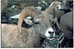
| 11g. In Oregon, the Canyons and Dissected Uplands include the Snake, Grande Ronde, and Imnaha river canyons that have cut 2,000 to 5,000 feet through the Columbia Plateau basalt and underlying metamorphic rocks. Stony colluvial soils retain little moisture and support bunch grasses and arid land shrubs. Grazing and recreation occur in Hells Canyon National Recreation Area. The canyons provide a refuge for elk, bighorn sheep, mountain goats, and a concentration of wintering bald eagles. Of the major historic Snake River salmon stocks, the coho and sockeye are extinct, the chinook are threatened, and summer steelhead are in decline. | |
| 11h. The mountainous Continental Zone Highlands experience seasonal temperature extremes and low annual precipitation. The predominant forest cover is ponderosa pine with a shrub or bunchgrass understory. As in Ecoregion 11b, frequent fires once influenced the open character of the forest. Ecoregion 11h lacks a zone of true firs found in other highland areas in the Blue Mountains. Many of its perennial streams flow south to end in the alkaline basins of the High Desert Wetlands (80e). | |
|
11i. The Continental Zone Foothills lie in the rainshadow of the Cascade Range and Blue Mountains. Plants experience wide temperature variations, high evapotranspiration rates, and high early-season moisture stress in the continental climate of Ecoregion 11i. The distribution of desert shrubs varies with soil depth, texture, and elevation. Mountain mahogany and bitterbrush provide winter cover and forage for mule deer. Rodents, songbirds, and upland game birds also use the fruits of bitterbrush. | |
|
11k. The Blue Mountain Basins ecoregion includes the Wallowa, Grande Ronde, and Baker valleys. All three valleys are faultbounded grabens or depressions filled with sediments. The Wallowa and Grande Ronde valleys have a marine-moderated climate and moisture retaining loess soils. The Baker Valley, located in the rainshadow of the Elkhorn Mountains, is drier and has areas of alkaline soil. All three valleys receive stream flow from the surrounding mountains. Most of the floodplain wetlands have been drained for agriculture, but a remnant exists in the Grande Ronde Basin at Ladd Marsh National Wildlife Refuge. | |
| 11l. The disjunct Mesic Forest Zone includes the highest forested areas in the western Wallowas and the Blue Mountains. Ecoregion 11l is marine-influenced with higher precipitation than other forested Blue Mountains ecoregions (such as 11b, 11d, and 11f). The ashy soil holds moisture during the dry season and supports a productive spruce-fir forest. The boundaries of Ecoregion 11 correspond to the distribution of true fir forest before the modern era of fire suppression and high grade logging. | |
| 11m. The Subalpine–Alpine Zone begins where the forest cover becomes broken by alpine meadows, and continues through alpine meadowland to include the exposed rock and snowfields of the highest mountain peaks. Subalpine fir, Engelmann spruce, and whitebark pine tolerate the cold soils, deep snowpack, and extremely short growing season near timberline. Historically, green fescue and sedges covered high alpine meadows and ridges particularly in the Wallowas; but, following intense sheep grazing in the early 20th Century, many alpine plant associations reverted to seral or exotic species on rocky subsoil. | |
| 11n. The Subalpine–Alpine Zone begins where the forest cover becomes broken by alpine meadows, and continues through alpine meadowland to include the exposed rock and snowfields of the highest mountain peaks. Subalpine fir, Engelmann spruce, and whitebark pine tolerate the cold soils, deep snowpack, and extremely short growing season near timberline. Historically, green fescue and sedges covered high alpine meadows and ridges particularly in the Wallowas; but, following intense sheep grazing in the early 20th Century, many alpine plant associations reverted to seral or exotic species on rocky subsoil. | |
| 11o. The Cold Basins ecoregion contains high, wet meadows. The high meadows are often alluvial and have a high water table and silt or clay soils. Streams, if not channelized, are meandering and have a dynamic interaction with their flood plains. These unconstrained streams provide pool habitats that are important to salmonids. The short growing season and saturated soil make these basins unsuitable for most crops, except hay, but they are heavily grazed by cattle and elk. | |
| 12. Snake River Plain The plains and low hills of Ecoregion 12 are part of the xeric intermontane west. It is considerably lower and less rugged than surrounding ecoregions. Irrigation water is plentiful in many areas. Many of the alluvial valleys bordering the Snake River are in agriculture and principally grow sugar beets, potatoes, alfalfa, small grains, and vegetables. The remainder of the Snake River Plain (12) in Oregon is covered by sagebrush–grassland and is used for cattle grazing. | |
| 12a.The Treasure Valley ecoregion flanks the Snake and Malheur rivers and is underlain by Quaternary alluvium, loess, lacustrine, and alluvial fan deposits. Soils have an aridic moisture regime and they originally supported sagebrush/grass associations before the valley was converted to agriculture. Canals and diversions in this portion of the Snake River Plain (12) supply water to pastureland and cropland as well as municipalities. Water quality in many stream reaches has been significantly affected by channel alteration, dams, irrigation diversions, irrigation return flow, and agricultural pollution. Crops include wheat, sugar beets, alfalfa, potatoes, and onions. Population density is greater than in neighboring, rangeland-dominated ecoregions. Vegetation outside of agricultural areas is dominated by Wyoming big sagebrush, basin big sagebrush, bluebunch wheatgrass, and cheatgrass. In saline areas, shadscale, greasewood, and saltgrass occur. |
|
| 12j. The Unwooded Alkaline Foothills ecoregion is shrub- and grass-covered. Ecoregion 12j contains rolling foothills, hills, benches, alluvial fans, and scattered badlands that are characteristically underlain by alkaline lacustrine deposits. The terrain is higher and more rugged than the neighboring Treasure Valley (12a). Perennial streams are rare. Ecoregion 12j is valuable as rangeland and wildlife habitat. Land use is generally distinct from the irrigated agriculture of the neighboring Treasure Valley (12a). However, scattered areas near rivers with enough water to leach salts from the soil, support alfalfa or sugar beet farming. Vegetation is dominated by Wyoming big sagebrush and associated grassses. Salt tolerant shrubs, including black greasewood, fourwing saltbush, inland saltgrass, and shadscale, occur on alkaline outcrops. | |
| 78. Klamath Mountains Ecoregion 78 encompasses the highly dissected ridges, foothills, and valleys of the Klamath and Siskiyou mountains. It was unglaciated during the Pleistocene epoch, when it served as a refuge for northern plant species. Its mix of granitic, sedimentary, metamorphic, and extrusive rocks contrasts with the predominantly volcanic rocks of the Cascades (4). The mild, subhumid climate of the Klamath Mountains (78) is characterized by a lengthy summer drought. It supports a mosaic of both northern Californian and Pacific Northwestern conifers and hardwoods. | |
| 78a. The Rogue/Illinois Valleys ecoregion supports Oregon white oak and California black oak woodland, ponderosa pine, and grassland. As in other highly developed valleys, little original vegetation remains. Remnants of oak savanna, prairie vegetation, and seasonal ponds persist on the mesa tops of the Table Rocks north of Medford. Elsewhere, land uses include orchards, cropland, and pastureland. Climate, vegetation, and resulting land use are more similar to northern California’s inland valleys than to the Willamette Valley (3). |
|
| 78b. The Oak Savanna Foothills border the Rogue and Illinois river valleys (Ecoregion 78a), sharing their Mediterranean-type climate. The driest area east of Medford is dominated by oak woodlands, grassland–savanna, ponderosa pine, and Douglasfir. The wetter foothills flanking the Illinois Valley support Douglas-fir, madrone, and incense cedar. Ecoregion 78b is lower and less dissected, with more oak woodland and less closed-canopied forest than the Inland Siskiyous (78e). | |
| 78c. Unlike the purely mountainous terrain of the Inland Siskiyous (78e) or the broader Rogue/Illinois Valleys (78a), the Umpqua Interior Foothills ecoregion is a complex of foothills and narrow valleys containing fluvial terraces and floodplains. Ecoregion 78c is drier than the foothills of the Willamette Valley (3d) partly because the summer Pacific high pressure system arrives earlier and remains longer than in ecoregions to the north. Summers are hot and dry, and soils have a xeric moisture regime in contrast to the udic soils of the Mid-Coastal Sedimentary ecoregion (1g) to the west. Oregon white oak woodland, Douglasfir, ponderosa pine, madrone, and an understory chaparral community cover the slopes and intermingle with pastureland, vineyards, orchards, and row crops. | |
| 78d. The Serpentine Siskiyous ecoregion is lithologically distinct from the rest of Ecoregion 78. Many plants have difficulty growing in its serpentine soils due to a shortage of calcium and high levels of magnesium, nickel, and chromium. As a result, vegetation is often sparse and composed of specialist species. Jeffrey pine and endemic oak and ceanothus species have evolved to grow in the potentially toxic and nutrient-poor serpentine soils. Historic mines and associated water quality problems occur. | |
| 78e. The forested Inland Siskiyous ecoregion is higher and more mountainous than neighboring foothill and valley ecoregions (78a, 78b, and 78c). Ecoregion 78e has a higher fire frequency, less annual precipitation, and longer summer droughts than the Coastal Siskiyous (78f). Forest cover in Ecoregion 78e is a diverse and multi-layered mix of conifers, broadleaf evergreens, and deciduous trees and shrubs in contrast to the predominantly coniferous forests that occur in the Coast Range (1) or Cascades (4). | |
| 78f. The Coastal Siskiyous ecoregion has a wetter and milder maritime climate than elsewhere in the Klamath Mountains (78). Productive forests composed of tanoak, Douglas-fir, and some Port Orford cedar cover its mountainous landscape; tanoak is more common than elsewhere in Oregon. Broadleaf evergreens, such as tanoak and madrone, quickly colonize disturbed areas, making it difficult to regenerate conifer forest growth. Xeric soils derived from Siskiyou rock types are characteristic; udic soils which support western hemlock and Sitka spruce are much less common than in the wetter Coast Range (1). | |
| 78g. The Klamath River Ridges have a dry, continental climate. Vegetation varies with slope, aspect, and elevation. Higher altitudes and north-facing slopes have Douglas-fir and white fir; lower elevations and south-facing slopes are covered in ponderosa pine and western juniper, species that are more drought resistant than other vegetation types found in Ecoregion 78. | |
| 80. Northern Basin and Range Ecoregion 80 contains dissected lava plains, rolling hills, alluvial fans, valleys, and scattered mountains. Overall, it is higher and cooler than the Snake River Plain (12) and has more available moisture and a cooler climate than the Central Basin and Range (13). Potential natural vegetation is sagebrush steppe; cool season grasses, such as Idaho fescue and bluebunch wheatgrass are more common than in Ecoregion 13. Juniper-dominated woodland occurs on rugged, stony uplands. Most of Ecoregion 80 is used as rangeland. Cropland is found locally, but, in general, soils are less suitable for agriculture than those in the Columbia Plateau (10) and the Snake River Plain (12). In Oregon, the western two-thirds of Ecoregion 80 is internally-drained. | |
| 80a. The nearly level to undulating Dissected High Lava Plateau is underlain by basalt and cut by shear-walled canyons. Potential natural vegetation is mostly sagebrush steppe but scattered juniper woodlands grow on rocky uplands. Streams drain to the Snake River; in contrast, the 80High Lava Plains (80g) and the Central Basin and Range (13) are internally-drained. Intermittent lakes occur but are much less common than in Ecoregion 80g. Ecoregion 80a is primarily rangeland and wildlife habitat. |
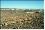
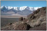
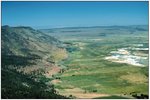 Fault block mountains, broad expanses of sagebrush, and alkaline playas characterize the landscape of the Northern Basin and Range (80), although the mountain ranges and associated playas are far fewer in number than those in the Central Basin and Range ecoregion (13) to the south. (Sharon Clarke, OSU) Fault block mountains, broad expanses of sagebrush, and alkaline playas characterize the landscape of the Northern Basin and Range (80), although the mountain ranges and associated playas are far fewer in number than those in the Central Basin and Range ecoregion (13) to the south. (Sharon Clarke, OSU) |
| 80d. The Pluvial Lake Basins contained vast lakes during the Pleistocene epoch, but, today, they do not seasonally collect water as extensively as the High Desert Wetlands (80e). The dry lake beds near the Cascade Mountains have a significant ash layer present. Sagebrush dominates with associated grasses. The land is used for rangeland and sprinkler-irrigated alfalfa farming. | |
| 80e. The nearly level High Desert Wetlands ecoregion provides critical habitat for nesting and migratory birds as well as associated upland birds and mammals. Its fine-textured soils are poorly-drained and basins collect water seasonally. Although water levels fluctuate from year to year, lakes and wetlands hold water more consistently than on the coarser, better drained soils of the Pluvial Lake Basins (80d). Sedges, rushes, black greasewood, tufted hairgrass, and creeping wildrye occur in wetter areas. | |
| 80f. The Owyhee Uplands and Canyons ecoregion is a sagebrush steppe containing deep river canyons, barren lava fields, badlands, and tuffaceous outcrops that are riddled by caves. Though Ecoregion 80f's climate and vegetation are similar to the dissected High Lava Plateau (80a), its lithology is more varied, stream density is higher, and water availability is greater than in Ecoregion 80a. These attributes, combined with its remote location, make Ecoregion 80f a particularly valuable refuge for wildlife. | |
| 80g. The vast, nearly level to undulating High Lava Plains ecoregion is shrub- and grass-covered and contains scattered volcanic cones and buttes. Ecoregion 80g is internally-drained in contrast to Ecoregion 80a, and, as a result, it lacks anadromous fish runs. Ecoregion 80g also differs from the Dissected High Lava Plateau (80a) in having numerous intermittent lakes (80d and 80e). The vegetation is sagebrush steppe; bunchgrasses, including bluebunch wheatgrass, are generally associated with Wyoming big sagebrush except in overgrazed areas where they have been depleted and replaced by cheatgrass. | |
| 80j. The Semiarid Uplands ecoregion includes scattered hills, low mountains, and buttes. Elevations vary from 4,800 to 7,500 feet. Moisture levels are high enough to support woodland. Ecoregion 80j is largely covered by juniper steppe woodland on rocky soils and sagebrush steppe or Idaho fescue on more finely textured soils. The density and extent of juniper varies over time and is dependent on climate, grazing pressure, and fire suppression. | |
| 80k. The Partly Forested Mountains ecoregion is represented in Oregon by the higher elevations of Steens Mountain. On Steens Mountain, above the juniper woodland zone (Ecoregion 80j), the landscape is almost treeless; broad areas of mountain big sagebrush alternate with scattered groves of aspen. Deep, glacial U-shaped valleys radiate from the summit. Alpine areas were seriously eroded following intense grazing by domestic sheep in the late 19th century. | |
| 80l. The arid Salt Shrub Valleys were once inundated by Pleistocene lakes. Nearly flat basin floors are extensive and wetlands, terraces, dunes, and alluvial fans also occur. Characteristically, the basin floors have strongly saline and very alkaline soils that support black greasewood, inland saltgrass, shadscale, and bud sagebrush. Soils, climate, and vegetation are transitional to the Central Basin and Range (13) and Lahontan Salt Shrub Basin (13j) to the south. Rangeland and irrigated agriculture occur. | |
| 80m. The Barren Playas ecoregion includes the playas and sand dunes of Summer Lake, Silver Lake, and the Alvord Desert, three of the most arid areas in Oregon. On the playas, lake levels and salinity fluctuate seasonally and yearly. Surface material is clayey, saline, alkaline, and poorly-drained. Ecoregion 80m is more barren than the Salt Shrub Valleys (80l); vegetation, where present, is sparse and composed of salt-tolerant plants. Ecoregion 80m is nonarable and used for recreation and wildlife habitat. | |
Notes
PRINCIPAL AUTHORS: Thor D. Thorson (NRCS), Sandra A. Bryce (Dynamac Corporation), Duane A. Lammers (USFS), Alan J. Woods (Dynamac Corporation), James M. Omernik (USEPA, retired), Jimmy Kagan (Oregon Natural Heritage Program), David E. Pater (Water Quality Program, Washington Department of Ecology), and Jeffrey A. Comstock (Indus Corporation).
COLLABORATORS AND CONTRIBUTORS: Thomas Atzet (USFS), Hugh Barrett (U.S. Department of Interior, Bureau of Land Management), Rick Hafele (Oregon Department of Environmental Quality), Charles Johnson (USFS), Thomas Loveland (USGS), Robert Meurisse (USFS, retired), Chad L. McGrath (NRCS), and Robert Ottersberg (Cordilleran Services, Inc.).
REVIEWERS: Sharon E. Clarke (Oregon State University), Robert M. Hughes (Dynamac Corporation), and Michael A. Bollman (Dynamac Corporation).
CITING THIS POSTER: Thorson, T.D., Bryce, S.A., Lammers, D.A., Woods, A.J., Omernik, J.M., Kagan, J., Pater, D.E., and Comstock, J.A., 2003. Ecoregions of Oregon (color poster with map, descriptive text, summary tables, and photographs): Reston, Virginia, U.S. Geological Survey (map scale 1:1,500,000).
Literature Cited:
Bryce, S.A., Omernik, J.M., and Larsen, D.P., 1999, Ecoregions – a geographic framework to guide risk characterization and ecosystem management: Environmental Practice, v. 1, no. 3, p. 141-155.
Bryce, S.A., Woods A.J., Morefield, J.D., Omernik, J.M., McKay, T.R., Brackley, G.K., Hall, R.K., Higgins, D.K., McMorran, D.C., Vargas, K.E., Petersen, E.B., Zamudio, D.C., and Comstock, J.A., 2003, Ecoregions of Nevada: Reston, Virginia, U.S. Geological Survey, map scale 1:1,350,000.
Clarke, S.E., and Bryce, S.A., eds., 1997, Hierarchical subdivisions of the Columbia Plateau and Blue Mountains Ecoregions, Oregon and Washington: Portland, Oregon, USFS, Pacific Northwest Research Station, General Technical Report PNW-GTR-395.
Commission for Environmental Cooperation Working Group, 1997, Ecological regions of North America – toward a common perspective: Montreal, Commission for Environmental Cooperation, 71 p.
Gallant, A.L., Whittier, T.R., Larsen, D.P., Omernik, J.M., and Hughes, R.M., 1989, Regionalization as a tool for managing environmental resources: Corvallis, Oregon, U.S. Environmental Protection Agency, EPA/600/3-89/060, 152 p.
Griffith, G.E., Omernik, J.M., Wilton, T.F., and Pierson, S.M., 1994, Ecoregions and subregions of Iowa – a framework for water quality assessment and management: Journal of the Iowa Academy of Science, v. 101, no. 1, p. 5-13.
Hughes, R.M., Whittier, T.R., Rohm, C.M., and Larsen, D.P., 1990, A regional framework for establishing recovery criteria: Environmental Management, v. 14, no. 5, p. 673-683.
McGrath, C.L., Woods A.J., Omernik, J.M., Bryce, S.A., Edmondson, M., Nesser, J.A., Shelden, J., Crawford, R.C., Comstock, J.A., and Plocher, M.D., 2002, Ecoregions of Idaho: Reston, Virginia, U.S. Geological Survey, map scale 1:1,350,000.
Omernik, J.M., 1987, Ecoregions of the conterminous United States (map supplement): Annals of the Association of American Geographers, v. 77, no. 1, p. 118-125, scale 1:7,500,000.
Omernik, J.M., 1995, Ecoregions – a framework for environmental management, in Davis, W.S. and Simon, T.P., eds., Biological assessment and criteria-tools for water resource planning and decision making: Boca Raton, Florida, Lewis Publishers, p. 49-62.
Omernik, J.M., Chapman, S.S., Lillie, R.A., and Dumke, R.T., 2000, Ecoregions of Wisconsin: Transactions of the Wisconsin Academy of Sciences, Arts, and Letters, v. 88, p. 77-103.
Omernik, J.M. and Griffith, G.E., 1991, Ecological regions vs. hydrologic units: frameworks for managing water quality: Journal of Soil and Water Conservation, v. 46, no. 5, p. 334-340.
Pater, D.E., Bryce, S.A., Thorson, T.D., Kagan, J., Chappell, C., Omernik, J.M., Azevedo, S.H., and Woods, A.J., 1998, Ecoregions of Western Washington and Oregon: Reston, Virginia, U.S. Geological Survey, map scale 1:1,350,000.
U.S. Department of Agriculture–Soil Conservation Service, 1981, Land resource regions and major land resource areas of the United States: Agriculture Handbook 296, 156 p.
U.S. Environmental Protection Agency, 2003, Level III ecoregions of the continental United States (revision of Omernik, 1987): Corvallis, Oregon, USEPA – National Health and Environmental Effects Research Laboratory, Map M-1, various scales.
Wiken, E., 1986, Terrestrial ecozones of Canada: Ottawa, Environment Canada, Ecological Land Classification Series no. 19, 26 p.
Whittier, T.R., Hughes, R.M., and Larsen, D.P., 1988, Correspondence between ecoregions and spatial patterns in stream ecosystems in Oregon: Canadian Journal of Fisheries and Aquatic Sciences, v. 45, p. 1264-1278.
