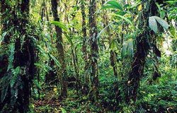
Eastern Cordillera real montane forests

Podocarpus National Park, Cajanuma, Ecuador Photograph by © WWF-Canon/Kevin Schafer
The Eastern Cordillera real montane forests is a tropical montane forest ecoregion located on the eastern slopes of the middle Andes, extending north-south from southern Colombia, through Ecuador, and into northern Peru. This rugged premontane habitat receives between 1,500-2,000 millimeters (mm) of rain each year, but can get as much as 4,500 in a heavy rain year. The dominant vegetation in this region varies dramatically with altitude, which ranges from 900 meters (m) to over 2100 m. In general, the plant communities here are tropical evergreen seasonal broad-leaved forests. The lower elevational areas, known locally as ceja de montaña, consists of closed, luxuriant forests. As elevation increased forests stature decreases and at higher elevations grades into cloud forests and finally elfin woodlands.. This area is home to several endangered and endemic birds, including the white-necked parakeet, coppery-chested jacamar, and bicoloured antvireo.
Location and General Description
This South American ecoregion lies in the territories of Colombia, Peru and Ecuador, occupying an area of 84,442 km2. The central range is the southern end of the complex of ecoregions of montane forests in the northern Andes (northern Peru). It has the lowest altitude pass in the Andes range (ca. 2000 masl) at the Huancabamba Depression, which allows organisms from the Amazon region to move westward to the lowlands of the Pacific, and vice versa. For this reason, the Huancabamba Depression probably has a proportionally higher increase in the number of species than any other barrier along the Andes and it is possible that no other low barrier has had such a profound effect on the distribution and evolution of Andean organisms. Historically, the greatest rise in the Andes to the south of the depression occurred in the Miocene era. To the north of the pass, the most important orogenic phenomenon occurred at the end of the Pliocene with continuous lifting until the Pleistocene. Thus, the Huancabamba Depression is not only a tectonic barrier but also connects tectonic segments that arose at different geological moments and now have contrasting aspects and orientations. In addition, these forests receive climatic and biogeographic influences from the Amazon basin, the hill areas of southern Ecuador, drainage from the Pacific Ocean and the inter-Andean dry forests. The region is the most important topographic and geologic filter and barrier in the central Andes and affects biotic migration and Andean speciation. As a result, these montane forests show highly pronounced local endemisms – principally in the department of Cajamarca, Peru (4.5º -7.0º), while many of the northern or southern distribution ranges have their limit in the region as has been seen in the case of species of rodents, birds, reptiles and amphibians, butterflies and plants.
In the case of Peru, part of the ecoregion crosses the Andes to reach the Pacific slope. These montane forests form a narrow belt (7º – 12º S) where the limited atmospheric moisture condenses enough to allow vegetation. Due to the dryness of the region and the more seasonal climate, these are primarily small forests (<20 hectares) that tend to the limited in terms of variety but rich in endemisms.
However, in the eastern range, forests occur on the Amazon side of the Andes range above 1,500 m. These forests receive a great deal of moisture from air masses rising from the Amazon. They naturally cover an almost continuous area 1,500 kilometers (km) long (5 – 15º S) but often only 30 to 200 km wide due to sharp altitudinal gradients. They contain a substantial amount of tropical cloud montane forests. The biota includes various altitudinal specialists, some of which are endemic due both to limited mobility and the presence of topographical barriers between hydrographic basins.
Biodiversity Features
 Passion flower. (Photograph by WWF-Canon/Kevin Schafer)
 These "mountain crown" forests owe their extraordinary diversity to their juxtaposition with the Amazon River Basin, the sharp altitudinal gradient and the barriers to distribution. This supports the belief that the Andean montane forests may have had "30,000 to 40,000 species of flora, more than in the Amazon basin and contained in a much smaller area".
The characteristic species of the ecoregion include the primates Alouatta seniculus, Cebus cf. albifrons and Lagothrix flavicauda, as well as other mammals such as Tremarctos ornatus, Hippocamelus antisensis, Lama guanicoe, Potos flavus and possibly the Tapirus pinchaque. Birds notably include Buthraupis wetmorei, Doliornis remseni, Otus petersoni (marshalli), Metallura odomae and Vultur gryphus. There are singular amphibians such as Eleutherodactylus cajamarcensis and Eleutherodactylus lymani.
Many studies identify a region of limited diversity but high endemism along the northern Pacific coast of Peru. Koopman’s study of South American bats (Mammalia: Chiroptera) shows that 37% of the species of biota on the western slope are endemic to the region. Information on other groups is scarce but generally supports the biotic distinction of the western slopes. Studying descriptions of neotropical birds, Cracraft recognizes three centers of endemism in western Peru. Similarly, when studying the distributions of butterflies in Peru, Lamas identified no less than 48 different biogeographic units in Peru, 12 or 13 of which are located on the eastern slope. These levels of endemism are demonstrated for many taxons and are explainable given the conditions of aridity, natural isolation and elevation.
Current Status
These moist montane forests are naturally isolated and have also been fragmented by the clearing away of forests to make way for agriculture and pasture. As access is relatively easy, in recent years these forests have been increasingly more threatened by the removal of valuable commercial species such as Podocarpus (Podocarpus and Prumnopitys of the family Podocarpaceae). Perhaps 75 percent of the coverage of original wet forest has been removed, having been cut and replaced by agricultural systems or thickets.
Types and Severity of Threats
Due to the sharp incline and limited agricultural potential of lands below 2,000 meters above sea level (masl), current human impact is concentrated in two areas: along the routes connecting the highlands with the Amazon and in areas below 2,000 masl that have been cleared by settlers to obtain income and practice subsistence agriculture. According to Young, the fragmentation of continuous forests has been produced by man and has probably reduced the original forest cover by 30 to 40 percent.
Justification of Ecoregion Delineation
 Northeastern Andes, Ecuador. (Photograph by WWF-Canon/Kevin Schafer)
 The delineation for this ecoregion were derived from three national vegetation maps and topography (lower limits are 500m in Colombia, rises to 600m in Ecuador, and in Peru begins at 800m) . In Colombia, our linework follows the Navarro et al. classification of "piedmont cordillera forests" and "escarpment cordillera forests" of the eastern slope of the Cordillera Real in the southern potion of the country. The ecoregion traverses Ecuador, following the eastern slope of the Andes – where linework follows Sierra and the CLIRSEN/DINAF classification of "humid lower montane forests", "humid premontane forests", and "very humid montane forests". In Peru, our linework follows Instituto Geográfico Nacional, who classify this as "high forests" or yungas. The southern delineation was drawn at the Marañon Valley, which is a recognized division of the Andean chain. In a broader context, this ecoregion essentially reaches from the continental divide to the premontane-lowland forest transition of the Amazon headwaters. Linework was reviewed and modified according to expert opinion at an ecoregion workshop in the northern Andes. This ecoregion is characteristically species rich, and diverse along an elevational gradient – and contains a great number of endemic species of both flora and fauna. Linework was reviewed and modified at an ecoregional priority setting workshop.
Further Reading
- Aguilar Fernández, P. 1994. Características Faunísticas del Norte del Perú. Arnaldoa Vol.1 (5): 1-9.
- Brack Egg, A. 1998. Ecología de un País Complejo. Gran Geografía del Perú. Cadle ,J. 1991. Systematics of Lizards of the Genus Stenocercus (Iguanis: Tropiduridae) from Northern Peru: New species and comments on the Relationships and Distribution Patterns. John Cadle. Proceedings of the Academy of Natural Sciences of Philadelphia, Vol.143, p 1-96.
- CLIRSEN/DINAF. 1990. Mapa forestal de la Republica de Ecuador. Map 1:1,000,000. Quito, Ecuador.
- Complejo Ecoregional de los Andes del Norte (CEAN). Experts and ecoregional priority setting workshop. Bogota, Colombia, 24-26, July, 2000.
- Davis, S. et al 1997. Centres of plant diversity: A guide and strategy for their Conservation. WWF for Nature.
- Duellman, W. and Wild, E. 1993. Anuran Amphibians from the Coordillera Huancabamba, Northern Peru: Systematics, Ecology, and Biogeography. Occasional Papers of the Museum of Natural History #157. The University of Kansas, Lawrence, Kansas,p.1-53.
- Duellman,W. 1988. Patterns of species diversity in anural amphibians in the American Tropics. Annals of the Missouri Botanical Garden, 75:p.79-104.
- Gentry, A. 1992. Diversity and floristic Composition of the Andean Forest of Peru and Adjacent Countries: Implications for their Conservation. Memorias del Mueso de Historia Natural,21. Biogeografía, Ecología y conservación del bosque Montano en el Perú. Universidad Nacional Mayor de San Marcos, p.11-31.
- Instituto Geográfico Nacional. 1987. Ecoregiones del Peru. Map 1:5,000,000. Atlas del Peru, Lima, Peru.
- Koopman,K. 1978. Zoogeography of Peruvian Bats with special emphasis on the role of the Andes. American Museum Novitates #2651,p.1-33, June 16, 1978.
- Navarro, A.E.S., G.H. Peña, F.C. Lemus, J.R. Baquero, R.F. Soto. 1984. Bosques de Colombia. IGAC-INDERENA-CONIF, Bogota, Colombia.
- O’ Neill, J.P. 1992. A general Overview of the Montane Avifauna of Peru. Memorias del Museo de Historia Natural, 21.Biogeografía , ecología y conservación del bosque Montano en el Peru. Universidad Nacional Mayor de San Marcos,p.47-57.
- Parker, T. et al. 1985. The Avifauna of the Huancabamba Región, Northern Peru. Ornithological Monographs #36,p. 169-197.
- Patterson, B. et al. 1992. On the Origins of the Western Slope Region Endemism: Systematics of Fig Eating Bats, Genus Artibeus. Memorias del Museo de Historia Natural, 21. Biogeografía , Ecología y Conservación del Bosque Montano en el Perú. Universidad Nacional Mayor de San Marcos, p.189-207.
- Roca, R.; Adkins, L. et al. 1996. Wings from Afar; An Ecoregional Approach to conservation of Neotropical Migratory Birds in South America.
- Sierra, R. (Ed.). 1999. Propuesta Preliminar de uns Sistema de Clasificación de Vegetación para el Ecuador Continental. Proyecto INEFAN/GEF-BIRF y EcoCiencia. Quito, Ecuador
- Vuilleumier, B . 1971. Pleistocene Changes in the Fauna and Flora of South America. Science, Vol.173, #3999. Aug.1971.
- Young, K. 1992. Biogeography of the Montane Forests Zone of the Eastern Slopes of Peru. Memorias del Museo de Historia Natural, 21. Biogeografía, Ecología y Conservación del bosque Montano en el Perú. Universidad Nacional Mayor de San Marcos, p.119-141.
- Young, K. 1993. National Park Protection in Relation to the ecological Zonation of a Neighboring Human Community: An Example form Northern Peru. Mountain Research Development, Vol.13.no.3.p 267-280.
| Disclaimer: This article contains some information that was originally published by the World Wildlife Fund. Topic editors and authors for the Encyclopedia of Earth have edited its content and added new information. The use of information from the World Wildlife Fund should not be construed as support for or endorsement by that organization for any new information added by EoE personnel, or for any editing of the original content. |