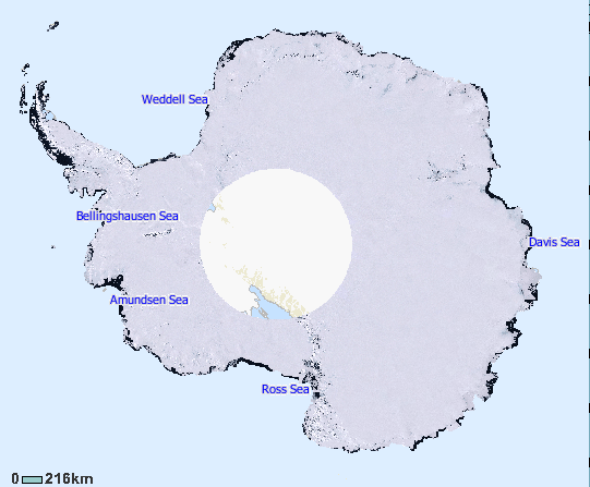
Davis Sea
From The Encyclopedia of Earth
October 14, 2009, 12:00 am
November 21, 2011, 9:30 pm
The Davis Sea is a marginal sea along the coast of Antarctica along Princess Elizabeth Land. Discovered during the Australasian Antarctic Expedition (AAE) (1911-14) from the vessel Aurora. Named by Sir Douglas Mawson for Captain J.K. Davis, master of the Aurora and second in command of the expedition. (See Mawson, Shackleton and the end of the Heroic Age opf Antarctic Exploration)
| This article is written at a definitional level only. Authors wishing to improve this entry are inivited to expand the present treatment, which additions will be peer reviewed prior to publication of any expansion. |
The Davis Sea has a total surface area of approximately 21,000 square kilometers and a maximum depth of 1300 meters. Located in eastern Antarctica, the Davis Sea is situated between two ice shelves: the West Ice Shelf and the Shackleton Ice Shelf. Its limits are reported by several sources to range between 82 and 86 degrees East and 96 to 98 degrees East.
References
- Antarctic climate and environment history in the pre-instrumental period. (2021) Editors: Luca Bargelloni, John Turner et al. Victoire Press. Cambridge, UK. Published by the Scientific Committee on Antarctic ResearchScott Polar Research Institute, Lensfield Road,Cambridge, UK. ISBN 978-0-948277-22-1
- U.S.Geological Survey. 1997. USGS Geographic Names Information System, Antarctica Data, Davis Sea
See also
Citation
Steve Baum & C. Michael Hogan (2011). Davis Sea. ed. Peter Saundry. Encyclopedia of Earth. National Council for Science and Environment. Washington DC. Retrieved from http://editors.eol.org/eoearth/wiki/Davis_Sea

