Churchill River
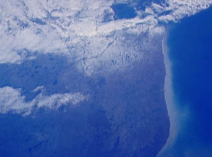
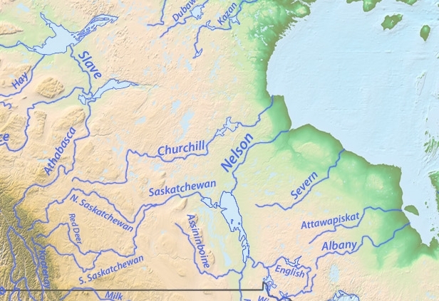
The Churchill River drains a portion of the Canadian Shield, and its catchment area lies entirely within Canada. Known by the French name Rivière Churchill, the basin spans portions of the provinces of Manitoba, Saskatchewan and Alberta, running a total length of 1610 kilometers, prior to discharge at Hudson Bay. The basin as a whole is sparsely populated, with an average human density of approximately five per square kilometer. The mouth of the Churchill River is a rich ecological area, with Beluga whales, polar bears and seals in abundance.
Source:Topography from U.S.Geological Survey stream course data from DEMIS Mapserver.
The Churchill River is iced over much of the year, but flows freely during the Canadian summer. The watershed is covered largely with taiga biome, and is an important denning area for the polar bear, who makes her way out to pack ice in November of each year.
Contents
Hydrology
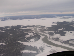 Churchill River at its mouth. Source: Manitoba Water Stewardship The drainage basin of the Churchill River constitutes 383,350 square kilometers of land, largely taiga and tundra land cover. The river flows generally from the west to the east, spanning a longitude range of about nineteen degrees and a latitude range of approximately six degrees. The Churchill basin is situated to the north of the Nelson and Saskatchewan River basins
Headwaters of the Churchill are in central eastern Alberta, and are generally characterized as a combination of the Beaver River, Winefred River and Sand River, along with Cold and Beaver Lakes; discharge from this complex of waters reach a chain of lakes (Churchill, Peter Pond and Lac Ile-a-la-Crosse) in Saskatchewan. Beaver River is the chief tributary to the Churchill, discharging at Lac Ile-a-la-Crosse.
Considerable waters of the Churchill freeze entirely to the bottom over the winter. This river has been used as a locus of studies into climate variability; however, satellite imagery is plagued with different interpretations, due to surface ice roughness and other parameters. Thus no clear temporal trends in ice persistence are evident.
Water quality
Water quality in the Churchill River is generally good, with pH levels being slightly alkaline at approximately 8.0. Nitrate plus nitrite concentrations are in the range of 15 milligrams per liter. Turbidity levels in Churchill River are quite variable, depending on the reach of the river examined; such a case of spatially varying turbidity was evident in historic times as well. For example the 1906 Catnadian Geological Survey noted that turbidity was high in lower South Indian Lake as well as waters of the mainstem Churchill River in the vicinity; however, upper South Indian Lake waters are quite clear.
Sediment in the Churchill River is considered only moderately contaminated with respect to mercury, exemplified by typical tissue concentration levels of six to fourteen parts per million of that heavy metal in members of the Chironomidae family.
Aquatic biota
 Beluga whale. The largest animal inhabiting the Churchill River is the Beluga whale, who enters the brackish waters of the river mouth near Hudson Bay when ice melting occurs in the summer. The seasonal high Beluga population of Belugas in western Hudson Bay is approximately 23,000 individuals. Belugas assemble at the mouth of the Churchill along with abundant populations of harbor seals (Phoca vitulina) in the summer.
Terrestrial ecoregions
 Polar bear moving toward ice in the Churchill River Basin. @ C.Michael Hogan At the mouth region of the Churchill River the Southern Hudson Bay taiga ecoregion covers the low lying plain along Hudson Bay. Stunted black spruce and tamarack dominate the vegetation here. These trees are larger and more dense toward the southern part of the ecoregion. The shrub layer consists of dwarf birch (Betula spp.), willow (Salix spp.), and northern Labrador tea (Rhododendron tomentosum, syn Ledum palustre ssp. decumbens).
Poorly drained areas support dense sedge (Carex spp.), moss, and lichen covers, and the raised beaches present a striking Pattern of successive black spruce-covered (Picea mariana) ridges alternating with depressional bogs and fens. The area to the south of James Bay acts as a transition between the coniferous mixed forests to the south and the tundra to the north, and as such, has a greater diversity of species, including balsam fir (Abies balsamea), white spruce (Picea glauca), and black spruce, quaking aspen (Populus tremuloides), and paper birch (Betula papyrifera). Wetlands make up 50-75 percent of this ecoregion.
Characteristic wildlife species in the Southern Hudson Bay taiga include caribou (Rangifer tarandus), snow goose (Chen caerulenscens), Canada goose (Branta canadensis) and snowshoe hare (Lepus americanus) throughout most of the ecoregion. Polar bear (Ursus maritimus), arctic fox (Alopex lagopus), tundra swan (Cygnus columbianus), sea ducks, shorebirds, Beluga whale (Delphinapterus leucas), and seal (Phocidae) are found along the Hudson Baycoast. Willow ptarmigan (Lagopus lagopus) occur south of the Hudson Bay coast, and toward the lower end of James Bay black bear (Ursus americanus), wolf (Canis lupus), moose (Alces alces), lynx (Lynx canadensis), ruffed grouse (Bonasa umbellus) and American black duck (Anas rubripes) are found.
Further upriver lies the Northern Canadian Shield taiga ecoregion. The ecoregion as a whole constitutes the tundra and boreal transition zone. Vegetation consists of open, stunted stands of black spruce (Picea mariana) and tamarack (Larix laricina), with secondary quantities of white spruce (Picea glauca) and ground cover of dwarf birch (Betula sp.), ericaceous shrubs (Ericaceae), cottongrass (Eriophorum spp.), [[lichen]s] and mosses. Drier sites can support open stands of white spruce, ericaceous shrubs and a ground cover of mosses and lichens. Poorly drained sites support tussock vegetation of sedge (Carex spp.), cottongrass, and sphagnum moss (Sphagnum spp.). Vegetation in the Tazin Lake Upland in the southwestern region is characterized by medium to tall closed stands of quaking aspen (Populus tremuloides) and balsam poplar (Populus balsamifera), with white spruce, balsam fir (Abies balsamea) and black spruce occurring in late successional stages.
Prehistory
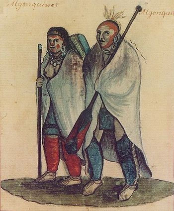 Algonquin Couple, an 18th-century watercolor. One of the major Native American groups in the Churchill Basin was the Algonquian Nation, which people inhabited a vast territory extending from Labrador south to Virginia and northwestward to the southern banks of the Churchill River. The western limit of the Algonquin people demarcates the boundary of the east and west Native American linguistic groups. The Algonquins are thought to have produced the notable rock paintings extant in the Churchill Basin today. These pictographs are a testimonial to the use of the Churchill River as an important navigation and trading route in ancient times.
History and naming
The Churchill River was named for John Churchill, first Duke of Marlborough and governor of the Hudson's Bay Company in the interval 1685 to 1691. The Cree name for the river is the Missinipi, meaning big waters.
In the interval 1694 to 1720 Crees battled the Chipewyans in the middle and lower Churchill Basin. In the upper Churchill reaches Crees were in conflict with the Beaver tribe near Lake Athabaska during the same time period. In historic times the headwaters area of the Churchill River have always been a significant fur trading zone.
References
- Arthur C. Benke & Colbert E. Cushing. 2005. Rivers of North America.1144 pages. Google eBook
- Canadian Plains Research Centre. 2006. Churchill River. Encyclopedia of Saskatchewan.
- Colbert E. Cushing, Kenneth W. Cummins, G. Wayne Minshall. 2006. River and stream ecosystems of the world. books.google.com ISBN 0520245679. 817 pages
- Claude R. Duguay & Alain Pietroniro. 2005. Remote sensing in northern hydrology: measuring environmental change. American Geophysical Union. 160 pages. books.google.com
- Geological Survey of Canada. 1906. Summary report, Geological Survey Department Google eBook
- A.Gunn, A.G.Appleby, G.Whelan Enns, C.O'Brien, K.Kavanagh, M.Sims, G.Mann.2011. Northern Canadian Shield taiga. World Wildlife Fund
- C. Michael Hogan. 2008. Polar Bear: Ursus maritimus, Globaltwitcher.com, ed. N. Stromberg
- Tim E.H.Jones. 2006. The Aboriginal rock paintings of the Churchill River. books.google.com, Saskatchewan Archaeological Society. 114 pages
- Guy Carleton Lee, W. J. McGee, Cyrus Thomas & Francis Newton Thorpe. 1905. Prehistoric North America. 482 pages
- James Francis Verchere Millar. 1997. The prehistory of the Upper Churchill River Basin, Saskatchewan. J.and E. Hedges. 220 pages books.google.com
- Kate M. Scow. 2000. Integrated assessment of ecosystem health. 358 pages. Google eBook
- Bruce G.Trigger & Wilcomb E.Washburn. 1996. The Cambridge History of the Native Peoples of the Americas. books.google.com
