Bransfield Strait
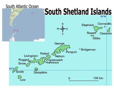
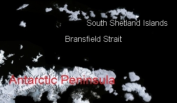
The Bransfield Strait is a strait located between the northern tip of the Antarctic Peninsula and the South Shetland Islands. It is about 120 km wide and extends 460 km from Clarence Island in the northeast to Low Island in the southwest. It consists of three separate basins isolated from the surrounding ocean by relatively shallow sills, with local deep water formation processes resulting in different water characteristics in each of the basins. The basins deepen to the northeast, having a maximum axial depth in the west basin of 1100 m near Low Island and a maximum depth of 2700 m in the east basin south of Elephant Island. Sills shallower than 500 m almost entirely circle the strait, with the east basin having the deepest access to outside water with sills deeper than 500 m. There are no passages deeper than 500 m into either the central or west basins, and the central basin is isolated from the adjacent basins by sills of 1,000 and 1,100 m at its western and eastern boundaries.
The strait is named after Edward Bransfield (1785-1852) a British naval officer who contributed to the exploration of the Antarctic and was one of the first people to sight the mainland of Antarctica on January 30, 1820 after sailing south from the South Shetlands.
Further Reading:
- Physical Oceanography Index
- A. J. Clowes. Hydrology of the Bransfield Strait. Discovery Reports, 9:-64, 1934.
- Cara Wilson, Gary P. Klinkhammer, and Carol S. Chin. Hydrography within the central and east basins of the Bransfield Strait, Antarctic. JPO, 29:-479, 1999.
- O. López, M. A. Garcia, D. Gomis, P. Rojas, J. Sospedra, and A. Sánchez-Arcilla. Hydrographic and hydrodynamic characteristics of the eastern basin of the Bransfield Strait (Antarctica). DSR, 46:-1778, 1999.
- A. L. Gordon, M. Mensch, Z. Dong, W. M. Smethie Jr., and J. de Bettencourt. Deep and bottom water of the Bransfield Strait eastern and central basins. JGR, 105:,337-11,346, 2000.

