Black Sea
Seas of the World  The Black Sea is a Mediterranean sea, centered at approximately 35o E and 44o N; it is considered the world’s largest inland water basin, although technically it is connected to the world's oceans via the Bosporus and the Dardanelles.
It has a surface area of about 461,000 km2 and a volume of 537,000 km3 with a mean depth of around 1200 to 1300 metres (m), although depths greater than 2000 m are common in the central basin.
 Grographic situation of the Black Sea at the crossroads of Europe and Asia. Source: Wikimedia Commons
The western part of the Black Sea is a wide shelf that gradually narrows to the south and breaks at around 100-150 m. In the rest of the basin the shelf doesn’t exceed 10 to 15 kilometres in width. It is connected to the Sea of Marmara via the narrow (760 m wide) and shallow (27.5 m maximum depth) Bosporus Straits, and further connects to the Mediterranean Sea via the long and narrow Dardanelles. It is also connected to the Sea of Azov to the north.
Hydrology
The Black Sea is a dilution basin due to a large freshwater input from the Danube, Dniester, Dnieper, Severskiy Donets and Don rivers (350 km3/yr). The flow through the Bosporus comprises a surface flow of low salinity water towards the Mediterranean (260 km3/yr) and an underlying return flow of salty Mediterranean (Mediterranean Sea) water (120 km3/yr). Precipitation (140 km3/yr) and evaporation (350 km3/yr) close the freshwater budget. The volume averaged salinity is 22, with surface salinities in the central part ranging from 16 to18 and increasing to a range of 21.0 to 22.5 at depths greater than 150 to 200 metres. The surface temperatures range from 25o C in the summer to 6 to 8o C in the open sea, with the northwestern part and the Sea of Azov covered with ice during the winter. The deep water is 8 to 9o C year round. The upper 50 m are saturated with oxygen, the content of which diminishes until, at a depth of 150-200 m, significant hydrogen sulfide appears and renders the lower regions uninhabitable.
The most remarkable circulation feature is the cyclonicically meandering Rim Current, the interior of which is formed either by one elongated cell covering the entire basin or by two separate cyclonic cells occupying the western and eastern halves of the basin. The interior of the Western and Eastern Gyres contains a number of recurring cyclonic mesocale eddies. These are in contact with each other by a recurrent anticyclonic eddy called the Central Basin Eddy, a recurrent feature observed to form via the merging of two anticyclonic eddies pinched off from the baroclinically unstable Rim Current southeast of Crimea and off Cape Sinop.
The upper layer flow field also consists of several mesoscale eddies distributed along the periphery of the basin. The two most pronounced and persistent of such are the anticylonic Batumi Eddy in the southeastern corner of the basin and the anticyclonic Sevastapol Eddy in the continental shelf topography of the Danube Fan, west of the Crimean Peninsula. The latter has also been reported in the literature as the Trabzon Eddy. Two other quasi–permanent anticyclonic eddies are found along the Anatolian (Turkish) coastal belt. They are situated off the Sakarya and Kizilirmak Rivers and given their names. Another quasi–permanent anticyclonic feature is the Bosphorous Eddy located northwest of the Bosphorous–Black Sea junction. Two other recurrent coastal anticyclonic eddies have been identified between Sakarya Canyon and Cape Sinop. Along the northern coast, the anticyclonic Crimean and Causasian Eddies are the most pronounced mesoscale features, with the Kali–Akra Eddy a recurrent feature to the north of the Bosphorous Eddy.
The intermediate depth circulation is characterized by the disappearance of the Rim Current, the shifting of eddy centers, coalescence of eddies, persistence of some features for the whole water column but changes with depth in the structure of others, and more organized and large sub–basin features.
Discharge is to the Aegean Sea (a northeast arm of the Mediterranean Sea) via the Bosporus and Dardinelle Straits. The warmer less saline waters from the Black Sea effectively float atop the northern Aegean, whilst a return flow of deeper, cooler water circulates back from the Aegean; in spite of the return flux, there is a net discharge of approximately 300 cubic kilometers southward to the Aegean.
Prehistory
During the last major glaciation era, the Black Sea was a completely landlocked freshwater lake, as evidenced by the finds of freshwater snail on the Turkish coasts and due to the shallowness of the connecting straits to the Aegean sea. Around the onset of the last major glacial retreat, roughly 13,000 years before present, the Danube Delta began its formation, subsequent ot the effective siltation of the Gulf of Tulcea, which was a significant northwestern embayment of the Black Sea. As seas levels rose from glacial melt, sometime approximately 5600 BC a hydrological connection was formed;according to the theory advanced by Ryan and Pitman, this occurred as a catasrophic event with the Mediterraanean spilling over a rocky sill in the Bosporus, possibly amplified by prolonged intense rainfall. Some argue these events emulate the biblical depiction of a major flood associated with Noah.
History
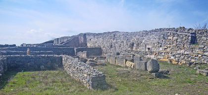
 Extant remains of Histria, along the Romania Black Sea. @ C.Michael Hogan
Enabled by the navigable connection to the Mediterranean Sea, ancient mariners plied the Black Sea as a major crossroads of early civilisations circa 3000 BC. Some hold that the steppes immediately north of the Black Sea are the original homland of the Proto-Indo European language, the precursor of the Indo-European language family. Earliest sailors on the Black Sea included such groups as Carians, Hittites, Cimmerians, Persian, Thracians, Scythians and Greeks. Significant finds in marine archaeology have been mad in the form of submerged shipwrecks from these cultures; the presence of anoxic benthic conditions for part of the coastal shelf have provided ideal conditions of preservation. The Romans formed a slightly later group of explorers to the region and colonists at some of the perimeter cities such as Histria. Later navigators from the Middle Ages included the Crusaders, Venetians, Genoves, Bulgars, Ottomans and Russians.
Further Reading
- Hubert Caspers. Black Sea and the Sea of Azov. In J. W. Hedgpeth, editor, Treatise of Marine Ecology and Paleoecology. Vol. 1: Ecology, pages 801–890. Geological Society of America, 1957.
- L. Zenkevitch. Biology of the Seas of the U.S.S.R. Wiley Interscience, 1963.
- Rhodes W. Fairbridge, editor. The Encyclopedia of Oceanography. Van Nostrand Reinhold Co., 1966.
- Emil V. Stanev. On the mechanisms of the Black Sea circulation. Earth–Science Reviews, 28:285–319, 1990.
- J. W. Murray. Hydrographic variability in the Black Sea. In Erol Izdar and J. W. Murray, editors, Black Sea Oceanography, pages 1–16. Kluwer Academic Publ., 1991a.
- T.Oguz, V. S. Latun,M. A. Latif, V. V. Vladimirov, H. I. Sur, A. A. Markov, E.Ozsoy, B. B.Kotovshchikov, V. V. Eremeev, and U. Unluata. Circulation in the surface and intermediate layers of the Black Sea. DSR, 40:1597–1612, 1993.
- William Ryan and Walter Pitman. Noah's Flood: The New Scientific Discoveries about the Event that Changed History. Simon and Schuster, New York
- Emin Ozsoy and Umit Unluata. Oceanography of the Black Sea: a review of some recent results. Earth–Science Rev., 42:231–272, 1997.
- Emin Ozsoy and Umit Unluata. The Black Sea. In A. R. Robinson and K. H. Brink, editors, The Sea - Vol. 11: The Global Coastal Ocean, Regional Studies and Syntheses, pages 889–914. Wiley, 1998.
See also: Seas of the world listed on the Encyclopedia of Earth
This article was reviewed and approved by Topic Editor Peter Saundry

