Benin
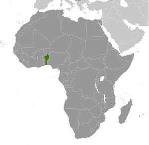
Countries and Regions of the World Collection  Benin is a nation of nine-and-a-half million people in western Africa between Nigeria on the east and Togo on the west.
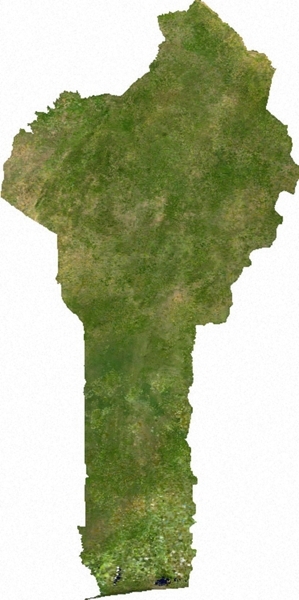
Its geography is a narrow strip of land running north-south. In the south, its' coast faces onto the Bight of Benin in the east Atlantic Ocean. Sandbanks create difficult access to a coast with no natural harbors, river mouths, or islands.
Its population is growing at nearly 3% per year.
Benin's major environmental issues include:
- inadequate supplies of potable water;
- poaching threatens wildlife populations;
- deforestation; and,
- desertification.
Present day Benin was the site of Dahomey, a prominent West African kingdom that rose in the 15th century.
The territory became a French Colony in 1872 and achieved independence on 1 August 1960, as the Republic of Benin.
A succession of military governments ended in 1972 with the rise to power of Mathieu Kerekou and the establishment of a government based on Marxist-Leninist principles.
A move to representative government began in 1989. Two years later, free elections ushered in former Prime Minister Nicephore Soglo as president, marking the first successful transfer of power in Africa from a dictatorship to a democracy.
Kerekou was returned to power by elections held in 1996 and 2001, though some irregularities were alleged.
Kerekou stepped down at the end of his second term in 2006 and was succeeded by Thomas Yayi Boni, a political outsider and independent. Yayi, who won a second five-year term in March 2011, has attempted to stem corruption and has strongly promoted accelerating Benin's economic growth.
Contents
Geography
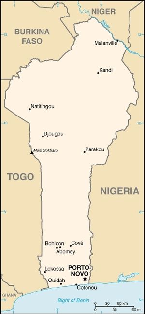
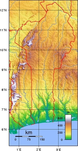
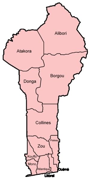
Benin, a narrow, north-south strip of land in West Africa, lies between the Equator and the Tropic of Cancer. Benin's latitude ranges from 6o30N to 12o30N and its longitude from 10E to 3o40E. Benin is bounded by Togo to the west, Burkina Faso and Niger to the north, Nigeria to the east, and the Bight of Benin to the south. With an area of 112,622 square kilometers, roughly the size of Pennsylvania, Benin extends from the Niger River in the north to the Atlantic Ocean in the south, a distance of 700 kilometers (about 500 mi.). Although the coastline measures 121 kilometers (about 80 mi.), the country measures about 325 kilometers (about 215 mi.) at its widest point. It is one of the smaller countries in West Africa: eight times smaller than Nigeria, its neighbor to the east. It is, however, twice as large as Togo, its neighbor to the west. A relief map of Benin shows that it has little variation in elevation (average elevation 200 meters).
Location: Western Africa, bordering the Bight of Benin, between Nigeria and Togo
Geographic Coordinates: 9 30 N, 2 15 E
Area: 112,620 km2 (110,620 km2 land and 2,000 km2 water)
The country can be divided into four main areas from the south to the north. The low-lying, sandy, coastal plain (highest elevation 10 meters) is, at most, 10 kilometers wide. It is marshy and dotted with lakes and lagoons communicating with the ocean. The plateaus of southern Benin (altitude between 20 meters and 200 meters) are split by valleys running north to south along the Couffo, Zou, and Oueme Rivers. An area of flat lands dotted with rocky hills whose altitude seldom reaches 400 meters extends around Nikki and Save. Finally, a range of mountains extends along the northwest border and into Togo; this is the Atacora, with the highest point, Mont Sokbaro, at 658 meters. Two types of landscape predominate in the south. Benin has fields of lying fallow, mangroves, and remnants of large sacred forests. In the rest of the country, the savanna is covered with thorny scrubs and dotted with huge baobab trees. Some forests line the banks of rivers.
Land Boundaries: 1,989 km. Border countries: Burkina Faso 306 km, Niger 266 km, Nigeria 773 km, Togo 644 km
- Talks continue between Benin and Togo on funding the Adjrala hydroelectric dam on the Mona River
- Benin retains a border dispute with Burkina Faso around the town of Koualou
- Location of Benin-Niger-Nigeria tripoint is unresolved
Coastline: 121 km
Maritime Claims:
Territorial sea: 200 nm
Natural Hazards: hot, dry, dusty harmattan wind may affect north from December to March
Terrain: mostly flat to undulating plain; some hills and low mountains. Its highest point is Mont Sokbaro 658 m.
Climate: tropical; hot, humid in south; semiarid in north.
Benin's climate is hot and humid. Annual rainfall in the coastal area averages 36 cm. (14 in.), not particularly high for coastal West Africa. Benin has two rainy and two dry seasons. The principal rainy season is from April to late July, with a shorter less intense rainy period from late September to November. The main dry season is from December to April, with a short cooler dry season from late July to early September. Temperatures and humidity are high along the tropical coast. In Cotonou, the average maximum temperature is 31oC (89oF); the minimum is 24oC (75oF).
Variations in temperature increase when moving north through a savanna and plateau toward the Sahel. A dry wind from the Sahara called the Harmattan blows from December to March. Grass dries up, the vegetation turns reddish brown, and a veil of fine dust hangs over the country, causing the skies to be overcast. It also is the season when farmers burn brush in the fields
Ecology and Biodiversity
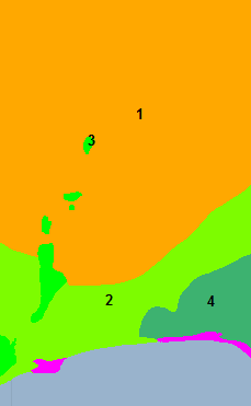
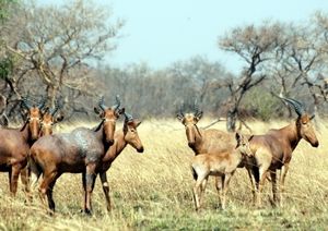
While Central African mangroves (pink) cover much of the coast strip in this part of Africa, they are abset from the Benin coast. In the north and the northwest of Benin the Reserve du W du Niger and Pendjari National Park attract tourists eager to see elephants, lions, antelopes, hippos, and monkeys. See also: Regional biodiversity hotspot (Guinean forests of West Africa) People and SocietyPopulation: 9,598,787 (July 2012 est.) The majority of Benin's 9 million people live in the south. The population is young, with a life expectancy of 59 years. About 42 African ethnic groups live in this country; these various groups settled in Benin at different times and also migrated within the country. Ethnic groups include the Yoruba in the southeast (migrated from Nigeria in the 12th century); the Dendi in the north-central area (they came from Mali in the 16th century); the Bariba and the Fulbe (Peul) in the northeast; the Betammaribe and the Somba in the Atacora Range; the Fon in the area around Abomey in the South Central and the Mina, Xueda, and Aja (who came from Togo) on the coast. Ethnic groups: Fon and related 39.2%, Adja and related 15.2%, Yoruba and related 12.3%, Bariba and related 9.2%, Peulh and related 7%, Ottamari and related 6.1%, Yoa-Lokpa and related 4%, Dendi and related 2.5%, other 1.6% (includes Europeans), unspecified 2.9% (2002 census)
0-14 years: 44.7% (male 2,126,973/female 2,042,340) Population Growth Rate: 2.877% (2012 est.) Birthrate: 37.55 births/1,000 population (2012 est.) Death Rate: 8.79 deaths/1,000 population (July 2012 est.) Net Migration Rate: 0 migrant(s)/1,000 population (2012 est.) Life Expectancy at Birth: 60.26 years male: 59 years Total Fertility Rate: 5.22 children born/woman (2012 est.) Languages: French (official), Fon and Yoruba (most common vernaculars in south), tribal languages (at least six major ones in north) Literacy::( age 15 and over can read and write) 34.7% male: 47.9% Urbanization: 42% of total population (2010) growing at an annual rate of change of 4% (2010-15 est.) History
Europeans began arriving in the area in the 18th century, as the kingdom of Dahomey was expanding its territory. The Portuguese, the French, and the Dutch established trading posts along the coast (Porto-Novo, Ouidah, Cotonou), and traded weapons for slaves. Slave trade ended in 1848. Then, the French signed treaties with Kings of Abomey (Guezo, Glele) and Hogbonou (Toffa) to establish French protectorates in the main cities and ports. However, King Behanzin fought the French influence, which cost him deportation to Martinique. As of 1900, the territory became a French colony ruled by a French Governor. Expansion continued to the North (kingdoms of Parakou, Nikki, Kandi), up to the border with former Upper Volta. On December 4, 1958, it became the Republique du Dahomey, self-governing within the French community, and on August 1, 1960, the Republic of Benin gained full independence from France. GovernmentPost-Independence Politics Former West African Development Bank Director Boni Yayi won the March 2006 election for the presidency in a field of 26 candidates. International observers including the United Nations, the Economic Community of West African States (ECOWAS), and others called the election free, fair, and transparent. President Kerekou was barred from running under the 1990 constitution due to term and age limits. President Yayi was inaugurated on April 6, 2006.
|
|||||||||||||||||||||||||||||||

