Barrier island (Wildlife)
Barrier island
Barrier Islands
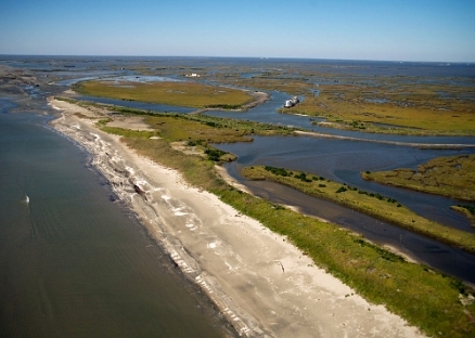
The term barrier islands might conjure images of beaches, boardwalks, and vacation homes for some, but barrier islands function as more than just areas for tourism and recreation. As the first line of defense during storms that threaten coastal communities, barrier islands are very important for reducing the devastating effects of wind and waves and for absorbing storm energy. They are also important marine habitat that supports commercially important fish species, as well as birds, sea turtles and other wildlife species.
Barrier Island Habitat Zones
Barrier islands are long, narrow, offshore deposits of sand or sediment that run parallel to the coastline. They are separated from the main land by a shallow sound, bay, or lagoon and are often found in chains along the East Coast and Gulf of Mexico. The islands themselves are separated by narrow tidal inlets.
A barrier island is made up of the following habitat zones:
- Salt marsh—Low-lying area on the sound-side of a barrier island that is stabilized by cord grasses and flooded by daily tidal activity. Helps purify runoff from main land streams and rivers.
- Barrier flat (overwash)—Formed by sediment pushed through the dunes by storms and stabilized by grasses. Often flooded daily during high tide.
- Dunes—Sand carried and deposited by winds and stabilized naturally by plants and sometimes artificially by fencing. Can be flooded during storms.
- Beach—Ocean side of the island with sand deposited by wave action. Covered by salt water twice daily.

