Ashmore and Cartier Islands
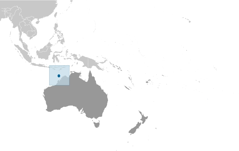
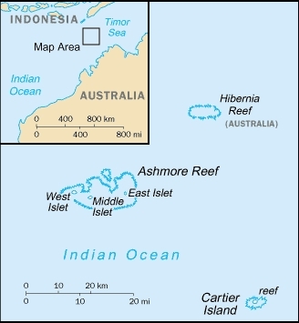
Ashmore and Cartier Islands are uninhabited and protected islands and reefs in the Ocean Indian Ocean, midway between northwestern Australia and Timor island.
Included are:
- Ashmore Reef 155.40km2 (60 sqmi) area within reef (including lagoon)
- West Islet, 51,200 m² land area;
- Middle Islet, 21,200 m² land area;
- East Islet, 25,000 m² land area;
- Cartier Reef (44.03km² area within reef (including lagoon)
- Cartier Island, 17,000 m² land area;
The Hiberian Reef, also part of Australia, is near by.
The major environmental issues include: illegal killing of protected wildlife by traditional Indonesian fisherman, as well as overfishing by non-traditional Indonesian vessels, are ongoing problems . Islands are susceptible to surrounded by shoals and reefs that can pose maritime hazards.
The islands came under Australian authority in 1931; formal administration began two years later.
Ashmore Reef supports a rich and diverse avian and marine habitat. In 1983, it became a National Nature Reserve. Cartier Island, a former bombing range, became a marine reserve in 2000.
The Ashmore Reef National Nature Reserve (58,343 Hectares or 583 square kilometers) is described by the Australian Department of Sustainability, Environment, Water, Population and Communities as follows:
Ashmore has three small, vegetated islands (West, Middle and East Islands). The combined area of the islands is 112 hectares with the largest island being about one kilometre long. The plant communities on the islands are mainly shrubland and herb land with grass species found throughout. Growth varies significantly throughout the year, from the luxuriant growth of the wet season to the dry season when a layer of dead plant material covers much of the islands.
The Ashmore islands provide important nesting habitat for many species, including marine turtles and a number of seabirds and migratory shorebirds. The unvegetated island at Cartier supports large populations of nesting marine turtles.
Despite the small size of the islands, Ashmore supports some of the most important seabird rookeries on the Northwest Shelf and is an important staging point for migratory wetland birds, especially waders. Seventy-eight species have been recorded at Ashmore. Of these, seventeen have been recorded breeding there. Thirty-five of the species that have been recorded at Ashmore are cited in international agreements between the Australian Government and the governments of China, Japan and the Republic of Korea concerning the conservation of migratory birds and their habitats. Colonies of sooty terns and common noddies can number up to 50,000 breeding pairs. Also present in smaller breeding colonies are little egrets, eastern reef egrets, black noddies, lesser noddies, white-tailed tropicbirds and red-tailed tropicbirds.
The Ramsar Convention on Wetlands adds:
The reef itself is one of only three emergent oceanic reefs in the northeastern Indian Ocean and the only one in the region with vegetated islands.
The site comprises numerous marine habitats, including seagrass meadows, intertidal sand flats, coral reef flats, and lagoons, and it supports an important and diverse range of species, including a significant sea snake community, a possibly genetically distinct population of Dugong, highly diverse marine invertebrate fauna, and numerous endemic species, particularly of sea snakes and molluscs. Nesting and feeding sites are supported for Hawksbill, Loggerhead, and especially Green Turtles, as well as an estimated 50,000 breeding pairs of various species of seabirds.
A high abundance and diversity of sea cucumbers, over-exploited near other reefs in the region, can be found, with some 45 species recorded.
The site is located some 500 nautical miles west of Darwin. Traditional fishers from Indonesia are permitted partial access for shelter and fresh water, but there are otherwise few visitors because of the site's isolation. Feral introductions pose a threat, though the alien rat population is now thought to have been eradicated; poachers constitute another possible concern. A management plan is in place. Ramsar site no. 1220. Most recent RIS information: 2002.
History
The Australian Department of Sustainability, Environment, Water, Population and Communities reports:
Indonesian fishermen have visited and fished the north Western Australian coast, islands and reefs of this coastline since the early eighteenth century.
Traditional fishers had no navigational equipment and many set a course south from Indonesia using local land marks in search of new sources of marine resources. When some distance out to sea they sighted the greenish tinge of Ashmore Reef reflected in the clouds. At Ashmore they stopped to replenish their stocks of food and water and, in some cases, to bury their dead, before continuing south to other islands and reefs and to the west Australian coastline. Coconut palms around the well on West Island were planted by visiting Indonesian fishing crews to provide food and shade.
Traditional fishers collected a range of species including beche-de-mer (trepang or sea cucumber), various molluscs (particularly trochus shell), seabirds, seabird eggs, sharks, marine turtles and clams. Trochus shells are used in the manufacture of buttons and ornaments and dried beche-de-mer and sharkfin are sought after delicacies throughout much of Asia. These products are traded through Indonesia into the wider Asian market.
In November 1974, Australia and Indonesia entered into a Memorandum of Understanding (MoU) which recognises the rights of access for traditional Indonesian fishers in a small area of Australian waters. Access to the area defined by the MoU, known as the MoU Box, was granted in recognition of Indonesia's long history of traditional fishing. Under the MoU, traditional Indonesian fishers are permitted to land on West Island to replenish their stores of fresh water, visit the graves of past fishers and to take shelter in the West Island lagoon.
The first recorded European sighting of Ashmore Reef was on 11 June 1811 by Captain Samuel Ashmore, Commander of the Hibernia. Captain Nash aboard the Hibernia is credited with discovering Cartier Island and the nearby Hibernia Reef was named after Captain Nash's vessel.
During the 1850's, American whaling ships operated in the region and during the latter half of the nineteenth century West Island was mined for its phosphate (guano) deposits.
The Ann Millicent, an iron hulled barge of 944 tons was wrecked on Cartier Island on 5 January 1888 on a voyage from the Gulf of Carpentaria to Adelaide. A wreck believed to be that of the Ann Millicent is visible at low tide on the southern edge of the island.
Cartier Island is a former air weapons range with active use of the area for Defence purposes dating back to the 1940s. During the Second World War a Royal Australian Air Force Beaufighter sustained damage during a conflict and set down on Cartier Island. Following the rescue of the crew, the Beaufighter was strafed by other aircraft and set alight. Some of its remnants are still present on the island.
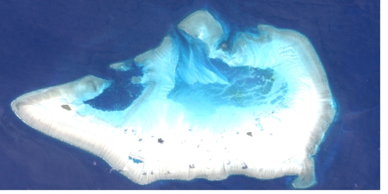
Ashmore Reeef and Islets. Source: NASA
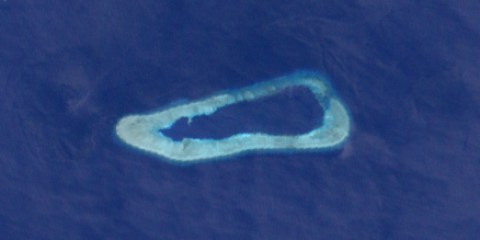
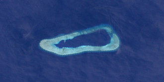 Hiberian Reef. Source: NASA Hiberian Reef. Source: NASA
|
Geographic Coordinates: 12 14 S, 123 05 E
Area: 5 sq km
Coastline: 74.1 km
Maritime Claims:
Territorial sea: 12 nm
Contiguous zone: 12 nm
exclusive fishing zone: 200 nm
Continental shelf: 200 m depth or to the depth of exploitation
Natural Hazards: Surrounded by shoals and coral reefs that can pose maritime hazards
Terrain: Low with sand and coral. The highest topographic point is three meters above sea level (unnammed).
Climate: Tropical
Land Use: The land all grass and sand
Economy: no economic activity
Further Reading
- "The Annotated Ramsar List: Australia". The Ramsar Convention on Wetlands, 21/10/02
- Geoscience Australia—Ashmore and Cartier Islands
- Department of the Environment and Heritage
