Ascension Island (Geography)
Ascension Island
| Topics: |
Source: Wikimedia Commons
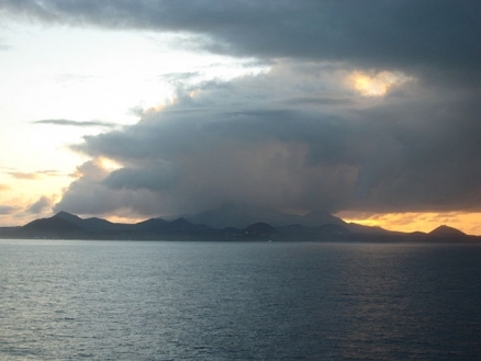
Ascension Island is in located in the South Atlantic Ocean. It is part of the British Overseas Territory of Saint Helena which consists of Saint Helena and Ascension Islands, and the island group of Tristan da Cunha. The islands of this group result from volcanic activity associated with the Atlantic Mid-Ocean Ridge.
|
|
|
|


Ascension is a relatively young volcanic island with 44 distinct craters, all considered "dormant" rather than extinct. The last major volcanic eruption occurred approximately 600 years ago. Much of the island remains covered by basalt lava fields and cinder cones, and steep cliffs mark the south and southeast coasts. There is a sloping plain to the northwest and sandy beaches.
This barren and uninhabited island was discovered and named by the Portuguese. It discovered in 1501 by Joao da Nova Castelia, and was then visited two years later on Ascension Day by Alphonse d'Albuquerque, who named the island.
The dry, barren nature of Ascension made it of little use to the East Indies fleets, and it remained uninhabited until Napoleon was incarcerated on St. Helena in 1815 and a small British naval garrison was established to prevent a rescue of Napoleon from Saint Helena.
The island served use as a resting stop for ships engaged in the suppression of the slave trade around the West African coast during this period. Ascension was managed by the Royal Marines from 1823 until it was made a Dependency of St. Helena in 1922, and was then managed by the Eastern Telegraph Company, later named Cable and Wireless.
During World War II, the UK permitted the US to construct an airfield on Ascension in support of trans-Atlantic flights to Africa and anti-submarine operations in the South Atlantic.
In 1964, radio broadcast stations were established to facilitate transmissions to southern Africa, and an Administrator was appointed. In the 1960s the island also became an important space tracking station for the US.
In 1982, Ascension was an essential staging area for British forces during the Falklands War.
It remains a critical refueling point in the air-bridge from the UK to the South Atlantic.
Ecologically, it is within the Ascension scrub and grasslands ecoregion.
At least 311 species of land animals (a few of which are now extinct) have established themselves on Ascension Island, while only about 95 species are considered to be native. This includes two marine turtles, twelve seabirds, and two extinct landbirds. Natural colonists arrive primarily by air, though some apparently crossed the ocean attached to birds or other animals or on floating objects. The natural colonization of Ascension Island was almost entirely from Africa.
Geographic Coordinates:7 57 S, 14 22 W
Area: 88 sq km
Maritime Claims:
Terrain: surface covered by lava flows and cinder cones of 44 dormant volcanoes; ground rises to the east. The highest point is Green Mountain (859 m).
Climate: tropical marine; mild, semi-arid
Dependency status: overseas territory of the UK
Capital: Jamestown - 1,000 (2009) on Saint Helena
Legal System: English common law and local statutes

Source: Wikimedia Commons.