Angola-Benguela Front
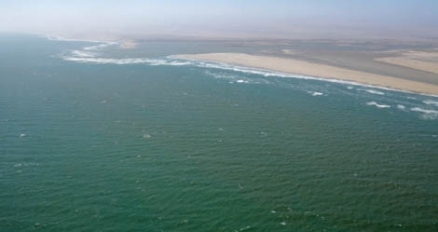
Kunene River mouth where where the Angola-Benguela Front previously existed. @ C.Michael Hogan
The Angola-Benguela Front (ABF) is a oceanic front caused by the confluence of the southward flowing Angola Current and the northward flowing Benguela Current presently near 16oS off the African coast. This can be identified in the temperature of the upper 50 metres (m) and in the salinity to at least 200 m in depth. The ABF varies somewhat in its exact location depending upon the regional meteorology, but is generally in the vicinity of the border between Angola and Namibia at the mouth of the Kunene River. 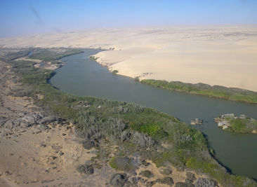 Kunene River estuary where warm water species such as the leatherback turtle are now trapped. @ C.Michael Hogan
Contents
Benguela Current
 |
|
Atlantic currents west of Africa. |
The Benguela Current originates with the confluence of Indian Ocean and South Atlantic subtropical thermocline water; saline, low-oxygen tropical Atlantic water; and cooler, fresher deep water. The current is noted for its cold temperature, leading to a cold dry wind driven to the coast of the Namib desert, contributing to the extreme arid conditions of that desert. The Benguela current is 200 to 300 kilometres wide, broadening as it flows northwest along the coast of South Africa and Namibia. Its western, seaward edge is poorly defined, with many time-fluctuating seasonal eddies and meanders; moreover, there is a well defined thermal front between the waters associated with the Benguela Upwelling System and those of the southeast Atlantic Ocean.
Angola Current
The Angola current is a southward moving current along the coast of Africa generally north of the Kunene River at the Angola/Namibia border. The Angola Current, in sharp contrast to the Benguela is a much warmer ocean current associated with the Atlantic Ocean surface near the African continent. This current can be viewed as extension of the Guinea Current, flowing near central and northern western Africa's coast. The Angola current manifests similar effects to the upwelling produced by the El Niño, though the Angolan Current counterpart is notably weaker.
Natural cycle of climate change
For millennia, the precise location of the Angola-Benguela Front has oscillated as part of the natural cycle of climate and oceanic current change. This location is not a simple intuitively obvious function of average temperature versus latitude of the Front. For example, the Front has been at the mouth of the Kunene River at a time not in the distant past, and has now moved further northward along the Angolan coast, during a presumed period of warming.
Ecology
The unique nature of this confluence of two oceanic currents of two distinct temperatures creates some unusual ecological outcomes. For example at present, as of 2010, the ABF has moved from a location near the mouth of the Kunene River to a point northward. This outcome has left a disjunct population of Leatherback turtles trapped at the Kunene mouth where the temperature is warm enough to sustain the species. Normally they are only found north of the ABF.
Likely impacts of future climate change
A reasonable projection of intermediate term climate change between present and year 2080 is a gradual movement southward of the Angola-Benguela Front, as Atlantic Ocean temperatures generally warm. In this most likely outcome, the harsh arid winds of the Benguela Current moving onshore to coastal arid parts of southern Angola and northern Namibia can be expected to be exchanged for more moisture laden air flow, relieving some of the desertification trend of the last several millennia to that region. It is not unlikely that nomadic tribes such as the Himba, who presently subsist in these drylands, will have improvement in agricultural productivity with global warming.
Further Reading
- Physical Oceanography Index
- Matthias Tomczak and J. Stuart Godfrey. Regional Oceanography: An Introduction. Pergamon, 1994.
- H.U.Lass, M.Schmidt, V.Mohrholz, and G.Nausch. Hydrographic and current measurements in the area of the Angola–Benguela Front. J. Phys. Oceanogr., 30:2589–2609, 2000.
- G.Nelson. 1992. Equatorial wind and atmospheric pressure spectra as metrics for primary productivity in the Benguela system. S. Afr. J. Mar. Sci. 12: 19–28
- Pérez, M.E., Charles, C.D., and Berger, W.H., 2001. Late Quaternary productivity fluctuations off Angola: evidence from benthic foraminifers, Site 1079. In Wefer, G., Berger, W.H., and Richter, C. (Eds.), Proc. ODP, Sci. Results, 175 [Online].