Alexander Island
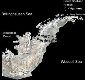
Alexander Island lies immediately off the west coast of the Antarctic Peninsula near its southern base in the Bellingshausen Sea. It is the largest Antarctic Island, being about 240 miles (386 km) long in a north-south direction, and 50 miles (80 km) to 150 (240 km) miles wide, with a land area of 16,700 mi² (43,250 km²).
History
The island was discoved by the Russian expedition led by Thaddeus von Bellinghausen in 1821, who, believing it to be part of the Antarctic Peninsula, named it the Alexander Coast after the reigning Tsar. However, Finn Ronne and Carl Eklund of the U.S. Antarctic Service Expedition discovered it was an island when they surveyed the area by sledge in 1940. It is separated from the mainland by Marguerite Bay and George VI Sound . Other names used include Alexander I Island, Alexander I Land, Alexander Land, Alexander The First Island, and Isla Alejandro I.
Governance
Terrain is mountainous with peaks up to 9800 feet (3000 meters). While Argentina, Chile, and the United Kingdom have made territorial claims to the peninsula, it is governed under the Antarctic Treaty System which limits military activity and promotes scientific study (there are 28 research stations), environmental protection, and other peaceful activities.
The British Antarctic Survey maintains a base at Fossil Bluff which is used primarily as a "forward facility for refuelling aircraft" in support of other British research stations.