Albertine Rift (collection)
| Topics: |
%2c_Parc_des_Volcans%2c_Rwanda.jpg)
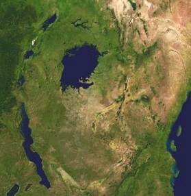
The Albertine Rift is a 1,200 km long rift valley in central Africa that is flanked by highlands, including some of the highest peaks on the continent, and includes a series of notable lakes, including Lake Albert, Lake Edward, Lake Kivu, and Lake Tanganyika. It is a region of high biodiversity, with many notable species found nowhere else. The Rift runs north-south with a westerly arc and provides a natural border for Democratic Republic of the Congo and its western neighbors, Uganda, Rwanda, Burundi, and Tanzania. The northern end of the Albertine Rift is usually taken to include all of Lake Albert which ends at the beginning of the Albert Nile (2°21' N 31°27' E). The southern end is usually taken to include most, but not all, of Lake Tanganyika, terminating at about the latitude of the Marungu Highlands (7°30’ S).
- Click here for an overview of the Albertine RiftCountries sharing the Albertine Rift
- Burundi: Short Overview - country profile (Burundi country profile)
- Democratic Republic of the Congo: Short Overview (Democratic Republic of the Congo) - country profile (Democratic Republic of the Congo country profile)
- Rwanda: Short Overview (Rwanda) - country profile (Rwanda country profile)
- Tanzania: Short Overview (Uganda) - country profile (Tanzania country profile)
- Uganda: Short Overview (Uganda) - country profile
- Geography: Overview - Climate - Rivers, Lakes, Mountains, and other Geographical features -Cities and towns
- Ecology and Biodiversity:
- Overview of Biodiversity
- Protected Areas of the Albertine Rift (by country)
- WWF Ecoregions of the Albertine Rift
- Regional biodiversity hotspots (Eastern Afromontane)
- Endangered Species of Albertine Rift
- Species of the Albertine Rift: Mammals, Birds, Fishes, Amphibians, Reptiles, Other Animals, Trees, Flowers, Other Plants, Species other than Animals and Plants
- Natural Resources: Water - Energy - Fisheries - Forests - Air -Agriculture
- Human Interactions with the Albertine Rift
- People and Settlements of the Albertine Rift
- Governance
- Organizations and Programs
- Environmental Services
- Profiles of people shaping the Rift