Admiralty Islands lowland rainforests
The Admiralty Islands Lowland rainforests contain several endemic species, yet the biodiversity of these islands is still poorly known. Intensive commercial logging and conversion of forests to agriculture are the greatest threats to the ecoregion.
Location and General Description

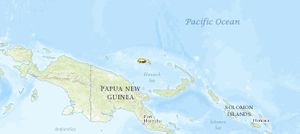
The Admiralty Islands are located slightly north of Papua New Guinea (PNG) in the southwest Pacific Ocean and are often grouped together with New Britain and New Ireland to make up the Bismarck Archipelago. The Admiralty Islands form the political unit of Manus Province, PNG. Manus Province is the smallest province of PNG in both land area and population (32,713). The temperature of the Admiralty Islands varies little throughout the year, reaching daily highs of 30-32° Celsius and 20-24°C at night. Average annual rainfall is 3382 millimeters (mm) and is somewhat seasonal, with June through August being the wettest months.
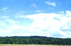
Manus is the main island that reaches an elevation of 700 meters, although there appears to be no discernible change in biota with altitude. Manus is volcanic in origin and probably broke through the ocean's surface in the late Miocene, eight to ten million years ago. The substrate of the island is either directly volcanic or from uplifted coral limestone. The vegetation of the Admiralty Islands is broadly described as lowland tropical rain forest. Johns highlighted the need to study the forests of central Manus, from Mt. Dremsel to the northern coast, and to protect the Calophyllum forests as an area of high biological importance.
History and Discovery
The first recorded history of these islands traces to the Dutch explorer, Cornelius Schooten, who first visited Admiralty Islands in the year 1616. Later the islands were re-explored by Philip Carteret in 1767; at that time Carteret gave the islands their definitive location on navigational charts and established the name they bear today.
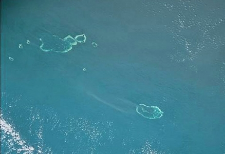
The French navigator D'Entrecasteaux conducted detailed mapping of the northern reaches of the Admiralty Islands in 1792. His work included thorough mapping of many reefs and shoals as well as terrestrial features. D'Entrecasteaux Island was named for him, and he provided the first comprehensive mensuration of Suhm Island, D'Entrecasteaux Reef, Wild Island, Observatory Islet and Havergal Shoal. By the latter part of the nineteenth century the estimated human population of the Admiralty Islands was 25,000.
Biodiversity Features
The Admiralty Islands are distinctive and contain endemic plant species because of their isolation from other landmasses. Characteristic species include tree species of the Calophyllum and Sararanga forests.
|
Table 1. Endemic and Near-Endemic Mammal Species. Family Species Phalangeridae Spilocuscus kraemeri* Pteropodidae Dobsonia anderseni Pteropodidae Pteropus admiralitatum Emballonuridae Emballonura serii Muridae Melomys matambuai* An asterisk signifies that the species' range is limited to this ecoregion. The Admiralty Islands contain several species with limited distribution, including five mammals species, two of which are found only in this ecoregion (Admiralty Islands lowland rainforests) (Table 1). Six bird species are endemic to the ecoregion, and seven more are near endemics (Table 2). There are three birds listed by IUCN as vulnerable (Tyto manusi, Pitta superba, and Rhipidura semirubra). P. superba is quite beautiful and certainly a candidate for becoming a flagship species. T. manusi and R. semirubra are both forest-dwelling species that may be overlooked on Manus. Small islands off Manus are thought to be important to R. semirubra. The Admiralty Islands Lowland Rain Forests have an endemic Platymantis frog and four endemic lizards. Additionally, the only land snail listed by IUCN, the green tree snail (Papustyla pulcherrima), is endemic to Manus. Johns estimates the total number of native plant species on Manus at 1500. {| width="640" border="1" cellpadding="1" align="center" ! colspan="3" align="center" | Table 2. Endemic and Near-Endemic Bird Species. Family Common Name Species Megapodiidae Melanesian scrubfowl Megapodius eremita Columbidae Yellow-bibbed fruit-dove Ptilinopus solomonensis Columbidae Yellow-tinted imperial-pigeon Ducula subflavescens Columbidae Pied cuckoo-dove Reinwardtoena browni Psittacidae Meek's pygmy-parrot Micropsitta meeki Tytonidae Manus owl Tyto manusi* Strigidae Manus hawk-owl Ninox meeki* Pittidae Black-headed pitta Pitta superba* Monarchidae Manus monarch Monarcha infelix* Rhipiduridae Manus fantail Rhipidura semirubra* Zosteropidae Black-headed white-eye Zosterops hypoxanthus Meliphagidae Ebony myzomela Myzomela pammelaena Meliphagidae White-naped friarbird Philemon albitorques* An asterisk signifies that the species range is limited to this ecoregion. (Admiralty Islands lowland rainforests) ==Current Status== There is little information about the status of the Admiralty Islands Lowland rainforests ecoregion. Rannells stated that four-fifths of Manus is forested, although this figure includes both primary and secondary forest cover. The interior forests around Mt. Dremsel are still intact and have been listed as an important area of terrestrial biodiversity in PNG. The Mt. Dremsel forests are listed as a protected area by WCMC, but the category of protected area has not been determined (Table 3). Meanwhile, many of the smaller islands have been converted into coconut plantations. {| width="640" border="1" cellpadding="1" align="center" ! colspan="3" align="center" | Table 3. WCMC (1997) Protected Areas That Overlap with the Ecoregion. Protected Area Area (km2) IUCN Category Ndrolowa 60 VIII Mt. Dremsel 240 ? Total 300 Ecoregion numbers of protected areas that overlap with additional ecoregions are listed in brackets. (Admiralty Islands lowland rainforests) ==Types and Severity of Threats== Threats to the Admiralty Island moist forests include commercial timber extraction and destruction of habitat caused by shifting agriculture. ==Justification of Ecoregion Delineation== We delineated two [[ecoregion]s] to represent the montane and lowland evergreen moist forests in the New Britain and New Ireland island complex; the New Britain-New Ireland lowland rainforests and the New Britain-New Ireland montane rainforests. The 1000-meter contour of the DEM was used as the transition between lowland and montane ecoregions. We placed the Admiralty Islands Lowland rainforests into a distinct ecoregion, following Stattersfield et al. MacKinnon combined these three ecoregions into a single subunit (P3p). Udvardy placed these ecoregions in the Papuan biogeographic province of the Oceanian Realm. ==Further Reading== * Great Britain Hydrographic Department. 1900. Pacific islands (Google eBook) The Great Britain Hydrographic office, Admiralty. 542 pages * Matthew Spriggs. 1997. Recent History (The Holocene). In Denoon, Donald. The Cambridge History of the Pacific Islanders. Cambridge: Cambridge University Press * Charles Marion Tyler. 1885. The island world of the Pacific Ocean. (Google eBook) Howard & Pariser. 337 pages ==Additional information on this Ecoregion== * For a shorter summary of this entry, see the WWF WildWorld profile of this ecoregion. |} |}
|
|---|

