United States Exploring Expedition
| Topics: |
The U. S. Exploring Expedition, 1838-1942, under the command of Charles Wilkes, was a significant undertaking: itexplored and charted part of the northwest coast of North America (especially Puget Sound and San Francisco Bay), Antarctica (especially a region now known as the Wilkes Coast) and Pacific islands (including Fiji and Hawaiian Islands). The record of the expedition was marked by Wilkes’ often harsh, capricious and self-serving approach to command, dislike of civilian scientists (which led him to significantly restrict their work), and some claims of discovery in Antarctica which proved to be erroneous. Two of the expedition’s six ships were lost on the journey.
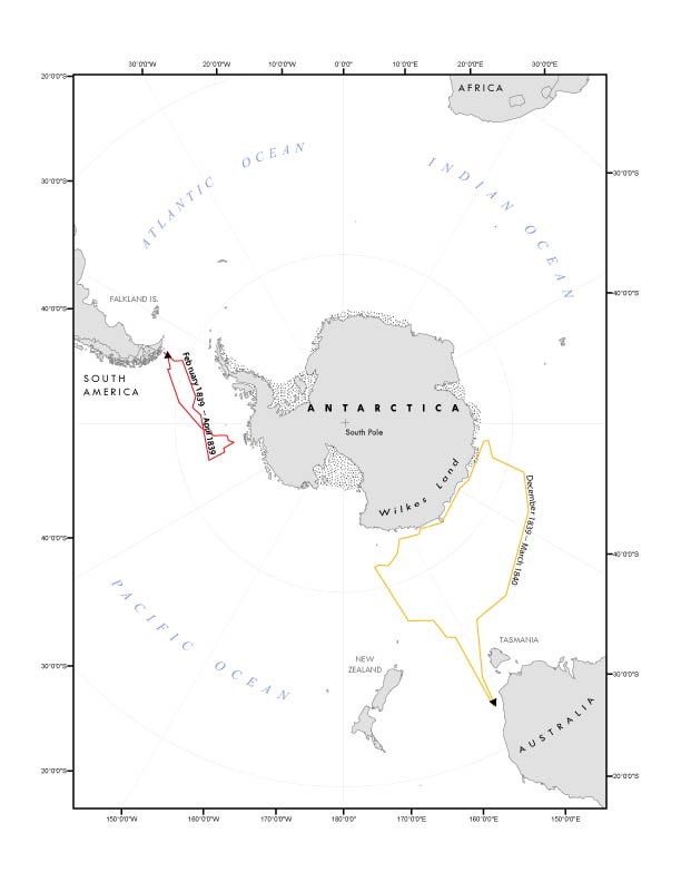 Course of the United States Exploring Expedition near Antarctica. Source: Ahn Wei Lee Course of the United States Exploring Expedition near Antarctica. Source: Ahn Wei Lee
|
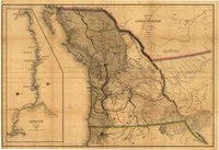 Map of the Oregon Territory from Charles Wilkes' Narrative of United States Exploring Expedition. The inset shows the Columbia River from its mouth to the Snake River. Source: Library of Congress Map of the Oregon Territory from Charles Wilkes' Narrative of United States Exploring Expedition. The inset shows the Columbia River from its mouth to the Snake River. Source: Library of Congress |
Like the bumptious republic it represented, the so-called "Wilkes Expedition" was also something of a mess. First proposed in the 1820s, its federal funding fell afoul of Congress’ jealousy of Executive-Branch prerogatives; ongoing political machinations and a lukewarm public reception to the spending of taxpayer dollars to underwrite this extended probe of mare incognita kept delaying the launch of a voyage whose scientific collections would in time form the foundation of the Smithsonian Institution. It took another two years after Congress authorized the trip in 1836 for it to set sail, delay that was “marked by cross purposes, charges and counter charges, and general inefficiency.” Antebellum Americans’ uncertainty about their geopolitical role was reflected in their ambivalence about something seemingly so simple as this international wave of the flag.
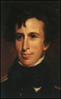
Aware of these turbulent political waters, and the swirling winds of public opinion, the U. S. Navy, despite the benefits that would accrue from the coastal and oceanic surveying the expedition would conduct, was also hesitant to embrace the project. Certainly, its senior officers had little interest in commanding what they perceived to be an unrewarding, perhaps even a career-ending, assignment. So many of them accepted then rejected the offer, or refused it outright, that in the end its leadership fell to Lieutenant Charles Wilkes (1798-1877), a non naval-line officer plucked from the Department of Charts and Instruments. A self-taught surveyor, Wilkes had had no real command experience, a lack that would mar the four-year probe of the Pacific and would culminate with his being brought up on charges upon returning to the United States.
The difficulties Wilkes had in organizing and outfitting the expedition were symptomatic of the subsequent complications he, the crew, and the scientific corps would face once they weighed anchor from Hampton Roads on August 18, 1838. Securing appropriate ships proved problematic; Wilkes ultimately was able to cobble together an odd fleet consisting of two sloops of war, USS Vincennes (780 tons) and USS Peacock (650 tons); the brig USS Porpoise (230 tons); a supply ship, USS Relief (468 tons); and tenders USS Flying Fish (96 tons) and USS Sea Gull (110 tons).
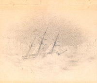
Not all of these vessels survived: the Gull disappeared with all hands in May 1839 during a fierce storm off the South American coast; in July 1841 the Peacock foundered at the mouth of the Columbia River, though its crewed was saved. Not all of the ships were well suited for the work, either. Unsuited, too, were some of the men appointed to take on the expedition’s chief work: "exploring and surveying the Southern Ocean” as well as determining “the existence of all doubtful islands and shoals, as to discover, and accurately fix, the position of those which lie in or near the track of our vessels in that quarter, and have escaped the observation of scientific navigators." Locating officers skilled in surveying proved knotty because the U. S. Coast Survey actually produced most of the charts on which the Navy relied; despite its official-sounding name, the Survey was a civilian outfit. Yet Wilkes, convinced of his cartographical abilities, refused to hire non-naval surveyors.
He was just as positive that he and his officers could handle key elements of the expedition’s scientific mission, despite being warned that none in the service had the relevant expertise. That was why when originally conceived, the expedition was to carry a full complement of botanists, mineralogists, and other naturalists, some of whom, notably Asa Gray, were preeminent scholars; others like geologist James Eights had been invited because of previous field work in Antarctica and the southern Pacific. Gray, fed up with the incessant delays, backed out; Wilkes unilaterally revoked the invitations to Eights and other distinguished researchers. Those who made it on board may have wished they had not: they were subject to Wilkes’ ill-disguised disdain for their attainments, which his crew then copied, dismissing the scientists as mere “bug catchers” and “clam diggers.” On many levels, Wilkes compromised the U. S. Exploring Expedition’s raison d’etre.
The tumult did not dissipate when the Vincennes lead the small flotilla out into the Atlantic, but at least its departure, observed Lieutenant George Foster Emmons of the Peacock, “silenced all the croakings of such incredulous individuals as were in the constant habit of affirming that the Expedition never could leave the waters of the United States.” He predicted that the voyage, “which may prove perilous, must be interesting and which we trust will prove by its results, that the confidence of the Government was not misplaced.”
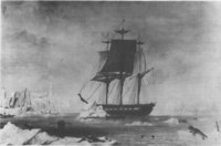
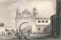
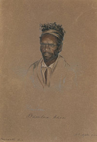
It is hard to find fault with some of the expedition’s accomplishments. Its itinerary was expansive: beginning with a layover in Madeira, the first of an estimated 280 islands it visited, it called in at ports in Brazil, Argentina, Chile and Peru; from that western coast, it sailed to the TuamotuArchipelago,Samoa and Australia, swung east to cruise along 1,500 miles of the Antarctic coast. After heading back to the Pacific, the expedition stopped off in Fiji, and then set its sights on Hawaii; there, not incidentally, it paid close attention to the islands' key ports, as it earlier had done in Samoa, sizing up their potential as naval bases. Next stop was the Pacific Northwest, and the mapping of more than 800 miles of the Oregon and northern California coastline; while so engaged, Wilkes tapped Lt. Emmons to lead an exploring party inland, down the Siskyou Trail, past Mt Shasta, and, and following the Sacramento River they made their way to the San Francisco Bay delta; there they rejoined the expedition. The voyage's final leg consisted of a long run across the central Pacific to the Philippines, Borneo, and Singapore, then down to the Cape of Good Hope, before turning north and east for New York City, sailing into its welcoming harbor on June 10, 1842. Having logged more than 87,000 miles, the expedition was the last all-sail-powered circumnavigation of the globe.
These impressive achievements pale in comparison to the bewildering number of specimens collected during that extensive voyage--upwards of 60,000--along with seeds of hundreds more. Post-voyage cataloguing and publication took decades to complete, not least because of the sheer numbers of flora and fauna to be dissected, analyzed, processed, described, and illustrated. It was also held up by Wilkes’ arrogance and meddling; the government’s periodic unwillingness to provide adequate funding; and the incompetence and negligence of those with whom the hundreds of specimen-filled barrels and crates initially were stored. This latter situation infuriated Titian Ramsey Peale, one of the expedition’s naturalists: “I am ashamed to record the fact, that when the boxes and packages were placed charge of the National [Smithsonian] Institution, the seals were broken and a general scramble for curiosities took place by irresponsible members of the Society, in which some ‘Honorable’ men took part. Many valuable specimens were lost, particularly shells and skins of birds.”
For all these complexities and disappointments, the collections helped turn the Smithsonian into a first-rate national museum, and nurtured the belief that this voyage would enable the United States to add to world’s store of knowledge. As one early proponent of the expedition had asserted, governmental patronage of this scientific enterprise would add to “the honor of the nation” by producing scientists on a par with “a Buffon, a Latrielle, a Cuvier.”
None accompanying the expedition achieved that elevated status; none could match the impact of their contemporary Charles Darwin (although Darwin cheered the scholarship of James Dwight Dana: “The size of the work and the necessary labor bestowed on it, are really surprising. Why if you had done nothing else whatever, it would have been a magnum opus for life. …I am really lost in astonishment…).
These scholars’ output was astonishing. By 1874, when the federal government stopped subventing the publication process, Wilkes had produced a five-volume narrative of the voyage, complete with an accompanying atlas. Nineteen other tomes had been completed, ranging in subject from ethnography to ornithology, botany to crustacea, hydrology to physics. Not all were published, however. Indeed, Wilkes suppressed Titian Peale’s 1849 volume on mammalia and ornithology, shortly after its initial appearance. The publishing-oversight committee then informed Peale it would stop paying his salary as a member of the expedition, at which point the frustrated Peale resigned. Wilkes was thrilled: “Peale has quit us, and left 30 plates or drawings to be made, it is happy riddance and we shall soon finish them.”
He spoke too soon: a year later he realized just how tricky Peale’s work had been, and had to commission another naturalist, John Cassin, to finish the study, which appeared under his name. This episode, like so much of the history of the expedition, was fraught with personality conflicts and clashing ambitions.
For all the energy Wilkes expended before, during, and after the expedition, he was so central to the many tensions surrounding its life that it is not too surprising that he was court martialed shortly after the Vincennes dropped anchor off New York in 1842. Accused of repeated and serious mistreatment of the crew as well as nonstop abuse of junior officers, he was also charged with the loss of the USS Peacock; although cleared of all accusations except those relating to the crew’s punishment, Wilkes was reassigned to shore duty. Yet by 1844, through the intervention of politically connected friends, he was given the responsibility for overseeing the publication of the voyage’s voluminous findings.
Wilkes never anticipated that this task would last three decades, but this enduring labor, and the varied collections on which it was based, remains the United States Exploring Expedition’s most important scientific contribution. The expedition’s cultural impact is more difficult to assess. By opening some Americans’ eyes to the larger world it expanded as well their conception of their role within it. That was an important first step for a new nation eager to make its mark.
Yet as Nathaniel Philbrick has argued, despitethe expedition’s initial success in bringing attention to the Pacific—its oddities and opportunities—the voyage's impact was more ephemeral than enduring:
Gradually, but inevitably, the Exploring Expedition would be overshadowed by the very historical forces that it had helped to set in motion. Foreshadowed by Frémont and made an accomplished fact by the discovery of gold in California in 1848, the interest of the American people shifted from the frontier of the sea to the frontier of the West. Instead of whalers, sealers, China traders, and Polynesian natives, it was now mountain men, pioneers, cowboys, and Indians who captured the American imagination. Even though the [expedition] had had such an early and vital role in the exploration of the Oregon territory and California, the nation would quickly lose all memory of the fact that Wilkes and his men had been the first Americans to chart Puget Sound, the Columbia River, and San Francisco Bay.
There is much to his claim, but it is important to recall, too, that not everyone lost sight of the Pacific’s potential as an American lake. Shortly after the end of the Civil War, that bloody conflict’s most remarkable and pragmatic general, U. S. Grant, became president; and as commander-in-chief he sought to rectify a strategic maritime problem that that war had exposed. U. S. naval forces in the Pacific, as they chased after the Confederate steamer, Shenandoah, which in 1864-65 was wreaking havoc with Union merchant vessels and its whaling fleet, lacked critical resources to maintain their pursuit; among them deep-water ports, fuel, and other essential supplies. Shortly after taking office, Grant sought to resolve this situation of depending on the kindness of other people and countries to rearm, refuel, and reprovision. So he sent envoys to Samoa and Hawaii seeking treaties that would provide the protected harbors and necessary material to keep a U. S. Pacific fleet in combat readiness. By the 1890s, with Samoa's Pago Pago and Hawaii's Pearl Harbor flying the Stars and Stripes, his ambition was realized, a realization that depended in part on the U. S. Exploring Expedition’s earlier charting of these havens’ military potential. Winning the west and dominating the Pacific, it turns out, were part of the same imperial project: projecting American power forward.
Further Reading
- Images of the five volume Narrative of the United States Exploring Expedition of 1838-1842 by Charles Wilkes and scientific texts courtesy of the Smithsonian Institution (accessed July 30, 2009)
- The Alfred Agate Collection:The United States Exploring Expedition, 1838-1842, U.S. Navy (accessed July 30, 2009)
- The Race to the White Continent, Alan Gurney, W.W. Norton and Company, 2002 ISBN: 0393323218.
- The Great United States Exploring Expedition, William Stanton, University of California Press, 1975 ISBN: 0520025571.
- The United States Exploring Expedition, 1838-1942: And Its Publications, 1844-1874; Bibiliography, Daniel C. Haskell; Introductory Note, Harry Miller Lydenberg, Greenwood Press, 1968 ISBN: 1578983851.
- Sea of Glory: America’s Voyage of Discovery, The U.S. Exploring Expedition, Nathaniel Philbrick, Viking , 2003 ISBN: 9780670032310.
- Narrative of the United States Exploring Expedition of 1838-1842 by Charles Wilkes, Adamant Media Corporation, 2002, Volume I ISBN: 142120892X; Volume II ISBN: 1421221152; Volume III ISBN: 1402111193.
- The Private Journal of William Reynolds: United States Exploring Expedition, 1838-1842, by William Reynolds, Nathaniel Philbrick, and Thomas Philbrick, Penguin Classics, 2004 ISBN: 0143039059
- Navy Biography of Charles Wilkes (accessed July 30, 2009)
- The U.S. Exploring Expedition, 1844-1874, Smithsonian Institution (accessed July 30, 2009)
- Learn More about the U.S. Exploring Expedition, 1844-1874, Smithsonian Institution (accessed July 30, 2009)
- Selected Internet Resources on the United States Exploring Expedition, Smithsonian Institution (accessed July 30, 2009)
- The Publications of The U.S. Exploring Expedition, 1844-1874, Leslie K. Overstreet, Smithsonian Institution (accessed July 30, 2009)
- The Scientific Legacy of the U.S. Exploring Expedition by Nathaniel Philbrick (accessed July30, 2009)
- The “Tuscarora’s” Mission to Samoa, in "The Century", 1889
- CSS Shenandoah
