Tubuai tropical moist forests
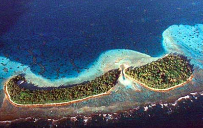
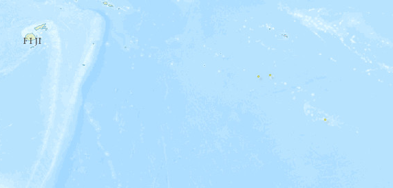
Introduction Located south of Tahiti, the Tubuai, or Austral Islands, are eroded volcanic peaks that are surrounded by uplifted limestone reef rims. These islands are among the least studied of the Pacific Island ecosystems (Tubuai tropical moist forests) . The vegetation includes lowland and montane rain forest, with about 150 species of flowering plants. While the islands are also host to several important endemic plant and animal species, they have a history of profound disturbance by humans.
Location and General Description
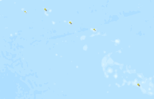
There are five inhabited islands in the Tubuai group: Rimatara, Rurutu, Tubuai, Raivavae, and Rapa. The largest is Tubuai, with an area of 44 km2. The chain also includes an uninhabited island group, Ilots de Bass (Marotiri), and an uninhabited atoll named Maria.
The islands are the expression of a geologic hotspot track and are similar in ages and rock composition to the Hawaiian Islands. The islands at the southeastern end are the youngest, and have highly dissected volcanic summits. The islands to the northwest become progressively older, more weathered, and eroded. In areas where uplift has occurred, the flanks of the islands are covered by coral limestone. Uninhabited Marotiri, the youngest island located at the southeastern end of the chain, has been eroded or has subsided almost to a high point of approximately 100 meters (m). It is steep-sided and rugged, with no flat land or adjacent reefs.
Next in line is Rapa Island, an ancient volcanic caldera open on the east side that rises to an elevation of 633 m. The deep bays and drowned valleys of the island suggest that it has subsided, possibly because of post-Pleistocene sea-level rise. The lower interior slopes of the caldera have outcrops of lignite, a low-grade coal, which suggests a long history of floral growth on the island. Rapa is one of only two oceanic Pacific Islands to have coal deposits, the other being Babeldaob in Palau. The flora of this island shows some relationship to that of New Zealand, and includes the genera Hebe, Olearia, Haloragis, and Corokia. There are many endemic species, and some strictly Pacific genera such as Fitchia, Bidens, and Sclerotheca.
The vegetation on Rapa has been highly disturbed by anthropogenic activities, including the introduction of goats. Of the remaining native vegetation, the dominant type is a moist to wet broadleaf evergreen forest that is remarkably rich in species considering the small size of the island. This forest hosts numerous ephiphytes, and there is a rich fern flora, including Marattia and Angiopteris, in the understory. Scrub forests of Metrosideros collina are found on high crests and ridges with associated tree species and numerous epiphytic bryophytes and ferns.
The volcanic peaks of Raivavae, located 600 kilometers (km) north of Rapa, are strongly dissected and the topography is rugged, rising to a maximum elevation of 437 meters. The flanks of the island include some areas of elevated reef limestone, and there is a surrounding barrier reef. The vegetation includes lowland and montane rain forest, with several important endemic plant species.
Tubuai Island is characterized by two mountain masses that rise to elevations of more than 400 meters. These mountains are surrounded by a raised coral limestone platform which extends across the island and between the two ranges. Patches of native forest remain around the higher peaks, and are characterized by Metrosideros, Aleurites, Celastrus vitiensis, Myrsine, Ixora, Psychotria, Cantium barbatum, and Charpentiera. There are also the large ferns Cyanthea and Angiopteris and many smaller species. Ferns are the dominant flora in some areas. About 150 species of flowering plants have been documented on Tubuai.
Rurutu Island is surrounded by an almost continuous limestone rim 50 to 60 meters high in elevation. This rim surrounds the inner volcanic hills which have elevations of up to 400 meters and are mantled with a red clay soil. The hills are cut by several ravines containing small streams that shelter scattered remnants of limestone forest.
Rimatara Island is also surrounded by a limestone rim, but the central peak is topographically lower and more weathered. The low hills of the interior are cut by small streams. Patches of marshy ground have developed in the flat land between the hills and on the surrounding limestone rim. Endemism rates are more than 20 percent among the native plants on Rimatara.
Maria is a small coral atoll with four islets, and is the oldest island of the Tubuai group. The islets support a dense atoll forest with nearly original vegetation.
Biodiversity Features
Several islands still have remnants of native montane rain forests with Metrosideros, Weinmannia, Celtis, Myoporum, Elaeocarpus, Psychotria, and Myrsine. Also, tall ferns such as Cythea, Angiopteris, and Marattia remain.
Invertebrates of conservation interest include Endontidae and two Partiluidae, which have been threatened by catastrophic snail extinctions.
The Austral Islands harbor a few endemic bird species. The Endangered Kuhl’s lorikeet (Vini kuhli) is found on 4 islands in the Pacific, but is considered to be native to the Australs. It is now found on Rimatara but was apparently once found on Rurutu. The bird is also found on three islands in Kiribati. The Rimatara reed-warbler (Acrocephallus rimatarae) is strictly endemic to Rimatara. It is common and widespread on the island, but is considered vulnerable due to the small size of the island.
Rapa Island harbors the Vulnerable Rapa fruit-dove (Ptilonopus huttoni), which is confined to 3km2 mid- to high-elevation forest fragments. While it has a small population and its habitat has diminished, there has been no ‘serious’ decline since 1974.
Current Status
The lowlands of the Tubuai Islands are more open than the higher island interiors, and are strongly altered by cultivation, anthropogenic fires, and uncontrolled grazing. Low elevations on the main high islands consists of secondary thickets of Hibiscus tiliaceus and orange trees, Psidium guajava, or Dicranopteris fernlands and grasslands, with some scattered secondary ravine forests. In fact, with the exception of remote Maria Atoll, the vegetation of the islands is considered ‘profoundly altered.’
Types and Severity of Threats
The remaining indigenous vegetation on Tubuai is threatened by clearing (Deforestation) and burning of forests for agricultural development, as well as by the development of an airport and hotels for the tourism industry. Remaining forest areas are in need of protection and extension. On many of the islands, there is a serious problem with feral goats, pigs, cattle, and horses.
Norway rats (Rattus norvegicus) are considered the key threat to remaining populations of Kuhl’s lorikeet on Rimatara – thus far none of the more dangerous black rats (Rattus rattus) have been detected.
Justification of Ecoregion Delineation
This ecoregion includes the Austral Islands group stretching from Illes Maria to Rapa and Marotiri. Van Balgooy et al lump the Cooks, Niue, Societies, Tuamotus, Tubaui, and Marquesas based on floristic affinities. However, Birdlife International separates two distinctive areas in the Austral Islands (Tubaui). This includes the island of Rimatara Endemic Bird Area, with 2 endemic bird species, and the Rapa Island Secondary Endemic Bird Area, with its one endemic fruit dove. On the basis of these three endemic bird species, we have separated out the Tubuai Islands as a distinct ecoregion.
Additional information on this ecoregion
- For a shorter summary of this entry, see the WWF WildWorld profile of this ecoregion.
- To see the species that live in this ecoregion, including images and threat levels, see the WWF Wildfinder description of this ecoregion.
- World Wildlife Fund Homepage
Further Reading
- Birdlife International. 2000. Threatened birds of the world. Lynx Edicions, Cambridge & Barcelona. ISBN: 0946888396
- Cahiers de L’Indo-Pacifique. Tubuai. 1980. Direction des Centres D’Experimentations Nucleaires, Service Mixte de Controle Biologique. Paris.
- Dahl, A.L. 1986. Review of the protected areas system in Oceania. International Union for Conservation of Nature and Natural Resources, Commission on National Parks and Protected Areas, in collaboration with the United Nations Environment Programme. ISBN: 2880325099
- Mueller-Dombois, D. and F.R. Fosberg. 1998. Vegetation of the tropical Pacific islands. Springer-Verlag, New York. ISBN: 038798285X
- Stattersfield, A, M.J. Crosby, A.J. Long, and D.C. Wege. 1998. Endemic Bird Areas of the World, Priorities for Biodiversity Conservation. BirdLife Conservation Series No. 7, Birdlife International, Cambridge, UK. ISBN: 0946888337
- Van Balgooy, P.H. Hovenkamp, and P.C. Van Welzen. 1996. Phytogeography of the Pacific – floristic and historical distribution patterns in plants. Pages 191-213 in Keast, A. and S.E. Miller, editors. The origin and evolution of Pacific island biotas, New Guinea to Eastern Polynesia: Patterns and processes. SPB Academic Publishing, Amsterdam. ISBN: 905103136X
| Disclaimer: This article is taken wholly from, or contains information that was originally published by, the World Wildlife Fund. Topic editors and authors for the Encyclopedia of Earth may have edited its content or added new information. The use of information from the World Wildlife Fund should not be construed as support for or endorsement by that organization for any new information added by EoE personnel, or for any editing of the original content. |


