Rivers (Water)
From The Encyclopedia of Earth
Rivers
Rivers are terrestrial flowing surface waters that drain well defined watersheds. A river typically has a geographic origin, termed its headwaters. In general, there are smaller rivers or streams that merge into the principal river of a given watershed; such influent streams are called tributaries of the principal river. Most rivers either discharge to a larger watercourse or flow into one of the seas of the world. In the less common circumstance, a river may terminate in an inland lake, with no outlet; this circumstance is called an endorheic basin. Rivers are home to a diversity of flora and fauna.
========
-
 Featured Article
 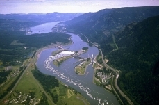 Columbia River (Rivers)The Columbia River is the largest North American watercourse by volume that discharges to the Pacific Ocean. With headwaters at Columbia Lake, in Canadian British Columbia, the... More »
-
 Featured Article
 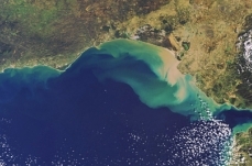 Heavy metal distributions in the Gulf of CadizPerianez is the lead author of this article Heavy metal distributions in the Gulf of Cadiz are generated chiefly by coastal riverine discharge, and thus... More »
-
 Featured Article
 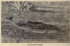 Ganges River dolphinThe Ganges River dolphin (scientific name: Platanista gangetica) is s freshwater cetacean closely related to the Indus river dolphin (Platanista minor). These two endangered... More »
-
 Featured Article
  U.S. Wild and Scenic Rivers ActThe U.S. Wild and Scenic Rivers Act of 1968 attempted to provide federal protection to certain pristine rivers of the USA. Major issues posed by the Act involve potential... More »
-
 Featured Article
  Daugava River (Rivers)The Daugava River drains portions of the countries of Latvia, Belarus and Russia, prior to discharging to the Gulf of Riga. Also known as the West Dvina River, this watercourse is... More »
-
 Featured Article
 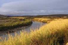 Invasive river cane along the Rio GrandeThis article was researched and written by a student at Texas Tech University participating in the Encyclopedia of Earth's (EoE) Student Science Communication Project.... More »
-
 Featured Article
 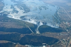 Zambezi River (Rivers)The Zambezi River, Africa's fourth largest after the Nile, Zaire and Niger rivers, exhibits a length of 2700 kilometers prior to discharge to the Indian Ocean in... More »
-
 Featured Article
 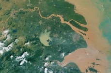 Yangtze River (Rivers)The Yangtze River, Asia's longest watercourse at about 6300 kilometers, has a basin that holds approximately one third of the population of China. The headwaters of the... More »
Recently Updated
 Lake Baikal Basin, Russian Federation Last Updated on 2015-09-15 16:56:57 Lake Baikal Basin (53°10'24.96 North, 107°39'45 East) is a World Heritage Site located in the Russian Federation. Situated in south central Siberia close to the Mongolian border, Lake Baikal is the oldest by 25 million years, and deepest, at 1637 metres (m), of the world's lakes. It is 3.15 million hectares (ha) in size and contains a fifth of the world's unfrozen surface freshwater. Its age and isolation and unusually fertile depths have given it the world's richest and most unusual lacustrine fauna which, like the Galapagos Islands, is of outstanding value to evolutionary science. The exceptional variety of endemic animals and plants make the lake one of the most biologically diverse on Earth. A pulp and cellulose mill on the southern shore, which has created water pollution of 200 square kilometres (km2) of the lake and generated some of the highest... More »
  Zambezian flooded grasslands Last Updated on 2015-06-01 15:56:03 WWF Terrestrial Ecoregions Collection Located within the miombo and mopane woodlands of the Central African Plateau, Zambezian flooded grasslands are an anomaly of productivity and abundance in a landscape characterized by nutrient deficientsoil and associated vegetation. Unlike the surrounding woodlands that generally support animals only in rather low densities, the wetlands and floodplains of this ecoregion provide habitats to sizable faunal populations, since food and water are abundant throughout the majority of the year. Large populations of waterbirds gather during the rainy season, and numerous herd animals and carnivores frequent the landscape. However, in a climate of rapid population growth and increasing need for land and natural resources, this fragile ecoregion may face increasing threat. Several conservation measures... More »
  Daugava River (Rivers) Last Updated on 2015-01-12 07:37:16 The Daugava River drains portions of the countries of Latvia, Belarus and Russia, prior to discharging to the Gulf of Riga. Also known as the West Dvina River, this watercourse is the fourth largest river discharging to the Baltic Sea catchment. This 1005 kilometer long river has suffered environmental damage from agricultural runoff and from hydroelectric dam construction, with major impacts dealt in the Soviet era of collective farming. In ancient history the Daugava estuary was a locus of prehistoric settlement, and later marked one of the eastern limits of the voyages of the Vikings. The lower Daugava valley (nearest the Gulf of Riga) was formed in relatively recent times, as glacial meltwater formed incision on the relatively level terrain near the Baltic Sea coast; these events occurred in the early Holocene, approximately 11,000 years before present. The relatively soft upper... More »
  Mississippi River (Rivers) Last Updated on 2014-11-29 22:15:22 The Mississippi River drains the largest river basin in North America, and is one of the major rivers of the world. The Mississippi River watershed is the fourth largest in the world, extending from the Allegheny Mountains in the east to the Rocky Mountains in the west. The watershed includes all or parts of 31 states and two Canadian provences. The watershed measures approximately 1.2 million square miles (3.1 million square kilometers), covering about 40% of the lower 48 states. The Mississippi drains most of the United States between the Appalachian Mountains in the east and the Rocky Mountains in the West. The mainstream of the Mississippi River has headwaters rising at Lake Itasca, Minnesota and flows approximately 2340 miles (3765 km). Though the longest part of the river includes the the Missouri River which flows approximately 2540 miles (4088 km) before joining the... More »
  Ecoregions of Oklahoma (EPA) Last Updated on 2014-06-28 15:53:00 (ftp://ftp.epa.gov/wed/ecoregions/ok/ok_front.pdf) Ecoregions denote areas of general similarity in ecosystems and in the type, quality, and quantity of environmental resources. They are designed to serve as a spatial framework for the research, assessment, management, and monitoring of ecosystems and ecosystem components. By recognizing the spatial differences in the capacities and potentials of ecosystems, ecoregions stratify the environment by its probable response to disturbance (Bryce, Omernik, and Larsen, 1999). Ecoregions are general purpose regions that are critical for structuring and implementing ecosystem management strategies across federal agencies, state agencies, and nongovernment organizations that are responsible for different types of resources in the same geographical areas (Omernik and others, 2000). A Roman numeral hierarchical scheme... More »