Pitcairn Islands
| Topics: |
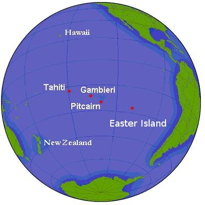
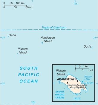
Countries and Regions of the World Collection  The Pitcairn Islands, with just 48 people (July 2011 est.) are in the South Pacific Ocean, about midway between Peru and New Zealand. The group includes the islands of Pitcairn, Henderson Island, Ducie, and Oeno.
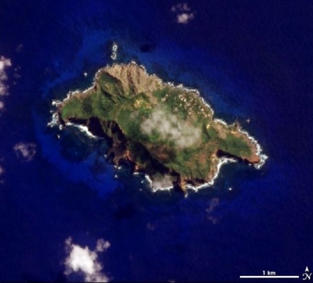
Ducie and Oeno are atolls. The pristine Henderson Island is a limestone plateau, raised 100 m or more above sea level by seismic activity below the Pacific Plate. Henderson Island has been above the sea surface for at least 380,000 years. Pitcairn Island is a volcanic high island, reaching 350 m.
It is Britain's most isolated dependency; only the larger island of Pitcairn is inhabited but it has no port or natural harbor. Therefore supplies must be transported by rowed longboat from larger ships stationed offshore.  Source: Wikimedia Commons
Its major environmental issues include deforestation (only a small portion of the original forest remains because of burning and clearing for settlement).
The inhabitants of this tiny isolated economy exist on fishing, subsistence farming, handicrafts, and postage stamps.
The fertile soil of the valleys produces a wide variety of fruits and vegetables, including citrus, sugarcane, watermelons, bananas, yams, and beans. Bartering is an important part of the economy.
The major sources of revenue are the sale of postage stamps to collectors and the sale of handicrafts to passing ships.
In October 2004, more than one-quarter of Pitcairn's small labor force was arrested, putting the economy in a bind, since their services were required as lighter crew to load or unload passing ships.
History
Henderson Island was occupied by Polynesians from 800 to 1600 but not since,
Pitcairn Island was discovered in 1767 by the British and settled in 1790 by the Bounty mutineers and their Tahitian companions. 
Pitcairn was the first Pacific island to become a British colony (in 1838) and today remains the last vestige of that empire in the South Pacific.
Outmigration, primarily to New Zealand, has thinned the population from a peak of 233 in 1937 to less than 50 today.
Ecology
Ecologically, the Pitcairn islands are included within the Tuamotu tropical moist forests ecoregion which is spread over 3,000 km2 of the Pacific Ocean, this ecoregion encompasses the 76 atolls and islands of Tuamotu, which stretch 1,800 kilometers (km) to the Gambier Islands and the Pitcairn Islands 1,000 km to the east.
In an incredibly small area, the Pitcairn and Henderson Islands support 5 endemic land birds.
Henderson Island provides a glimpse into what the forests of atoll and limestone islands would have once looked like throughout the Pacific. Its natural vegetation has been intact since the 1600s and Polynesian rat (Rattus exulans) is the only introduced species. As such, it supports an extremely large number of endemic species for an island its size. This includes 2 species of bird, 9 endemic land snails, and at least 450 arthropod species, including 50 endemics.
Henderson Island is also interesting because its ecosystem is simple. The endemic parrot, the Henderson lory (Vini stepheni), feeds largely on the nectar of two plant species, a degree of specialization unknown in nectarivorous birds elsewhere. The Henderson Island fruit-dove (Ptilinopus insularis) has a narrower fruit diet than all other Ptilinopus species so far studied, feeding on all 14 fruiting species available on the island and dispersing seeds of those plants.
Henderson Island has now been set aside as a World Heritage Site by United Nations Educational, Scientific and Cultural Organization (UNESCO). Conservation organizations are working with Pitcairn Islanders to establish a management plan that will protect the flora and fauna of Henderson, Oeno, and Ducie Islands from introduced species and unsustainable use.
In addition, some of Pitcairn’s 22 species of land snail and plant species occupy less than 1 hectare of habitat, and forest conservation and control of the invasive tree Syzygium jambos is important for the survival of both snail and plant species. Henderson, Oeno, and Ducie Islands together support more than 600,000 breeding petrels. It is hoped that Polynesian rats can be eradicated from Oeno Island to improve nesting success of breeding seabirds.
Location: Oceania, islands in the South Pacific Ocean, about midway between Peru and New Zealand
Geographic Coordinates: 25 04 S, 130 06 W
Dependency Status: overseas territory of the UK
Population: 48 (July 2012 est.)
Ethnic Groups: descendants of the Bounty mutineers and their Tahitian wives
Languages: English (official), Pitkern (mixture of an 18th century English dialect and a Tahitian dialect)
Area: 47 sq km
Coastline: 51 km
Maritime Claims:
territorial sea: 3 nm
exclusive economic zone: 200 nm
Natural Hazards: typhoons (especially November to March)
Terrain: rugged volcanic formation; rocky coastline with cliffs. The highest point is Big Ridge (347 m).
Climate: tropical; hot and humid; modified by southeast trade winds; rainy season (November to March)
Natural Resources: miro trees (used for handicrafts), fish. Note: manganese, iron, copper, gold, silver, and zinc have been discovered offshore.
Currency: New Zealand dollars (NZD)
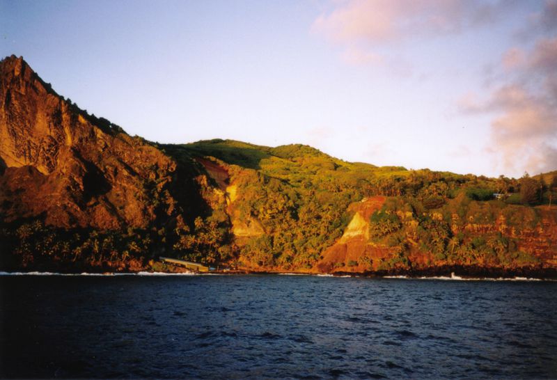
Bounty Bay, Pitcairn Island, at dawn. November 2000. Source: Wikimedia Commons.

