Old Woman Creek National Estuarine Research Reserve, Ohio
Contents
Introduction Old Woman Creek Reserve boundary map. (Source: NERRS (Old Woman Creek National Estuarine Research Reserve, Ohio) )
The Old Woman Creek National Estuarine Research Reserve is one of 27 National Estuarine Research Reserves established nationwide as living laboratories for long-term scientific research and estuarine education. The Reserve was designated in 1980 and is managed as a cooperative partnership between the Ohio Department of Natural Resources (ODNR) and the National Oceanic and Atmospheric Administration (NOAA). Old Woman Creek is also dedicated as an Ohio State Nature Preserve.
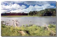
Located in Huron, Ohio on the south-central shore of Lake Erie, Old Woman Creek is one of Ohio’s few remaining examples of a natural estuary. As a transition zone between land and water, the site contains a variety of habitats including marshes and swamps, upland forests, open waters of the estuary, tributary streams, barrier beach and near-shore Lake Erie. The Reserve supports a diverse and important assemblage of native plants and animals representative of freshwater estuaries. Old Woman Creek estuary is of particular regional and national significance because it is the only National Estuarine Research Reserve on the Great Lakes and the only freshwater estuary in the National System.
The Reserve’s administrative offices are located in the Visitor/Research Center which overlooks the eastern shore of the estuary. The Center also provides laboratories for ecological research and serves as a focal point for public visitation and educational programs. Renovations to the Center, which were completed in 2003, have incorporated many environmentally-friendly building materials and construction techniques.
Flora
High plant species diversity encountered around the Great Lakes coastal wetlands such as Old Woman Creek is largely the result of wide seasonal and annual fluctuations in lake levels. Natural changing water levels over various substrates create habitats that support dynamic aquatic plant community structure.
The diversity of habitats present within the reserve contributes to a wide variety of plant communities, each comprised of a distinctive flora. Aquatic and wetland habitats include open water areas, mud flats, embayment marshes, shoreline and forested floodplain. The lower estuary is dominated by American lotus, sago pondweed, coontail and to a lesser extent white water lily. During and following high lake level periods, vegetation in this area can be sparse. Plants characteristic of the reserve's mud flats include cattail, marsh mallow, bur-reed and water smartweed.
Wetland species occurring along the shoreline include buttonbush, dogwood, blue flag, river bulrush, cattail and arrowhead. Flooded forest plain predominates in the southern portion of the reserve. Here, swamp forest species comprise the major component of vegetation, with a minor component of marsh species, as associates.
Terrestrial habitats within the reserve are represented largely by former agricultural fields in various stages of succession. On the steep banks surrounding the estuary on Star Island, oak-hickory forest predominates. Additional terrestrial habitat is provided by the dry portion of the barrier beach and the prairie area. Old field plant communities are composed primarily of successional species such as ragweed, asters, goldenrod, sumac, wild carrot and various grasses.
Upland forest areas are dominated by white oak and shagbark hickory, with sassafras as a major associate. Herbaceous associates of the forest communities include large-flowering trillium, mayapple, violets, troutlillies and other woodland spring species. Because of the exeric environment, few species thrive on the barrier beach. Among species characteristic of this habitat are Russian thistle, cocklebur, witchgrass, inland Sea Rocket and velvetleaf. Plants characteristic of the prairie area include big bluestem, Indian grass, whorled rosinweed, butterfly-weed, ladies'-tresses and bush clover.
Fauna
 (Source: NERRS)
 Mammals more commonly observed in the reserve include deer mice, deer, short-tail shrew, eastern chipmunk, little brown bat, red fox, fox squirrels, cottontail rabbits, eastern woodchuck, raccoon, opossum, muskrat and whitetail deer.
Old Woman Creek lies within a major route for bird migrations. The reserve serves as a way station for tired and hungry migratory birds. More than 200 species have been recorded in and around the estuary. Some common bird species are swallows, terns, eagles, ospreys, diving ducks and belted kingfishers, egrets, herons, meadowlarks, song sparrows, goldfinches, red-tailed hawks, great horned owls.
 (Source: NERRS)
 While little is currently known of the populations of reptiles and amphibians in the reserve, a brief study conducted during 1980 revealed the presence of several species, including slimy salamander, American toad, Fowler's toad, American bullfrog, snapping turtle, midland painted turtle, Blanding's turtle, map turtle, fox snake, northern water snake, Dekay's snake and the eastern garter snake (including the melanistic form.)
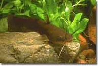
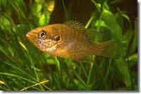
Test netting for fish species conducted by staff have identified more than 40 species in the reserve's lake and stream waters. Fish species have included adult northern pike, largemouth bass, brown and black bullhead, longnose gar, goldfish, carp, common shiner, black and white crappie, bluegill, sunfish, common shiner, Johnny darter, white sucker, creek chub, flathead minnow, stone roller and bluntnose minnow.
Endangered Species
The reserve's threatened federally-listed endangered species is the American bald eagle. Several state listed endangered species also occur within the reserve.
Tidal Range and River Flow
The lunar and solar tides are a very minor component in water level fluctuations on Lake Erie, as the tidal amplitude in Lake Erie is approximately 3 cm. However, wind- and/or pressure (Atmospheric pressure)-induced water setup can result in seiches that act very much like tides. These oscillations in lake level last about 12-14 hours. The amplitude of wind setup and the resulting seiches is normally less than 0.7 meters (m) in the Old Woman Creek area.
The Old Woman Creek estuary, like many of the Great Lakes estuaries, is a storm-driven system. Transient time of water through the estuary ranges from less than 24 hours upwards. During periods of low flow, a barrier sand beach will often close the mouth, isolating the estuary from Lake Erie proper. Water movement through the sand barrier beach is generally very limited.
The geological history of the area has resulted in Old Woman Creek having three different sections, each of which demonstrate different stream characteristics. The upper reaches of the creek flow through the till plain. Here, the creek has an average slope of 0.4 percent. The creek has a slope of 2.0 percent as it passes through the escarpment. Only in the escarpment, where the creek has excavated a deep channel, is bedrock exposed. The lower reaches of the creek meander through lake plain. Here the slope is 0.12 percent. Stream erosion is much greater here than in the upper till plain.
Soil Types
The till plain is predominantly Mahoning-Bogart-Haskins-Juntown Association of soils. This association is found in approximately 67% of the watershed. These soils are predominantly loams and silty loams. They are easily eroded. Approximately 70% of the land associated with this soil is used for cropland.
The lake plain soils are primarily Kibbie-Tuscola-Colwood Association. These soils cover approximately 21 percent of the watershed. These soils are fine sandy loams and silt loams and are easily eroded. Cropland is the dominant land use in the soil association.
The sediments in the estuary proper have been termed marsh soils. These soils contain a large amount of poorly compacted organic material (up to 50 percent dry weight.) Over the past 150 years, the organic content of he sediments has been reduced. This is primarily due to increased erosion rates in the watershed caused by greater agricultural activities in the watershed.
Geology
The bedrock underlying the Old Woman Creek watershed is composed of three different rock types, Ohio Shale, Bedford Shale and Berea Sandstone. Ohio Shale is the oldest formation, dating from the Devonian Period. Bedford Shale and then Berea Sandstone were both deposited during the Mississippian Period. Ohio Shale is the predominant bedrock formation under the lakes plain, while the other two formations are largely confined to the escarpment and till plain areas of the watershed. It is only where the Old Woman Creek has eroded down through the escarpment that bedrock can be seen.
Glaciers have covered northern Ohio several times during the Pleistocene Period. The final glacial retreat was approximately 14-15 thousand years ago. Following this retreat, various ice-dammed lakes were formed above present lake levels. The glacial till in the watershed appears to be either direct deposition from the ice shelf itself (till plain) or sedimentation in ice-dammed lakes (lake plain). The depth of glacial till deposition in the watershed is quite variable. The deepest deposits in the watershed are at the current mouth of Old Woman Creek. This appears to be the preglacial mouth of the Huron River. Here, glacial deposits are greater than 147 feet in depth.
Research
The research program at Old Woman Creek Reserve is directed toward determining the role of estuaries and other wetlands in the Great Lakes ecosystem. A second and equally important responsibility of the program is to develop a database that can be used to evaluate the subtle, long-range changes in the Lake Erie system.
Within the Old Woman Creek watershed, agriculture is the major land use; therefore, much of the research undertaken here has focused on the effectiveness of the estuary in lessening storm runoff from agricultural lands. Recent research has focused on the movement of sediments from farm fields into the creek, and finally into the estuary.
Other research projects are examining the function of the estuary in breaking down organic pollutants, particularly herbicides, before these pollutants move into Lake Erie. The recent marked decline in water levels in Lake Erie has also presented the research community with an opportunity to examine the impact of changing water levels on the coastal wetlands environment.
Cultural History
 (Source: NERRS)
 Archaeological evidence suggests that following the last phase of Wisconsonian glaciation, early Indians entered north-central Ohio and lived in the Old Woman Creek region. These people, referred to as Paleoindians, were probably nomadic hunters exploiting the last of the great herds of now extinct Pleistocene animals. Successive time periods found various Prehistoric Indian cultures undergoing a constant change in social and survival strategies. Information concerning these early peoples and later Indians is somewhat lacking prior to European chroniclers circa 1600 A.D.
The southern shores of Lake Erie were the domain of the Erie Indians early in the 17th century. An incident in which the Erie Indians captured a great Iroquois leader led to a war of revenge between the two nations. The Iroquois defeated their enemy, and by 1656 the entire Erie nation was destroyed. Huron Indians migrated into the western Lake Erie region in the late 1600s and became the dominant tribe for a time.
The Hurons remained here until circa 1700 when the New York Iroquois once again invaded Ohio and defeated them. It was at this time that the surviving Hurons journeyed to the Sandusky Bay region and became known as the Wyandotte, a word derived from their language meaning "in the islands." Remnants of the Wyandotte tribe were probably living in the vicinity when the first settlers arrived at Old Woman Creek.
Europeans first settled this area known as "The Firelands" around 1800. By 1850 agriculture had become the major land use practice in the Old Woman Creek watershed. Row crop agriculture presently remains the dominant land use in the watershed.
Partners and Supporters
Old Woman Creek is operated as both a National Estuarine Research Reserve and a State Nature Preserve by the Ohio Department of Natural Resources, Division of Natural Areas and Preserves. A 14-member advisory council provides advice and assistance to reserve staff, solicits support from other agencies for the reserve and serves as co-hosts for conferences and meetings.
Volunteers help operate the reserve's visitor center and provide staff support for educational programs and other public events. The Friends of Old Woman Creek, Inc., a nonprofit group, was founded in 1998 and provides financial support and assistance for reserve projects.
Further Reading
| Disclaimer: This article is taken wholly from, or contains information that was originally published by, the National Oceanic and Atmospheric Administration. Topic editors and authors for the Encyclopedia of Earth may have edited its content or added new information. The use of information from the National Oceanic and Atmospheric Administration should not be construed as support for or endorsement by that organization for any new information added by EoE personnel, or for any editing of the original content. |