Geography of Malaysia
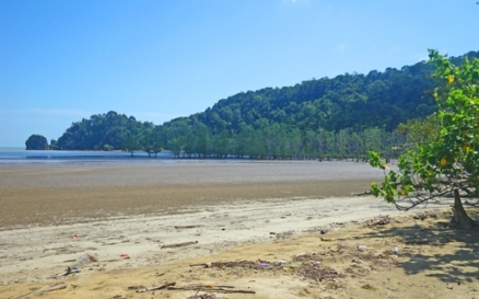
Flooded mangroves with dipterocarp forest beyond, Bako National Park. @ C.Michael Hogan
The geography of Malaysia deals with the physical and human geography of Malaysia, a country located in Southeast Asia. There are two distinct parts to this country being Peninsular Malaysia to the west and East Malaysia to the east. Peninsular Malaysia is located south of Thailand, north of Singapore and east of the Indonesian island of Sumatra. East Malaysia is located on the island of Borneo and shares common borders with Brunei and Indonesia.
Malaysia is located in Southeast Asia, and it is the sole nation to have part of its landmass on the Asian continent and part within the Malay Archipelago . Most of its land area is contained in two noncontiguous regions separated by about 530 kilometres of the South China Sea. One region is Peninsular Malaysia, which is bordered by Thailand to the north, the Strait of Malacca to the west, the Johore Strait to the south, and the South China Sea to the east. The other region, sometimes called East Malaysia, is the northern portion of the island of Borneo that is composed of two states, Sabah and Sarawak. The Kingdom of Brunei and the Indonesian territory of Kalimantan make up the rest of Borneo. Malaysia also encompasses many small islands, the largest of which is Labuan, off the coast of Sabah.
Contents
Extent
Malaysia’s total land area is 329,758 square kilometers: 131,598 square kilometres in Peninsular Malaysia and 198,160 square kilometers in Sabah and Sarawak.
Land Boundaries
Malaysia’s land boundaries total 2669 kilometres. There is one land boundary on the peninsula, a 506 kilometre border with Thailand. On Borneo, Malaysia has a 381 kilometre long border with Brunei and a 1782 kilometre border with Indonesia.
Disputed Territory
Malaysia has several territorial disputes with other countries, but none have resulted in military conflict. Malaysia disputes sovereignty over the possibly oil-rich Spratly Islands with Brunei, China, the Philippines, Taiwan, and Vietnam. The Philippines previously claimed the state of Sabah, and Indonesia has disputed Malaysia’s incorporation of Sarawak. However, both claims appear dormant. Indonesia and the Philippines claim the Ligitan and Sipadan Islands, which the International Court of Justice (ICJ) awarded to Malaysia in 2002. However, the ICJ left those islands’ maritime boundaries in the hydrocarbon-rich Celebes/Sulawesi Sea unsettled, and thus the countries still have overlapping claims to petroleum resources located in the seabed. Brunei and Malaysia both claim offshore seabeds, so the dispute has terminated gas and oil exploration in the area. Finally, Malaysia has disputed Singapore’s land reclamation, bridge construction, maritime boundaries, and claim to Pedra Branca Island (Pulau Batu Putih), approximately 15 kilometers off the southern coast of the state of Johor. However, in 1998 the two countries agreed to future ICJ arbitration on the island dispute, and observers expect the case will be heard in 2007.
Length of Coastline
Malaysia’s total coastline is 4675 kilometres in length: 2068 kilometres for Peninsular Malaysia and 2607 kilometres for East Malaysia.
Topography
The topography of Peninsular Malaysia, Sabah, and Sarawak is generally coastal plains with hills and mountains in the interior. Malaysia’s lowest elevation is sea level along the coasts, and the highest is Gunung Kinabalu in northern Sabah at 4100 meters. In the year 2005, forests covered approximately 64 percent of the country’s total land area.
Climate
Malaysia lies entirely within the equatorial zone. The climate is governed by a regime of the northeast and southwest monsoons. The northeast monsoon blows from October to March, and is responsible for produces intense rains which pound the east coast of the peninsula and frequently cause widespread floods. It also causes the wettest season in Sabah and Sarawak. The southwest monsoon period occurs between May and September, and is a drier period for the whole country. The period between these two monsoons is marked by heavy rainfall.
References
- Eric D. Wikramanayake. 2002. Terrestrial ecoregions of the Indo-Pacific: a conservation assessment. Island Press. 643 pages