List of Maps and Charts
The South Pole: List of Maps and Charts
Return to Table of Contents of The South Pole: An Account of the Norwegian Antarctic Expedition in the "Fram"
Chart of the Immediate Surroundings of the South Pole 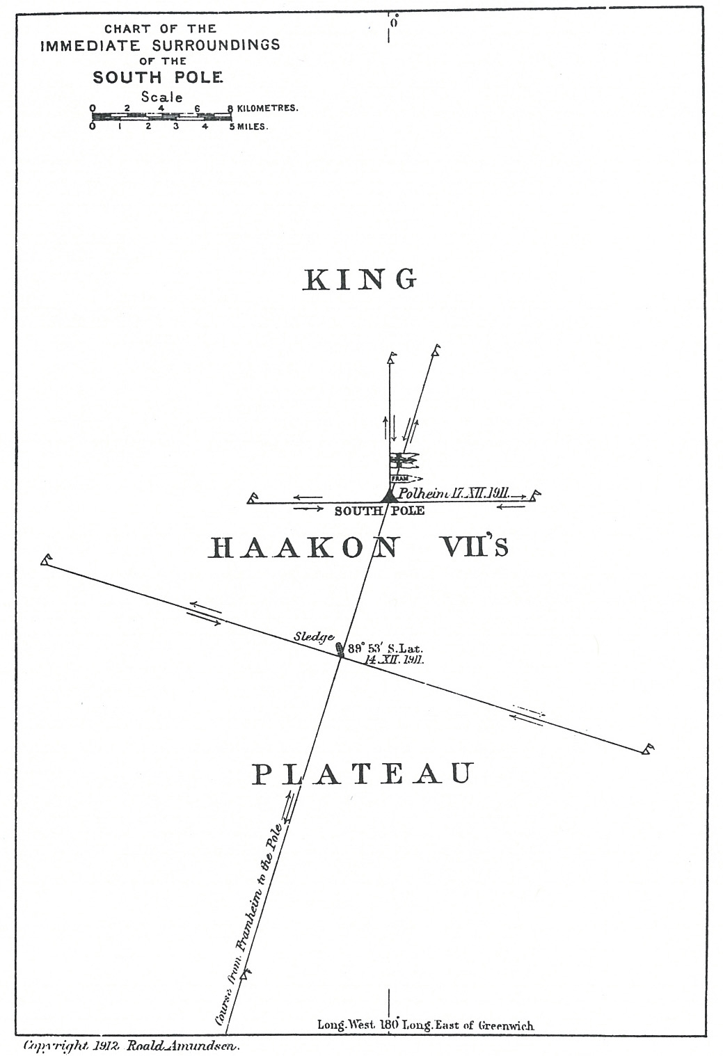
1. Hypothetical Representation of the Surface Currents in the Northern Atlantic in April 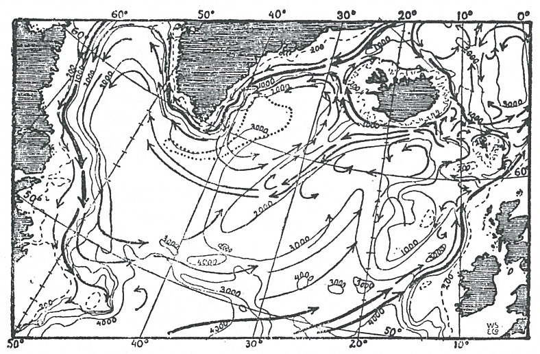
2. The "Fram's" Route from June 20 To July 7, 1910 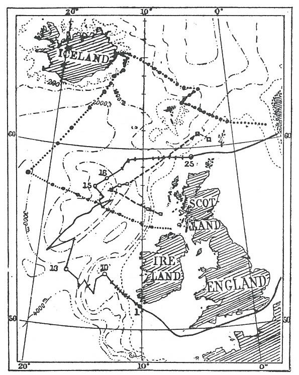
3. Temperature and Salinity in the "Fram's" Southern Section, June, 1910 
4. Temperature and Salinity in the "Fram's" Northern Section, July, 1910 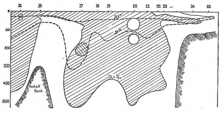
5. The "Fram's" Stations in the South Atlantic (June -- August, 1911) 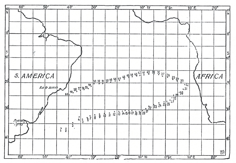
6. Currents in the South Atlantic (June -- August, 1911) 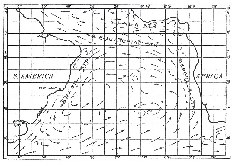
7. Salinities and Temperatures at the Surface in the South Atlantic (June -- August, 1911) 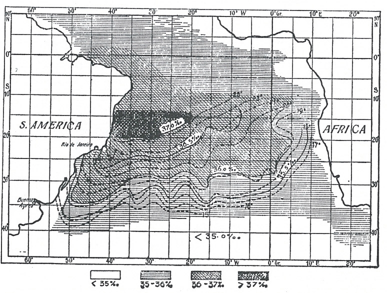
8. Temperatures (Centigrade) at a Depth of 400 Metres (218 Fathoms) 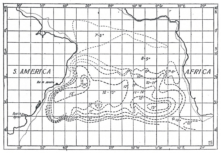
9. Temperatures at Station 32 (In the Benguela Current, July 22, 1911), and at Station 60 (In the Brazil Current, August 19, 1911) 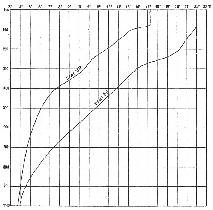
10. Salinities at Station 32 (In the Benguela Current, July 22, 1911), and at Station 60 (In the Brazil Current, August 19, 1911) 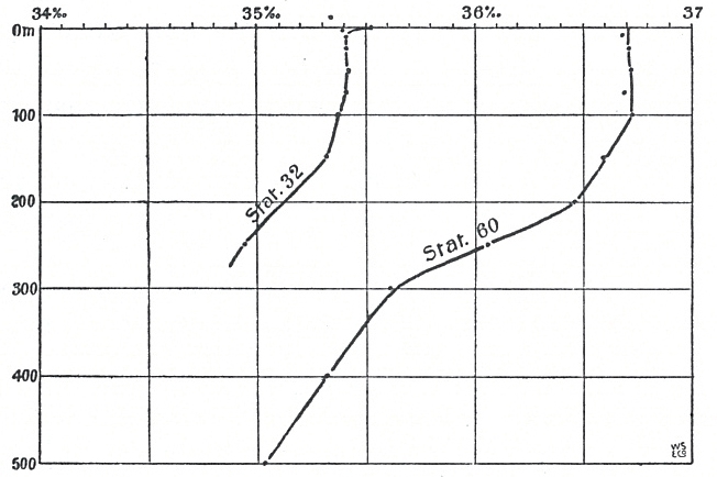
11. Salinities and Temperatures in the Southern Section (June -- July, 1911)
12. Salinities and Temperatures in the Northern Section (July -- August, 1911) 
13. Temperatures at one of the "Fram's" and one of the "Challenger's" Stations, to the South of the South Equatorial Current 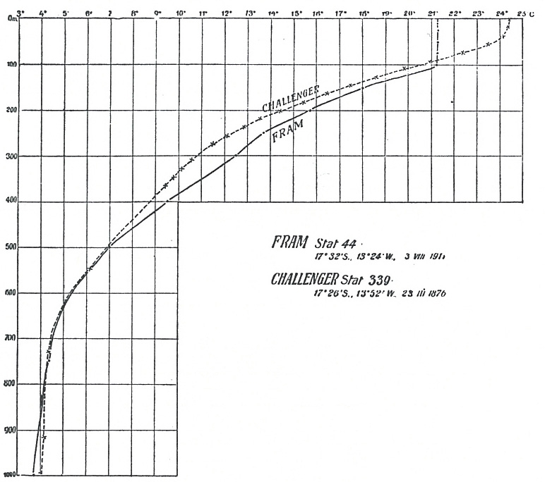
14. Temperatures at one of the "Fram's" and one of the "Valdivia's" Stations, in the Benguela Current 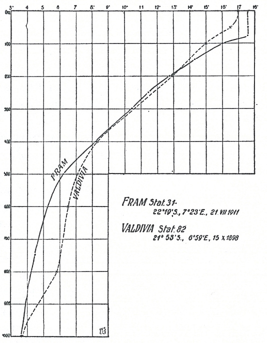
15. Temperatures at the "Planet's" Station 25, And the "Fram's" Station 39 -- Both in the Neighbourhood of St. Helena
16. Salinities at the "Planet's" Station 25 (March 19, 1906), and the "Fram's" Station 39 (July 29, 1911) 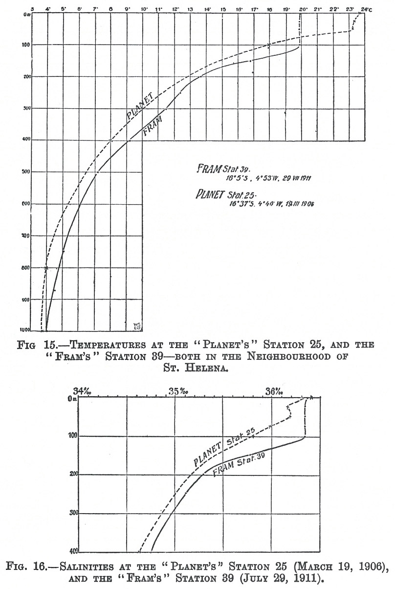
|
|



0 Comments