Environmental Archaeology (Society & Environment)
Environmental Archaeology
Environmental archaeology is the study of early civilizations using techniques of biological markers that are intrinsic to the layer of human prehistory under investigation. Our understanding of ancient man is enhanced by concurrent study of pollen cores, plant and animal remains, fossil records; even abiotic evidence such as sediment layering, changes in river meanders, ocean levels, salinity records and other inanimate data provide great context to life in earlier times.
The environmental data can not only provide insights as to the time horizons of early civilizations, but also gives direct insights to the lifestyles of those who came before us; namely the dietary habits, proximity to water supplies, wood and clay used in primitive structures are all elucidated by collecting data on environmental features that pertain to the earlier time period.
Examples of archaeological conclusions that can be derived from certain environmental data include: intensity of resource exploitation; population levels and density; nature of society organization; division of labor. Conversely the joint study of conventional archaeological excavation combined with environmental data collection yields important information that is useful to researchers who are concentrating on historical ecology, since the data can be reduced to yield insights as to distributional range of plants and animals relative to human populations; in addition, insights are provided regarding methods of harvesting plants and animals in the prehistoric landscape, that abet our understanding of the time change of species numbers and the influence of man on extinction processes.
-
 Featured Article
  Economy of Ancient GreeceThe economy of ancient Greece is somewhat of an enigma. Given the remoteness of ancient Greek civilization, the evidence is minimal and difficulties of interpretation abound.... More »
-
 Featured Article
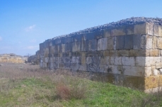
  Histria (Environmental Archaeology)Situated near the Black Sea in the Dobrogea region, Histria is the oldest town in present day Romania, With clear Neolithic roots, the first substantial... More »
-
 Featured Article
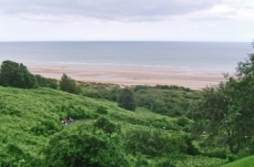
  English Channel (Environmental Archaeology)The English Channel is that saline water body that connects the North Sea to the Celtic Sea. It is bounded on the north by England and on the south by France. This water body... More »
 Big Bend National Park, United States Last Updated on 2014-10-19 16:55:59 Big Bend National Park is one of the two National Parks located in the state of Texas, in the USA. Big Bend National Park is located in the Big Bend region along the border of Texas and Mexico where the Rio Grande bends toward the Gulf of Mexico. Because the park contains a variety of habitat types including mountains, deserts, and riparian habitats, the park is home to a diverse flora and fauna. Visitors arrive at Big Bend National Park to hike, camp, watch wildlife, and experience the river by rafting or canoeing. Big Bend National Park is located in the big bend of the Rio Grande along more than 161 kilomters (100 miles) of the Texas-Chihuahua-Coahuila border southeast of El Paso, Texas in Brewster County, Texas. It includes a large portion of the Chihuahuan Desert as well as the Chisos Mountains on the Texas side of the Rio Grande’s expansive steep canyons. In 1933,... More »
  Miguasha National Park, Quebec, Canada Last Updated on 2014-06-20 14:56:50 Miguasha National Park is a paleontological site on the southern coast of the Gaspé peninsula in southeastern Québec, Canada, is considered the most outstanding fossil site in the world for its picture of the Devonian Period Age of Fishes. The Upper Devonian Escuminac Formation there, dating from 370 million years ago, contains five of the six fossil fish groups known from the period and the highest number and best-preserved fossils of the lobe-finned fishes that gave rise to the first four-legged, air-breathing terrestrial vertebrates, the tetrapods. Miguasha National Park (Parc National de Miguasha) was inscribed on the World Heritage List under Natural criterion viii. in the year 1999. Its IUCN Management Category is designated as a National Park. Canadian Taiga (1.2.3) On the southern coast of the Gaspé peninsula in southeastern... More »
  Black Sea (Environmental Archaeology) Last Updated on 2013-09-21 16:00:44 The Black Sea is a Mediterranean sea, centered at approximately 35o E and 44o N; it is considered the world’s largest inland water basin, although technically it is connected to the world's oceans via the Bosporus and the Dardanelles. It has a surface area of about 461,000 km2 and a volume of 537,000 km3 with a mean depth of around 1200 to 1300 metres (m), although depths greater than 2000 m are common in the central basin. The western part of the Black Sea is a wide shelf that gradually narrows to the south and breaks at around 100-150 m. In the rest of the basin the shelf doesn’t exceed 10 to 15 kilometres in width. It is connected to the Sea of Marmara via the narrow (760 m wide) and shallow (27.5 m maximum depth) Bosporus Straits, and further connects to the Mediterranean Sea via the long and narrow Dardanelles. It is also connected to the Sea of Azov to... More »
  Labrador Innu land claims and the indigenous archaeology paradox Last Updated on 2013-09-05 13:58:35 Though several indigenous groups within Canada and North America have historically been exploited during the land claims process, the lack of treaties, the discovery of myriad natural resources, the hydroelectric potential, and the superimposition of provincial boundaries upon “traditional” territory have left the Innu of Interior Labrador (Nitassinan) in a uniquely challenging situation, both with regards to land claims and maintaining their autonomy. In recent years, the Innu of Nitassinan have initiated archaeological research to document sites important to their cultural heritage before they are destroyed in industrial development projects, to provide long standing evidence of land tenure to aide in land claim struggles, and even in what could be deemed “life projects” to help educate their youth. Arguably, such projects were instrumental in bridging the gap... More »
  Anthropocene (Environmental Archaeology) Last Updated on 2013-09-03 12:23:40 The Anthropocene defines Earth's most recent geologic time period as being human-influenced, or anthropogenic, based on overwhelming global evidence that atmospheric, geologic, hydrologic, biospheric and other earth system processes are now altered by humans. The word combines the root "anthropo", meaning "human" with the root "-cene", the standard suffix for "epoch" in geologic time. The Anthropocene is distinguished as a new period either after or within the Holocene, the current epoch, which began approximately 10,000 years ago (about 8000 BC) with the end of the last glacial period. Anthropocene is a new term, proposed in 2000 by Nobel Prize winning scientist Paul Crutzen. A similar term, Anthrocene, was coined by Andrew Revkin in his 1992 book Global Warming: Understanding the Forecast, but was not adopted by scientists.... More »