Cauca Valley dry forests
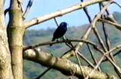
Cauca River Valley, Valle, Columbia Photograph by Carl Downing
A narrow strip of dry forest is situate in a dry valley of the Cauca River in northwestern Colombia, this ecoregion is one of the most degraded in area. Little is left of the natural vegetation in the valley due to agricultural expansion and urban development. There are many endemics within this region that desperately need protection in order to avoid extinction.
Location and General Description
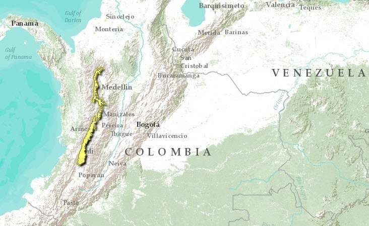
This dry inter-Andean valley is located between the West and Central Andes in Colombia. This ecoregion consists of a narrow, elongate, north-south strip of dry forest habitat along the Cauca River in the Valley and Risaralda departments.
This Andean valley ranges from 200 to 1700 meters above sea level (masl). There are various vegetation formations including open woodland, dry forest, riparian forest, arid scrub and wetland s.
The vegetation in this ecoregion was historically deciduous dry forest, mixed with evergreen dry forest and arid scrubland, with a gallery forest along the Cauca River. On either side of the valley, the dry forests give way to moist montane forest along the slopes of the central and west Andes. More specific information about the native flora in this ecoregion is not available. The entire ecoregion has been severely altered by human activities, principally agriculture. The secondary vegetation in the area includes Cecropia, Cestrum, Crton, Inga, Isertia, Trema, and Vismia ).
Biodiversity Features
Endemic birds found in the El Cauca valley may also be found in other [[ecoregion]s]. The white-chested swift (Cypseloides lemosi, classified vulnerable) inhabits secondary forest, grassland, scrub and rocky areas in the Cauca valley. The greyish piculet (Picumnus granadensis) and apical flycatcher (Myiarchus apicalis) are found in tropical deciduous and secondary forest, tropical lowland evergreen forest edge, and scrub. These three species are adapted to scrub and secondary growth, so their numbers have not declined, with the exception of Cypseloides lemosi, a species apparently threatened by agrochemical applications in the region.
Current Status
Almost the entire ecoregion has been converted to agricultural land. Remaining unprotected areas of the original vegetation are few and small.
The Sonso Lagoon Reserve is the only protected area located in an ancient oxbow of the Cauca River. The reserve consists of wetlands and forests, and has an area of 2,050 hectares (IUCN category IV). The species found in the reserve are representative of wetlands and gallery forests. There are no protected areas in the dry forests.
Types and Severity of Threats
- Extensive habitat loss due to agriculture
- Urban development. The ecoregion contains the city of Cali, and a number of other cities and towns that line the Cauca valley and river.
- Unknown effects of agrochemical applications on the Cypseloide lemosi population.
Justification of Ecoregion Delineation
This narrow dry inter-Andean valley has long since been degraded by human activity. Linework for the ecoregion follows an elevational contour (1000 m) around the valley of the upper Cauca River which is distinct floristically and faunistically from the montane forests which encompass it. This is a coarse boundary, as current vegetation does not reflect historic distributions of dry forest, although reference was made to historic coverage (Instituto Geográfico "Agustín Codazzi" 1976, Instituto Geografico "Agustin Codazzi" 1985). The northern delineation was made at the approximate location along the valley where the dry forests species association grade to moist forest association. Current vegetation coverage’s were also considered. Linework was reviewed and modified at an ecoregion priority setting workshop.
Further Reading
- Complejo Ecoregional de los Andes del Norte (CEAN). Experts and ecoregional priority setting workshop. Bogota, Colombia, 24-26, July, 2000.
- Instituto Geográfico "Agustin Codazzi". 1976. Mapa ecológico de la República de Colombia. Ministerio de Hacienda y Crédito Público. Bogotá, Colombia.
- Instituto Geografico "Agustin Codazzi". 1985. Mapa de bosques . Bogotá, Colombia.
- Navarro, A.E.S., G.H. Peña, F.C. Lemus, J.R. Baquero, R.F. Soto. 1984. Bosques de Colombia. IGAC-INDERENA-CONIF, Bogota, Colombia.
- Stattersfield, A.J., M.J. Crosby, A.J. Long and D.C. Wege. 1998. Endemic Bird Areas of the World: Priorities for Biodiversity Conservation. Birdlife Conservation. Series No. 7., Birdlife International, Cambridge, UK.
- UNESCO. 1981. Vegetation Map of South America: Explanatory notes. UNESCO, Paris.
| Disclaimer: This article is taken wholly from, or contains information that was originally published by, the World Wildlife Fund. Topic editors and authors for the Encyclopedia of Earth may have edited its content or added new information. The use of information from the World Wildlife Fund should not be construed as support for or endorsement by that organization for any new information added by EoE personnel, or for any editing of the original content. |