Cape Crozier (Geography)
From The Encyclopedia of Earth
Environmental History (main)
Cape Crozier
February 1, 2009, 12:00 am
November 1, 2011, 9:18 am
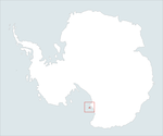
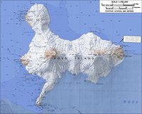
Cape Crozier in Antarctica was discovered by a British expedition under Admiral Sir James Clark Ross, and named for Commander Francis R.M. Crozier, captain of the ship Terror, one of the two vessels of the Ross expedition. The Cape Crozier headland forms theeastern extremity of Ross Island.
| This article is written at a definitional level only. Authors wishing to improve this entry are inivited to expand the present treatment, which additions will be peer reviewed prior to publication of any expansion. |
|
Latitude: |
773100S |
|
Longitude: |
1692400E |
References
- USGS Geographical Names Information System

