Brazilian Atlantic Islands, Brazil
| Topics: |
Contents
- 1 IntroductionBrazilian Atlantic Islands ( 03° 45' to 03° 57' S and 32° 19' to 32° 41'W and 03° 30' to 04° 30' S and 32° 00' to 34° 00' W) is a World Heritage Site located in the Atlantic Ocean. (Brazilian Atlantic Islands, Brazil)
- 2 Geographical Location
- 3 Date and History of Establishment
- 4 Area
- 5 Land Tenure
- 6 Altitude
- 7 Physical Features
- 8 Climate
- 9 Vegetation
- 10 Fauna
- 11 Cultural Heritage
- 12 Local Human Population
- 13 Visitors and Visitor Facilities
- 14 Scientific Research and Facilities
- 15 Conservation Value
- 16 Conservation Management
- 17 IUCN Management Category
- 18 Further Reading
IntroductionBrazilian Atlantic Islands ( 03° 45' to 03° 57' S and 32° 19' to 32° 41'W and 03° 30' to 04° 30' S and 32° 00' to 34° 00' W) is a World Heritage Site located in the Atlantic Ocean. (Brazilian Atlantic Islands, Brazil)
Geographical Location
The nominated World Heritage site is identical to that of the existing Fernando de Noronha Island National Marine Park and covers the majority of the main island, excluding the central section of the north coast. It also includes the majority of smaller offshore islands and islets. These islands are located in the Atlantic Ocean some 345 kilometers (km) north-west from Cabo de São Roque in the state of Rio Grande do Norte. Approximate co-ordinates 03° 45' to 03° 57' S and 32° 19' to 32° 41'W. The Atoll das Rocas lies 145 km to the west at 03° 30' to 04° 30' S and 32° 00' to 34° 00' W.
Date and History of Establishment
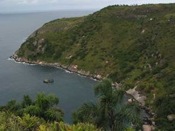
 Brazilian Atlantic Islands, Brazil. (Source: Department of Ecology and Evolutionary Biology at Cornell University)
 Part of the area was first designated as an Environmental Protection Area in 1986 through Federal Decree no. 92.755. The Marine National Park was created in 1988 through Federal Decree no. 96.693. The Archipelago was reincorporated into the State of Pernambuco in 1988, and in 1989 State Decree no 13555 declared the entire Archipelago and surrounding waters as an Environmental Protection Area (Área de Proteção Ambiental). This latter legislation forms the basis for the definition of a buffer zone around the Marine National Park.
The Rocas Atoll was established as a National Biological Reserve in 1978.
Area
The National Marine Park of Fernando de Noronha covers some 11,270 hectares (ha), of which 85% is marine. The land area incorporates some 70% of the total land area of the archipelago. The Biological Marine Reserve of Rocas Atoll covers 42,270 hectares (ha). In addition there is a proposed buffer zone encircling each entire site and encompasses all remaining terrestrial areas, following the contour of the 2,000 meter (m) isobath and totalling 140,713 (ha).
Land Tenure
The Federative Republic of Brazil is the sole owner of both nominated areas, including the proposed buffer zones.
Altitude
From sea level to 323 [[meter]s] (m) (Morro do Pico)
Physical Features
The Fernando de Noronha Archipelago and Rocas Atoll represents the peaks of a large submarine mountain system of volcanic origin which rises up from the ocean floor some 4,000 m depth. In this respect it may be compared to other Atlantic volcanic islands, including the rocks of São Pedro and São Paulo, as well as the UK administered Ascension Island. The origin of the Fernando de Noronha volcano has been estimated between 1.8 and 12.3 million years. There are a number of volcanic rocks, including pyroclastic deposits of tufa and breccia, lavas and also a number of intrusive formations including volcanic plugs, dykes and domes. Lavas dominate on narrow plateaux on the eastern and western side of the main island, while the central plateau is cut into tufa. Over this basic structure harder intrusions have remained and now form distinctive peaks such as Morro do Pico. In addition to volcanic structures there are a number of more recent sedimentary deposits, including the calcareous plateau which predominates on the island of Meio in the north-east. The coastline is complex, with a number of high cliffs, but also 16 sandy beaches. The north-west facing shores are relatively calm, while the south-east shores face the predominant currents and winds and are largely rocky shores with significant wave action.
The Rocas Atoll is a reef formation on a submarine mountain rock substrate, with an area of some 7.5 sq. kilometers (km). During high tide only two sandy islands with a maximum height of 3 [[meter]s] (m) above sea-level (asl) and some isolated calcareous formations, the "rocas", stand above water. Farol Island, the larger of the two, has a stretched "S" form, with approximately 1,000 [[meter]s] (m) in length and 200 [[meter]s] (m) average width. During low tide the reef ring of the atoll is exposed, consisting of a natural wall some 1.5 m high and bordered by sandbanks. Inside the atoll is a large lagoon with shallows and pools 1 to 5 m deep.
Climate
The climate is tropical, with a rainy season from January to August, and a dry season for the rest of the year. An average of 731.5 millimeters (mm) of rain fall annually, with the heaviest rains between March and July, sometimes reaching 190 mm in 24 hours. October is the driest month. The average temperatures vary from 23.5ºC to 31.5ºC. The hottest months are January, February and March. The relative humidity varies little from 81.5%, while average annual sunshine is 3.215 hours per day, with a maximum in November and a minimum in April.
Vegetation
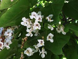
 Biononiaceae, Brazil. (Source: Ozarks Regional Herbarium, Missouri State University Department of Biology)
 The original vegetation of the Fernando de Noronha islands has clear affinities with the highly threatened Atlantic Rainforest, but with considerably reduced diversity and some endemism, as might be expected from its isolation. It has been termed Insular Atlantic Rainforest, but only 5% of the original cover of this forest remains, in the region near the Sapata headland. A small area of some 1.5 hectares (ha) of mangroves occurs, this is the only oceanic mangrove community in the south Atlantic, and consists of a monospecific stand of Laguncularia racemosa. In all over 400 plant species have been recorded, including 3 endemic species: the gameleira Ficus noronhae, the mulungo Erythina velutina and the burra leiteira Apium escleratium.
The islands are now largely dominated by shrubby and grassy vegetation, with a few trees, principally represented by the Nyctaginaceae, Bignoniaceae, Anacardiaceae, Rubiaceae and Euphorbiaceae. There are also a great number of introduced species. These include the jitiranas Ipomea spp. and Merremia spp., which are harmful climbing vines. Introduced fruit trees include papaya, cashew, banana, tamarind, caja, and guava, while other ornamental species include almond, the royal poinciana, eucalyptus, and even coconut palms.
Rocas Atoll has a sense island vegetation which is herbaceous and salt resistant and predominant species include Portulaca oleracea (Portulacaceae), Sesuvium portulacastrum (Aizoaceae), Cyperus ligularis (Cyperaceae), and Eragrrostris prolifera (Poaceae). A few individuals of Coconuts (Cocos mucifera) and casuarinas (Casuarina equisetifolia) introduced by fishermen exist.
Fauna
The Fernando de Noronha islands have important bird communities, including terrestrial and marine species. They are also visited by large numbers of migratory species. Six terrestrial birds are found of which three are endemic: the Noronho vireo, or sebito Vireo gracilirostris (VU D2), the cucurata Elaenia spectabilis ridleyana, and the arribaçã Zenaida auriculata noronha. One other endemic species, the saracura, has never been scientifically described and is now extinct.
For seabirds some of the largest colonies of tropical Atlantic seabirds are found on the Fernando de Noronha islands, with large numbers species including the black noddy or Anous minutis, the brown noddy Anous stolidus, the sooty tern Sterna fuscata, the fairy tern Gygis alba, the masked booby Sula dactylatra, the brown booby Sula leucogaster, the red footed booby Sula sula; the magnificent frigatebird Fragata magnificans and the red-billed tropicbird Phaethon aethereus. The Rocas Atoll hosts more than 150,000 seabirds, including the largest South Atlantic colonies of sooty terns, brown noddies and masked boobies Sula dactylatra.
The Fernando de Noronha islands have two endemic species of reptile, the mabuia Mabuya maculata and the two headed snake Amphisbaena ridleyana.
The marine environment off these islands is of particular interest. Two species of marine turtles are common in the nearshore waters, the green turtle Chelonia mydas (EN A1abd), and the hawksbill turtle Eretmochelys imbricata (CR A1abd+2bcd ). The former of these breeds in the islands. A resident population of the spinner dolphin Stenella longirostris (LR/cd), numbering up to 1,200 individuals occur in the surrounding waters, and many other cetaceans are regular visitors to the islands.
Benthic communities are largely thin veneers which have grown over the volcanic substrate. Reef-building corals are widespread, however reef structures are not recorded in the Fernando de Noronha islands. Although Brazilian reefs lack the diversity of the Caribbean reefs they are of considerable biogeographical interest, and include a number of endemic species. Some 15 reef-building corals have been recorded from Brazil, including six species endemic to the region. Some 95 fish species have been recorded including Thalassoma noronhum and Stegastes rocasensis which are described as endemic. Pelagic species are also widespread as a result of the proximity to deep oceanic waters around the islands. The lemon shark (Negaprion brevirostris) breeds around Rocas Atoll.
Cultural Heritage
Originally uninhabited, the first maps (1502) marking the islands named them as the "Ilha da Quaresma" (Isle of Lent). From this it was supposed that knowledge of the existence of the islands dated from the Portuguese expeditions which passed near them during Lent in 1500, 1501, or 1502. It has been suggested that another expedition to Brazil in 1502-1503, under the command of Fernao de Loronha, also visited the islands, but it is known for certain that the islands were given to the same Fernao de Loronha in a hereditary land grant in 1504, which would account for their present name. The islands were variously invaded by the English (1534), French (1556 until 1612), and Dutch (1628). In 1646, the Dutch built a small fort on the high ground at the site of the later Forte de Nossa Senhora dos Remedios (Fort of Our Lady of Medicines).
In 1700, the Capitania of Fernando de Noronha reverted to the Portuguese crown and became part of the Capitania of Pernambuco, however the island was uninhabited and so, in 1736, the French East Indies Company took the island and renamed it Isle Dauphine. In 1737, at the order of Governor Henrique Luis Pereira Freire, a French force occupied the islands and constructed the forts of Nossa Senhora dos Remedios, Nossa Senhora de Conceicao and Santo Antonio.
The church of N. S. dos Remedios, a landmark of the repopulation of the island, was completed in 1772. From around this time, the first prisoners were sent to the island, and it is suggested that much of the vegetation clearance which occurred may have been prompted by efforts to prevent escapes and to eliminate hiding places. Its use as both a defensive outpost and a prison island continued until the early 20th century.
A number of sites are found within the park and the buffer zone which carry an important record of the history of the island. The Nossa Senhora dos Remédios Church was completely restored in 1988. There are also Fort Ruins also remain at Capela da Quixaba, a former building for holding troublesome prisoners. São Miguel Palace, formerly the administration centre of the penitentiary, now forms the administrative headquarters of the State District of Fernando de Noronha.
The uninhabited Rocas Atoll was first charted in the 16th century map of Cantino, with the first detailed chart done in 1852 by Capt. Lieutenant Phillip Lee.
Local Human Population
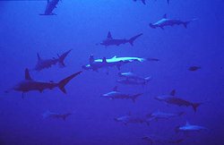
 Lemon shark, Brazil. (Source: The Florida Museum of Natural History)
 None within the Park. Some 2,100 inhabitants are found on the non-park area of the islands, within the buffer zone. Small-scale agricultural activities also take place outside the park boundaries.
Visitors and Visitor Facilities
Tourism is an important economic activity on the islands, and there are daily flights from Recife and Natal. There are 70 small hotels on the island, totalling 1,000 beds. However visitor numbers into the park are strictly controlled (sources cite between 120 and 770 at any one time, or approximately 15,000 per year). Visitors are required to pay an environmental tax, levied daily, which is paid to the State, to limit the number and length of stay of visitors. The National Park has a visitors centre with environmental education talks are given several evenings a week at the park headquarters. Five flights arrive daily, as well as cruise ships. Only scientific research expeditions are permitted to Rocas Atoll.
Scientific Research and Facilities
Scientific research is regularly conducted on the islands and Rocas Atoll, particularly looking at the spinner dolphin and marine turtle populations. Project TAMAR (Tartarugas marinhas - sea turtles) has fixed a base between the Sueste Bay and the Leão Beach which are the main nesting beaches for the green turtle. On Rocas Atoll regular studies have been conducted since 1990 on migratory and resident seabirds, as well as fish, crustaceans and benthonic organisms.
Conservation Value
The site is of interest for a number of reasons. Although limited in number there are a few examples of endemic species. The vegetation of the island is largely degraded however there are remnants of an otherwise unique vegetation community, the Insular Atlantic Rainforest. It seems likely that the offshore benthic communities may harbour some of the best examples (alongside the Atoll das Rocas) of the unique Brazilian coral reef fauna in existence, although there is insufficient information to clearly judge this. The Fernando de Noronha islands are important in harbouring a large population of spinner dolphins. Rocas Atoll is the only atoll in the South Atlantic and is important for its reef formations and large colonies of breeding seabirds.
Conservation Management
The Fernando de Noronha Island National Marine Park and the Biological Marine Reserve of Rocas Atoll are administered by IBAMA (Instituto Brasileiro do Meio Ambiente e dos Recursos Naturais Renováveis-Brazilian Institute of the Environment and Renewable Natural Resources). The Environmental Protection Area also falls under IBAMA's supervision. A management plan was prepared by FUNATURA in 1990 for Fernando de Noronha Island National Marine Park. An Implementation Plan has been developed by IBAMA for the Rocas Atoll, which guides its management and conservation.
Management Constraints
Environmental degradation of Fernando de Noronha island has a long history. During the period that the island functioned as a penitentiary the trees were systematically cut, and only 5% of the original forest remains. Introduced species are a particular problem. As on so many islands, rats have been introduced and decimated bird populations. Goats are widespread through the island and have severe impacts on the native vegetation. The teju lizard Tupinambis teguxim, was introduced to feed on the rats, but prefers other prey such as the eggs and young of birds and turtles. The introduced 'jitirana' plants Ipomea sp. and Merremia sp., have spread through the native vegetation, and are proving impossible to eradicate, as their seeds stay for many years in the soil, without germinating.
Human construction has clearly influences wide areas in the buffer zone, including the most recent developments such as the aeroplane landing strip, a dam recently built to guarantee the supply of water to the growing number of tourist lodges. There are some problems of solid waste disposal and some sewage release into the ocean, although the quantities are relatively low.
Staff
The National Marine Park of Fernando do Noronha has a staff of 21, consisting of one Unit Manager, eight administrative and eleven general services personnel. They are equipped with a 3 cars, 3 motorcycles and one fast motorboat which is also used to control the Atoll das Rocas. Rocas Atoll National Biological Reserve has a Unit Manager and support/administrative person, with additional support for enforcement from the Regional Office of IBAMA in Natal, State of Rio Grande do Norte.
Budget
No information.
IUCN Management Category
- II ([[]National Par]k) and Ib (National Biological Reserve)
- Natural World Heritage Site - ii, iii, iv
Further Reading
- Álvaro de Oliveira D'Antona (1994). BRASIS: viajando pelos parques nacionais (Brasis: traveling through the national parks). Mercado de Letras. ISBN: 8585725044.
- Mateus Batistella and Evaristo Eduardo Miranda (n.d.) Ecological cartography of the Fernando de Noronha's archipelago.
- Fernando de Noronha Island National Marine Park Online
| Disclaimer: This article is taken wholly from, or contains information that was originally published by, the United Nations Environment Programme-World Conservation Monitoring Centre (UNEP-WCMC). Topic editors and authors for the Encyclopedia of Earth may have edited its content or added new information. The use of information from the United Nations Environment Programme-World Conservation Monitoring Centre (UNEP-WCMC) should not be construed as support for or endorsement by that organization for any new information added by EoE personnel, or for any editing of the original content. |
1 Comment
jade smith wrote: 10-31-2010 22:04:10
Fernando de noronha island brazil, second heaven after Hawaii and Bahamas. Thanks to the deep clear water surrounding the island. It is a great location for scuba diving. Warm water and exuberant subaquatic fauna and flora can be found during dives from 25 to 40 m deep. The life above and below sea is the main attraction of the island. Sea tortoises, dolphins, albatrosses and many other species are frequently observed. http://www.travelamerica360.com/fernando-de-noronha-island-brazil.html