Bismarck Sea
Contents
Bismarck Sea
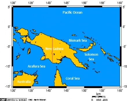
The Bismarck Sea is regional sea located in the northwest corner of the South Pacific Ocean.
| This article is written at a definitional level only. Authors wishing to improve this entry are inivited to expand the present treatment, which additions will be peer reviewed prior to publication of any expansion. |
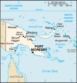
The Bismarck Sea is bounded to the southwest by the island of New Guinea and to the east and south by the Bismarck Archipelago.
Its area and volume are about 40,000 km2 and 60,000 km3, respectively.
Geography and extent
The Bismark Sea is bounded on the south by the island nation of Papua New Guinea, which is the eastern portion of the island of New Guinea; moreover, it is surrounded on the east and south by an arc constituted by the Bismarck Archipelago. At the north of the Bismarck Sea lie the Admiralty Islands (part of the Paua New Guinea). Further to the south of the Bismarck Archipeligo is the Solomon Sea.
The International Hydrographic Organization defines the limits of the Bismarck Sea as follows:
- At the north and east. By the northern and northeastern coasts of the islands of New Ireland, New Hanover, the Admiralty Islands, Hermit Island, and the Ninigo Group, through Manu and Aua Islands to Wuvulu Island and thence a line to Baudissin Point in New Guinea (142°02'E).
- At the southeast. A line from the Southern point of New Ireland along the parallel of 4°50' south to the coast of New Britain, along its northern coastand thence a line from its western extreme through the northern point of Umboi Island to Teliata Point, New Guinea (5 degrees 55 minutes S 147 degrees 24 minutes E).
- At the southwest. By the northeast coast of New Guinea.
History
The eastern half of the island of New Guinea was divided between Germany (north) and the UK (south) in 1885. As a result, the sea was under German control until the beginning of World War I (1914). During that time the sea was named after the German Chancellor Otto von Bismarck (1815-1898).
The Bismarck Sea was the site of a defining defeat for the Japanese Imperial forces in World War II, marking a turnaround to Japan's broad invasion of the western Pacific region .
References and further reading
- Physical Oceanography Index
- Seas of the World on Encyclopedia of Earth
- International Hydrographic Organization. 1953. Limits of Oceans and Seas, 3rd edition.
- K.R.Howe, Robert C.Kiste, Brij V.Lal, eds. 1994. Tides of History: The Pacific Islands in the Twentieth Century. Honolulu: University of Hawaii Press. ISBN 0-8248-1597-1.

