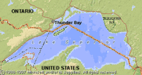
Lake Superior, Ontario
| Topics: |
Physical Attributes
 (Source: Biodiversity Institute of Ontario)
 - Altitude: 183 m above sea level
- Surface Area: 82,100 sq. km
- Mean Depth: 147 m
- Maximum Depth: 406 m
- Volume: 12,100 cu. km
- Shoreline Length: 4,400 km
- Drainage Basin: 128,000 sq km
General Description
 (Source: Biodiversity Institute of Ontario)
 Lake Superior has the largest surface area of any freshwater lake in the world and is second in volume only to Lake Baikal in Russia. As a result of its large size, waves can reach up to 10 m during storms. Numerous short rivers feed Lake Superior from its drainage basin. Water flows out of the lake into Lake Huron via the St. Mary's River. The offshore waters of Lake Superior are oligotrophic to ultra-oligotrophic. The lake has only low levels of dissolved minerals because the hard Precambrian rocks of the watershed are not easily dissolved. The introduction of sea lamprey and rainbow smelt as well as over-fishing have depleted the populations of whitefish and lake trout that form the core of the Lake Superior fisheries (Fisheries and aquaculture). The sea lamprey control program implemented by Canada and the United States has been quite effective. Most of the contaminants and dissolved solids enter the lake via the atmosphere (Atmospheric composition and structure).
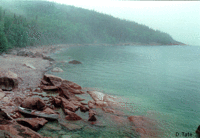
Watershed
The drainage basin is located on the 1-2 billion year old rocks of the Canadian Shield. The northern continental climate and shallow soils have resulted in an economic focus on forestry, mining and fishing. While the pulp and paper industry is an important economic activity along the north shore of the lake, mining for copper, iron and gold is significant in other areas.