Amphidrome (Environmental & Ecological Modeling)
Amphidrome
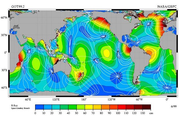
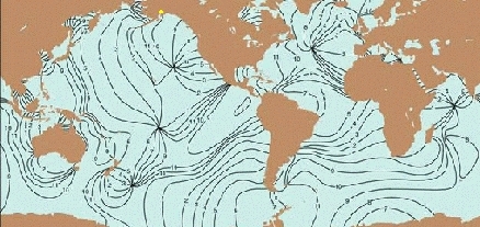
An amphidrome is a stationary ocean (Seas of the world) point around which tides rotate in a counterclockwise (clockwise) sense in the northern (southern) hemisphere, i.e. the point about which the cotidal lines radiate.
| This article is written at a definitional level only. Authors wishing to expand this entry are inivited to expand the present treatment, which additions will be peer reviewed prior to publication of any expansion. |
The vertical range of the tide increases with distance away from the amphidrome, with the amphidrome itself the spot where the tide vanishes to zero (or almost zero). This is also called an amphidromic point.

The dozen tidal amphidromes observed in the ocean are critical points that determine the fundamental pattern of the global tidal system. Exploration of recently available satellite data with an unprecedented 1-2 decades duration suggests that an amphidrome is not a tide-only phenomenon in the ocean. Analysis of altimeter-derived sea level anomaly (SLA) data and radiometer-derived sea surface temperature (SST) data allows ten amphidromic points to be clearly identified in annual SLA and SST variations. These amphidromes are located in the tropical areas of the Pacific, Atlantic, and Indian Oceans. Their existence implies that the annual cycle (in time) of the atmosphere-ocean system is translated into a rotary variation (in space) for many of the geophysical parameters. It can be concluded that annual amphidromes are common, the knowledge of which is of particular interest, given their annually "constant" nature, for the monitoring and understanding of oceanic, climatic, as well as biological variabilities at seasonal to decadal scales, which strongly affect many aspects of the natural and societal activities on the globe.- Chen and Quartly (2005)
</blockquote>
See Also
Further Reading
- Physical Oceanography Index
- Rhodes W. Fairbridge, editor. The Encyclopedia of Oceanography. Van Nostrand Reinhold Co., 1966.
- Chen, G.;Quartly, G. D., Ieee Geoscience And Remote Sensing Letters, V.2, p. 423-42, 2005
- TOPEX/Poseidon: Revealing Hidden Tidal Energy, NASA, 2007
