Map of Boston, 1775
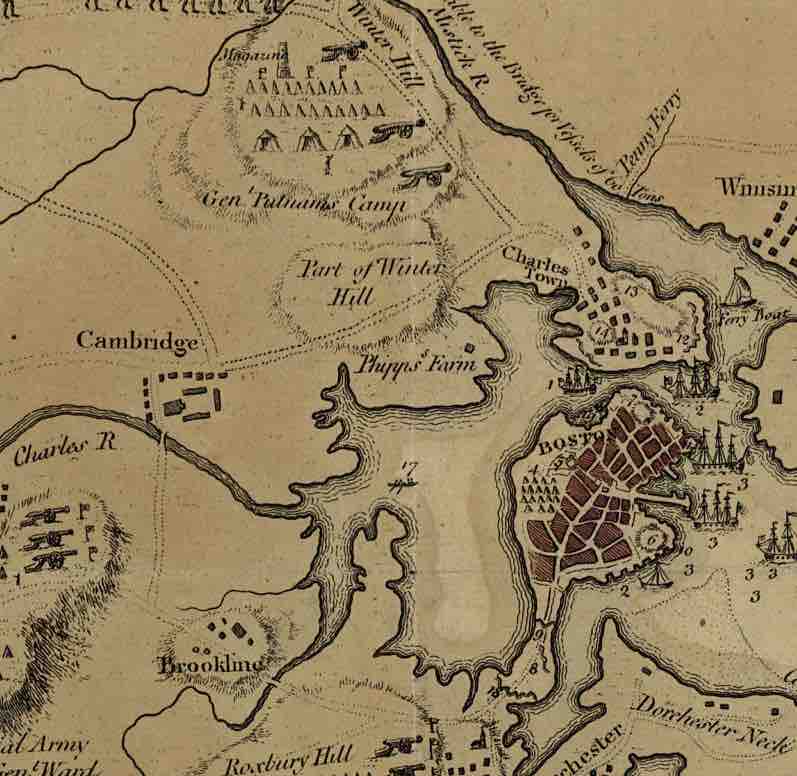
Detail of a 1775 map of Boston, with Dorchester Heights at the bottom right: "A plan of the town and harbour of Boston and the country adjacent with the road from Boston to Concord, shewing the place of the late engagement between the King's troops & the provincials, together with the several encampments of both armies in & about Boston. Taken from an actual survey. Humbly inscribed to Richd. Whitworth by J. De Costa; C. Hall, sc."
Source
Boundless vets and curates high-quality, openly licensed content from around the Internet. This particular resource used the following sources:
"Fortification of Dorchester Heights."
https://commons.wikimedia.org/wiki/File:Boston_1775.jpg
Wikimedia
Public domain.